- Population
- 8,823,358
- 8.8M
- Elevation
- 25 m
- above sea level
- Local time
- UTC+09:00
- Asia/Tokyo · UTC+09:00
- Places inside
- 39
- listed under Osaka
- Airports
- ITM Osaka Itami International Airport13 km
- UKB Kobe Airport28 km
About Osaka
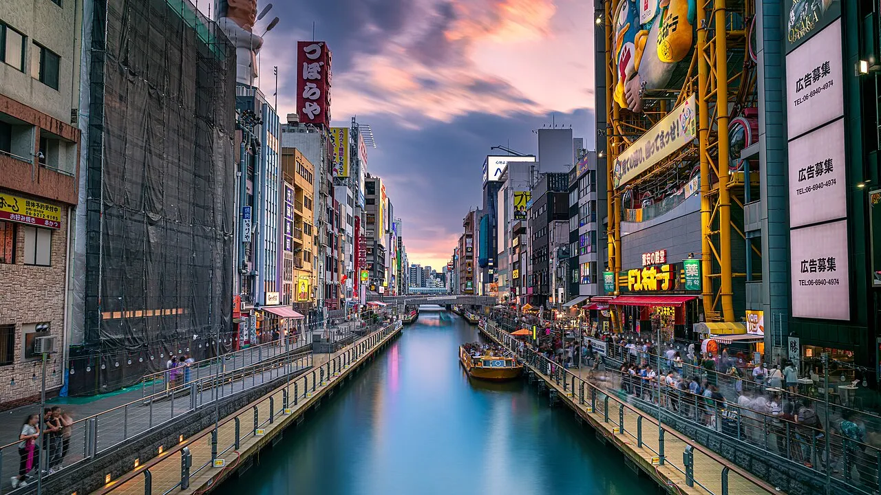
Osaka is a region. Location: Japan. Population: 8,823,358.
Osaka Prefecture (大阪府, Ōsaka-fu; pronounced [ò̞ó̞.sä́.kä́(.ɸɯ̈̀), ó̞ó̞-]) is a prefecture of Japan located in the Kansai region of Honshu. Osaka Prefecture has a population of 8,778,035 (as of 1 April 2022) and has a geographic area of 1,905 square kilometres (736 sq mi). Osaka Prefecture borders Hyōgo Prefecture to the northwest, Kyoto Prefecture to the northeast, Nara Prefecture to the southeast, and Wakayama Prefecture to the south.
Read more on Wikipedia Text: Wikipedia contributors · CC BY-SA 4.0 · shortened
Places bordering Osaka
- Hyōgo
- Kyoto
- Nara
- Wakayama
Twin towns and sister cities of Osaka
- California· United States
- Lombardy· Italy
Source: Wikidata. Only places with a page on this site are shown.
Climate of Osaka
Best months for sightseeingBest months for sightseeing: May, October.
Bars: average monthly low and high temperature. Below: precipitation. Monthly averages for 1970–2000 at about 18 km resolution, adjusted for elevation. Highlighted months are mild and relatively dry. Source: WorldClim 2.1 (CC BY 4.0).
Show values as a table
| Month | Jan | Feb | Mar | Apr | May | Jun | Jul | Aug | Sep | Oct | Nov | Dec |
|---|---|---|---|---|---|---|---|---|---|---|---|---|
| Average high (°C) | 9° | 10° | 14° | 20° | 24° | 27° | 31° | 33° | 28° | 23° | 17° | 12° |
| Average low (°C) | 1° | 1° | 4° | 9° | 14° | 19° | 23° | 24° | 20° | 13° | 8° | 3° |
| Precipitation (mm) | 45 | 60 | 100 | 133 | 143 | 215 | 172 | 111 | 183 | 113 | 69 | 37 |
Airports nearest to Osaka
- Osaka Itami International Airport (ITM) Osaka 13 km
- Kobe Airport (UKB) Kobe 28 km
- Kansai International Airport (KIX) Osaka 38 km
Straight-line distance; airports with scheduled flights only. Source: OurAirports (public domain).
Places in Osaka
39 places- 1 Sakai Shi 842K
- 2 Higashiōsaka Shi 501.3K
- 3 Hirakata 408.6K
- 4 Toyonaka 400.1K
- 5 Suita Shi 360.1K
- 6 Takatsuki Shi 356.4K
- 7 Ibaraki Shi 277.7K
- 8 Yao-shi 270.3K
- 9 Neyagawa 241.3K
- 10 Kishiwada Shi 201.1K
- 11 Izumi Shi 187.5K
- 12 Moriguchi Shi 145.5K
- 13 Minoo Shi 134.3K
- 14 Kadoma Shi 127.6K
- 15 Matsubara-shi 123.6K
- 16 Daitō 119.3K
- 17 Tondabayashi Shi 116.9K
- 18 Habikino-shi 115.9K
- 19 Kawachi-nagano Shi 112.2K
- 20 Ikeda Shi 103K
- 21 Izumisano Shi 101.7K
- 22 Kaizuka Shi 90.2K
- 23 Settsu Shi 84.3K
- 24 Katano Shi 78.3K
- 25 Izumi-Ōtsu 76.5K
- 26 Kashiwara-shi 72.6K
- 27 Sennan-gun 67.7K
- 28 Fujiidera-shi 66.4K
- 29 Sennan Shi 64.5K
- 30 Takaishi Shi 58.9K
- 31 Osakasayama 57.9K
- 32 Hannan Shi 57.4K
- 33 Shijonawate 57K
- 34 Minamikawachi-gun 34.7K
- 35 Mishima-gun 30K
- 36 Senboku-gun 16.8K
Bar: population relative to the most populous place in this list.
-
Kizu River River
-
Osaka City District
-
Toyono Gun District
Largest cities and towns
-
Chūō Ku Municipality, Osaka City104.9K
-
Kita-ku Municipality, Osaka City139.5K
-
Higashisumiyoshi-ku Municipality, Osaka City130.7K
-
Minato-ku Municipality, Osaka City84.9K
-
Abeno-ku Municipality, Osaka City111K
-
Suminoe Ku Municipality, Osaka City127.2K
-
Kita-ku Municipality, Sakai Shi159.4K
-
 Moriguchi City, Moriguchi Shi143.1K
Nature and heritage in Osaka

Sources & licences
Data last updated: · 2 independent sources