- Population
- 89,219
- 89.2K
- Elevation
- 22 m
- above sea level
- Local time
- UTC+09:00
- Asia/Tokyo · UTC+09:00
- Airports
- ITM Osaka Itami International Airport15 km
- UKB Kobe Airport27 km
About Tennōji-ku
Tennōji-ku is a municipality. Location: Osaka City, Osaka. Population: 89,219. Elevation: 22 m.
Tennōji Ward (Japanese: 天王寺区, romanized: Tennōji-ku) is one of 24 wards of Osaka, Osaka Prefecture, Japan. It is named after the Shitennō-ji, the temple of the Four Heavenly Kings, which is located in the ward.
Source: Wikipedia · CC BY-SA 4.0
Photos of Tennōji-ku
-
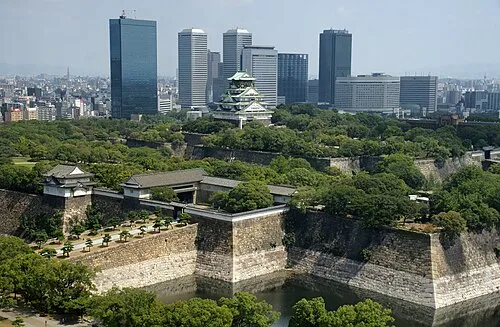
Osaka Castle 663highland · CC BY 2.5

Travel notes for Tennōji-ku
From Wikivoyage
Tennōji (大阪 天王寺) is a city district of Osaka.
Understand+
On the southeast side of Osaka, Tennōji is named after the nearby ancient temple of Shitennōji, which dates back to 593. Today it's better known as a major train hub with plenty of shopping and eating options. The south side of the district is a working class neighborhood, and Shinsekai (新世界, "New World"), built in 1912 in conscious imitation of New York and Paris, went through some pretty rough times after the war but has gentrified into a bit of a tourist trap.
Get in+
By plane:
The fastest trains between Kansai International Airport and Tennoji station are "Ltd.Express Haruka" which operates by JR West. The journey takes approximately 32 minutes at a cost of ¥1760: ¥1030 regular fare + ¥730 limited express fare.
By train:
Tennoji is a major train hub and well connected not just to Osaka, but other major cities in the region. The JR Kyoto Line links to Shin-Osaka (for Shinkansen services) and Kyoto, the JR Yamatoji Line to Nara, while the subway Midosuji Line connects to Namba and Umeda and the JR Loop Line to the rest of the city.
Source: Wikivoyage · CC BY-SA 4.0 · abridged
Places bordering Tennōji-ku
- Higashinari Ku
- Ikuno-ku
- Abeno-ku
- Nishinari-ku
- Naniwa Ku
- Chūō Ku
Population of Tennōji-ku over time
| 2010 | 69,775 | |
|---|---|---|
| 2015 | 75,729 | |
| 2021 | 82,478 |
Censuses and official estimates; source: Wikidata.
Climate of Tennōji-ku
Best months for sightseeingBest months for sightseeing: May, October.
This month · November
Outside the best season
Day 18° · Night 8° · Rain 72 mm
Better nearby cities in November
- Kochi · 220 km southwest18°
- Fujinomiya · 289 km east18°
- Fuji · 294 km east20°
- Hottest month
- August (day 33°)
- Coldest month
- January (night 1°)
- Wettest month
- June (223 mm)
- Driest month
- December (37 mm)
Bars: average monthly low and high temperature. Below: precipitation. Monthly averages for 1970–2000 at about 18 km resolution, adjusted for elevation. Highlighted months are mild and relatively dry. Source: WorldClim 2.1 (CC BY 4.0).
Show values as a table
| Month | Jan | Feb | Mar | Apr | May | Jun | Jul | Aug | Sep | Oct | Nov | Dec |
|---|---|---|---|---|---|---|---|---|---|---|---|---|
| Average high (°C) | 10° | 10° | 14° | 20° | 25° | 28° | 31° | 33° | 29° | 23° | 18° | 12° |
| Average low (°C) | 1° | 1° | 4° | 9° | 14° | 19° | 23° | 24° | 20° | 14° | 8° | 3° |
| Precipitation (mm) | 44 | 58 | 100 | 136 | 146 | 223 | 167 | 113 | 191 | 119 | 72 | 37 |
How to get to Tennōji-ku
The nearest airport is Osaka Itami International Airport (ITM), 15 km to the northwest as the crow flies. The nearest large city is Higashiosaka, 6 km to the east.
Airports
- Osaka Itami International Airport (ITM) Osaka 15 kmnorthwest
- Kobe Airport (UKB) Kobe 27 kmwest
- Kansai International Airport (KIX) Osaka 36 kmsouthwest
Nearby large cities
- Higashiosaka Population: 493.9K 6 kmeast
- Yao Population: 273.2K 9 kmsoutheast
- Moriguchi Population: 143.1K 9 kmnortheast
- Kadoma Population: 131.7K 10 kmnortheast
- Matsubara Population: 130.9K 11 kmsouth
Straight-line distances; road distances are longer. Airport data: OurAirports.
Day trips from Tennōji-ku
Within 100 km: 31 historic and cultural sites, 43 natural sites, 20 lakes, rivers and coasts.
0–25 km13 places
- Mount Shigi Mountain 15 kmE
- Yamato Gawa River 9 kmSW
- PL Peace Tower Landmark 18 kmS
- Mukogawa River River 14 kmW
25–60 km51 places
- Mount Rokkō Mountain 27 kmNW
- Mount Miwa Mountain 35 kmSE
- Mount Amanokagu Mountain 33 kmSE
- Mount Miminashi Mountain 31 kmSE
60–100 km30 places
- Awaji Island Island 70 kmSW
- Kumozu River River 94 kmE
- Mount Ōdaigahara Mountain 73 kmSE
- Mount Kunimi Mountain 71 kmSE
Straight-line distances.
Tennōji-ku and similar cities
Side by side with cities of similar size in the same country: population, elevation and climate.
| Measure | Tennōji-ku | Iga | Kōka | Takayama |
|---|---|---|---|---|
| Population | 89.2K | 88.9K | 89.6K | 88.5K |
| Elevation | 22 m | 152 m | 170 m | 583 m |
| Summer day (hottest month) | 33° | 31° | 31° | 29° |
| Winter night (coldest month) | 1° | -1° | -1° | -5° |
| Annual rainfall | 1,406 mm | 1,621 mm | 1,666 mm | 1,891 mm |
| Best months | May, Oct | May–Jun, Sep–Oct | May–Jun, Sep–Oct | May–Jun, Sep |
| Distance | — | 57 km | 68 km | 227 km |
Climate values are 1970–2000 monthly averages; straight-line distance.
Nearby attractions & nature
Everything nearby-
Osaka Castle Historic site, Chūō Ku3.3 km N
-
Yamato Gawa River, Japan8.6 km SW
-
Tenpō Zan Mountain, Minato-ku8 km W
-
Kizu River River, Osaka7.4 km SW
-
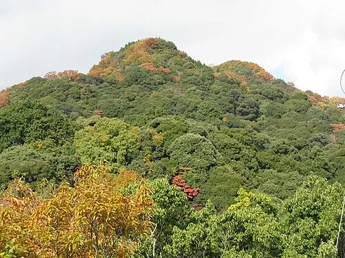 Mount Shigi Mountain, Heguri-chō15 km E
-
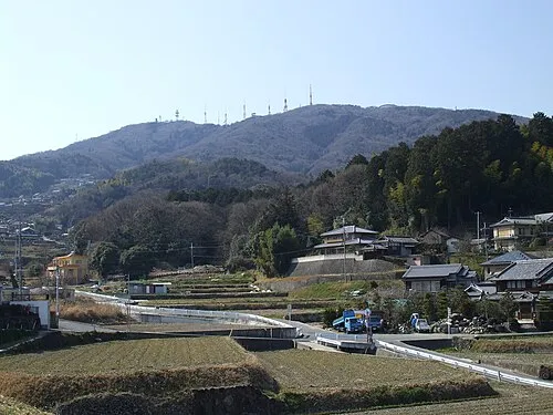 Ikoma Yama Mountain, Ikoma-shi15 km E
-
 National Museum of Ethnology Museum, Suita Shi17 km N
-
Yodo River River, Japan9.8 km W
Sources & licences
Data last updated: · 2 independent sources