- Population
- 17,888
- 17.9K
- Elevation
- 6 m
- above sea level
- Local time
- UTC+09:00
- Asia/Tokyo · UTC+09:00
- Places inside
- 1
- listed under Tadaoka Chō
- Airports
- KIX Kansai International Airport16 km
- UKB Kobe Airport22 km
About Tadaoka Chō
Tadaoka Chō is a municipality. Location: Senboku-gun, Osaka. Population: 17,888. Elevation: 6 m.
Tadaoka (忠岡町, Tadaoka-chō) is a town located in Senboku District, Osaka Prefecture, Japan. As of 31 December 2021, the town had an estimated population of 16,793 in 7854 households and a population density of 1200 persons per km2. The total area of the town is 3.97 square kilometres (1.53 sq mi), making it the smallest town in Japan in terms of land area.
Source: Wikipedia · CC BY-SA 4.0
Places bordering Tadaoka Chō
- Izumi
- Izumi-Ōtsu
- Kishiwada Shi
Population of Tadaoka Chō over time
| 2010 | 18,149 | |
|---|---|---|
| 2015 | 17,298 | |
| 2021 | 16,628 |
Censuses and official estimates; source: Wikidata.
Climate of Tadaoka Chō
Best months for sightseeingBest months for sightseeing: May, October.
This month · November
Outside the best season
Day 18° · Night 9° · Rain 77 mm
Better nearby cities in November
- Kochi · 201 km southwest18°
- Fujinomiya · 305 km east18°
- Fuji · 309 km east20°
- Hottest month
- August (day 32°)
- Coldest month
- January (night 2°)
- Wettest month
- June (232 mm)
- Driest month
- December (39 mm)
Bars: average monthly low and high temperature. Below: precipitation. Monthly averages for 1970–2000 at about 18 km resolution, adjusted for elevation. Highlighted months are mild and relatively dry. Source: WorldClim 2.1 (CC BY 4.0).
Show values as a table
| Month | Jan | Feb | Mar | Apr | May | Jun | Jul | Aug | Sep | Oct | Nov | Dec |
|---|---|---|---|---|---|---|---|---|---|---|---|---|
| Average high (°C) | 10° | 10° | 14° | 20° | 24° | 27° | 31° | 32° | 28° | 23° | 18° | 12° |
| Average low (°C) | 2° | 2° | 4° | 10° | 15° | 19° | 23° | 24° | 20° | 14° | 9° | 4° |
| Precipitation (mm) | 45 | 58 | 100 | 143 | 153 | 232 | 169 | 121 | 203 | 124 | 77 | 39 |
How to get to Tadaoka Chō
The nearest airport is Kansai International Airport (KIX), 16 km to the southwest as the crow flies. The nearest large city is Izumi, 4 km to the east.
Airports
- Kansai International Airport (KIX) Osaka 16 kmsouthwest
- Kobe Airport (UKB) Kobe 22 kmnorthwest
- Osaka Itami International Airport (ITM) Osaka 32 kmnorth
Nearby large cities
- Izumi Population: 184.6K 4 kmeast
- Kishiwada Population: 205.6K 4 kmsouthwest
- Izumisano Population: 100.1K 11 kmsouthwest
- Matsubara Population: 130.9K 17 kmnortheast
- Kawachi-Nagano Population: 101.7K 18 kmeast
Straight-line distances; road distances are longer. Airport data: OurAirports.
Places in Tadaoka Chō
1 placeBar: population relative to the most populous place in this list.
Nearby attractions & nature
Everything nearby-
Yamato Gawa River, Japan14 km N
-
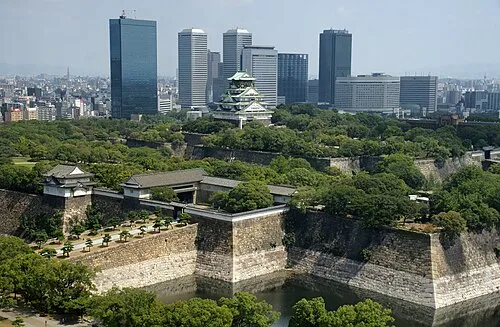 Osaka Castle Historic site, Chūō Ku25 km NE
-
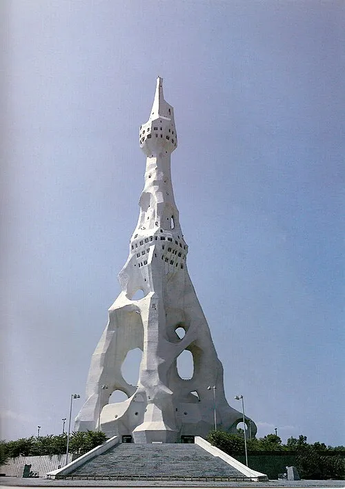 PL Peace Tower Landmark, Tondabayashi Shi18 km E
-
Tenpō Zan Mountain, Minato-ku19 km N
-
Kizu River River, Osaka16 km N
-
Yodo River River, Japan21 km N
-
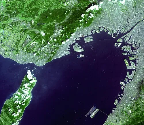 Osaka Bay Natural site, Japan24 km W
-
Mukogawa River River, Hyōgo22 km N
Sources & licences
Data last updated: · 2 independent sources