Chinzeimachi-nagoya
Located in Karatsu Shi, Saga Prefecture Coordinates: 33°31′27″ N 129°52′15″ E
- Elevation
- 47 m
- above sea level
- Local time
- UTC+09:00
- Asia/Tokyo · UTC+09:00
- Airports
- IKI Iki Airport26 km
- FUK Fukuoka Airport54 km
About Chinzeimachi-nagoya
Chinzeimachi-nagoya is a village. Location: Karatsu Shi, Saga Prefecture. Elevation: 47 m.
Nagoya Castle (名護屋城, Nagoya-jō) was a Japanese castle located in the Chinzei neighborhood of the city of Karatsu, Saga Prefecture. It is sometimes called Hizen-Nagoya Castle to distinguish it from the more famous Nagoya Castle in Aichi Prefecture. It is located on a hill in the center of Higashi Matsuura peninsula, about 10 kilometers north of the Karatsu city center. It is known for serving as the base from which Toyotomi Hideyoshi launched his invasions of Korea from 1592 to 1598.
Source: Wikipedia · CC BY-SA 4.0
Climate of Chinzeimachi-nagoya
Best months for sightseeingBest months for sightseeing: May–June, October.
This month · November
Outside the best season
Day 17° · Night 11° · Rain 85 mm
Better nearby cities in November
- Beppu · 153 km east17°
- Ōita · 164 km east18°
- Nobeoka · 197 km southeast18°
- Hottest month
- August (day 30°)
- Coldest month
- January (night 4°)
- Wettest month
- June (291 mm)
- Driest month
- January (70 mm)
Bars: average monthly low and high temperature. Below: precipitation. Monthly averages for 1970–2000 at about 18 km resolution, adjusted for elevation. Highlighted months are mild and relatively dry. Source: WorldClim 2.1 (CC BY 4.0).
Show values as a table
| Month | Jan | Feb | Mar | Apr | May | Jun | Jul | Aug | Sep | Oct | Nov | Dec |
|---|---|---|---|---|---|---|---|---|---|---|---|---|
| Average high (°C) | 9° | 10° | 13° | 18° | 22° | 24° | 28° | 30° | 26° | 22° | 17° | 12° |
| Average low (°C) | 4° | 4° | 7° | 11° | 15° | 19° | 24° | 25° | 21° | 16° | 11° | 6° |
| Precipitation (mm) | 70 | 79 | 107 | 151 | 148 | 291 | 269 | 173 | 235 | 98 | 85 | 71 |
How to get to Chinzeimachi-nagoya
The nearest airport is Iki Airport (IKI), 26 km to the north as the crow flies. For international flights: Fukuoka Airport (FUK) (54 km). The nearest large city is Karatsu, 13 km to the southeast.
Airports
- Iki Airport (IKI) Iki 26 kmnorth
- Fukuoka Airport (FUK) Fukuoka 54 kmeast
- Kyushu Saga International Airport (HSG) Saga 58 kmsoutheast
Nearby large cities
- Karatsu Population: 117.7K 13 kmsoutheast
- Sasebo Population: 243.2K 42 kmsouth
- Saga Population: 233.3K 51 kmsoutheast
- Kasuga Population: 111K 55 kmeast
- Ōnojō Population: 102.1K 56 kmeast
Straight-line distances; road distances are longer. Airport data: OurAirports.
Day trips from Chinzeimachi-nagoya
Within 100 km: 17 historic and cultural sites, 15 natural sites, 14 lakes, rivers and coasts.
0–25 km3 places
- Niji no Matsubara Natural site 16 kmSE
- Kakara Shima Island 9 kmN
- Karatsu Castle Historic site 13 kmSE
25–60 km23 places
- Iki Island Island 32 kmNW
- Hario Jima Island 47 kmS
- Genkai Island Island 38 kmNE
- Aino-Island Island 53 kmNE
60–100 km20 places
- Okino-shima Island 83 kmN
- Mount Unzen Mountain 94 kmSE
- Iō Jima Island 92 kmS
- Shimabara-hantō Natural site 93 kmS
Straight-line distances.
Nearby attractions & nature
Everything nearby-
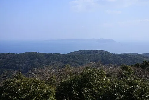 Kakara Shima Island, Karatsu Shi8.6 km N
-
 Karatsu Castle Historic site, Karatsu Shi13 km SE
-
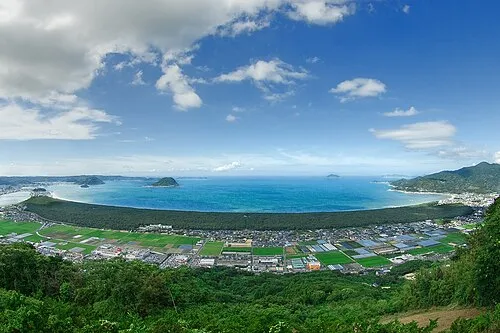 Niji no Matsubara Natural site, Saga Prefecture16 km SE
Sources & licences
Data last updated: · 2 independent sources