Karatsu Castle
Located in Karatsu Shi, Saga Prefecture Coordinates: 33°27′13″ N 129°58′43″ E

- Local time
- UTC+09:00
- Asia/Tokyo · UTC+09:00
- Elevation
- 35 m
- above sea level
- Airports
- IKI Iki Airport37 km
- HSG Kyushu Saga International Airport45 km
About Karatsu Castle
Karatsu Castle is a historic site. Location: Karatsu Shi, Saga Prefecture.
Karatsu Castle (唐津城, Karatsu-jō) is a Japanese castle located in Karatsu, Saga Prefecture, Japan. It is a hirayamajiro, a castle built on a plain rather than a hill or mountain. At the end of the Edo period, Karatsu castle was home to the Ogasawara clan, daimyō of Karatsu Domain. It was also known as "Dancing Crane Castle" (舞鶴城, Maizuru-jō).
Source: Wikipedia · CC BY-SA 4.0
Photos of Karatsu Castle
-

Marie-Sophie Mejan · CC BY 4.0 -

Pekachu · CC BY-SA 4.0 -

そらみみ · CC BY-SA 4.0 -

Thomas Woodtli from Zürich, Switzerland · CC BY-SA 2.0 -

Thomas Woodtli from Zürich, Switzerland · CC BY-SA 2.0


Climate of Karatsu Castle
Best months for sightseeingBest months for sightseeing: May–June, October.
This month · November
Outside the best season
Day 17° · Night 10° · Rain 86 mm
Better nearby cities in November
- Beppu · 142 km east17°
- Ōita · 153 km east18°
- Nobeoka · 185 km southeast18°
- Hottest month
- August (day 30°)
- Coldest month
- January (night 3°)
- Wettest month
- June (307 mm)
- Driest month
- December (70 mm)
Bars: average monthly low and high temperature. Below: precipitation. Monthly averages for 1970–2000 at about 18 km resolution, adjusted for elevation. Highlighted months are mild and relatively dry. Source: WorldClim 2.1 (CC BY 4.0).
Show values as a table
| Month | Jan | Feb | Mar | Apr | May | Jun | Jul | Aug | Sep | Oct | Nov | Dec |
|---|---|---|---|---|---|---|---|---|---|---|---|---|
| Average high (°C) | 9° | 10° | 13° | 18° | 22° | 25° | 29° | 30° | 27° | 22° | 17° | 12° |
| Average low (°C) | 3° | 4° | 6° | 11° | 15° | 19° | 24° | 24° | 21° | 15° | 10° | 5° |
| Precipitation (mm) | 72 | 82 | 114 | 159 | 158 | 307 | 295 | 185 | 234 | 102 | 86 | 70 |
How to get to Karatsu Castle
The nearest airport is Iki Airport (IKI), 37 km to the northwest as the crow flies. For international flights: Kyushu Saga International Airport (HSG) (45 km). The nearest large city is Karatsu, 1 km to the southwest.
Airports
- Iki Airport (IKI) Iki 37 kmnorthwest
- Kyushu Saga International Airport (HSG) Saga 45 kmsoutheast
- Fukuoka Airport (FUK) Fukuoka 46 kmeast
Nearby large cities
- Karatsu Population: 117.7K 1 kmsouthwest
- Saga Population: 233.3K 39 kmsoutheast
- Sasebo Population: 243.2K 39 kmsouthwest
- Kasuga Population: 111K 46 kmeast
- Ōnojō Population: 102.1K 47 kmeast
Straight-line distances; road distances are longer. Airport data: OurAirports.
Day trips from Karatsu Castle
Within 100 km: 17 historic and cultural sites, 16 natural sites, 13 lakes, rivers and coasts.
0–25 km2 places
- Niji no Matsubara Natural site 4 kmE
- Kakara Shima Island 20 kmNW
25–60 km28 places
- Iki Island Island 44 kmNW
- Hario Jima Island 43 kmSW
- Genkai Island Island 35 kmNE
- Aino-Island Island 50 kmNE
60–100 km16 places
- Okino-shima Island 89 kmN
- Mount Unzen Mountain 83 kmS
- Iō Jima Island 85 kmS
- Shimabara-hantō Natural site 82 kmS
Straight-line distances.
Nearby attractions & nature
Everything nearby-
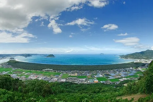 Niji no Matsubara Natural site, Saga Prefecture3.5 km E
-
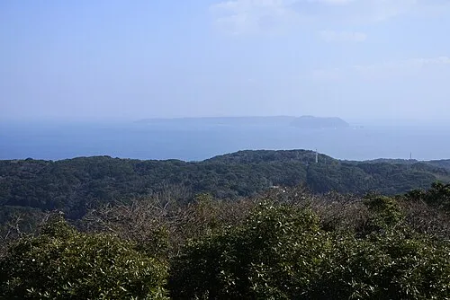 Kakara Shima Island, Karatsu Shi20 km NW
Nearest towns and villages
-
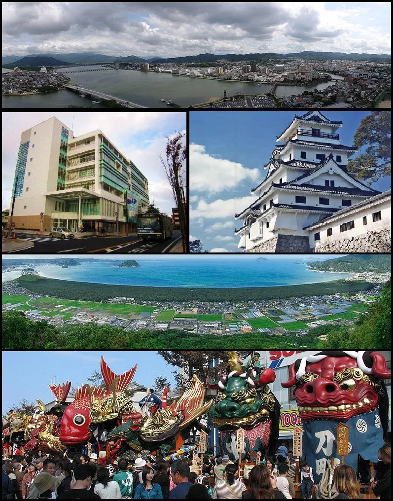 Karatsu City, Karatsu Shi1.5 km SW
-
Genkai Chō Municipality, Higashimatsuura-gun11 km W
-
Ōchichō-ōchi Village, Karatsu Shi12 km S
-
 Imarichō-kō Town, Imari Shi22 km SW
Sources & licences
Data last updated: · 2 independent sources