Nagahama
Local name: 長浜市
Located in Nagahama Shi, Shiga Prefecture Coordinates: 35°23′00″ N 136°16′00″ E
- Population
- 113,636
- 113.6K
- Elevation
- 86 m
- above sea level
- Local time
- UTC+09:00
- Asia/Tokyo · UTC+09:00
- Airports
- NKM Nagoya Airport / JASDF Komaki Air Base61 km
- NGO Chubu Centrair International Airport76 km
About Nagahama
Nagahama is a city. Location: Nagahama Shi, Shiga Prefecture. Population: 113,636. Elevation: 86 m.
Nagahama (長浜市, Nagahama-shi) is a city located in Shiga Prefecture, Japan. As of 1 November 2021, the city had an estimated population of 116,043 in 46858 households and a population density of 120 persons per km2. The total area of the city is 680.79 square kilometres (262.85 sq mi).
Source: Wikipedia · CC BY-SA 4.0
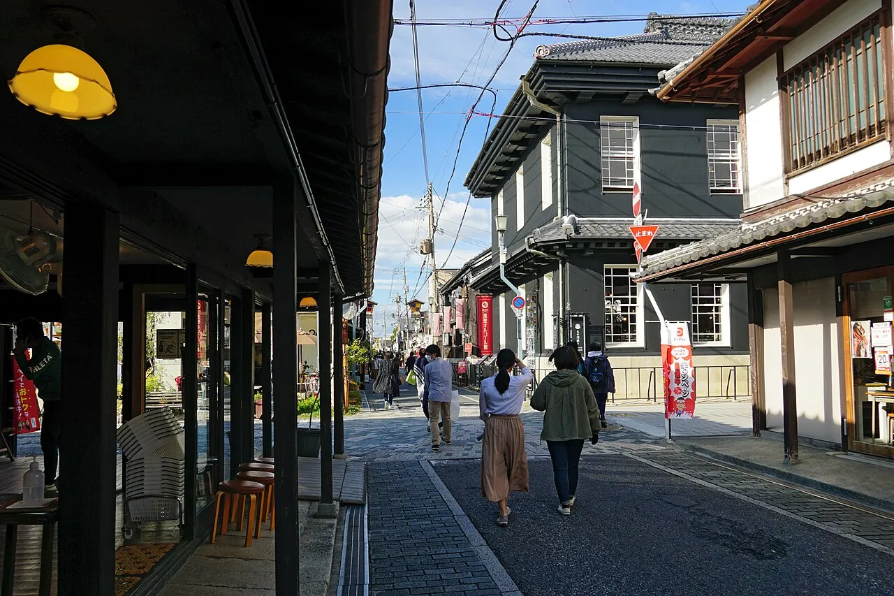
Photos of Nagahama
-

m-louis .® from Osaka, Japan · CC BY-SA 2.0 -

NevinThompson · CC BY-SA 4.0 -

NevinThompson · CC BY-SA 4.0 -

Alpsdake · CC BY-SA 4.0 -

Hyppolyte de Saint-Rambert · CC BY-SA 4.0


Travel notes for Nagahama
From Wikivoyage
Nagahama (長浜市) is a city in Shiga Prefecture, Japan.
Understand+
Tourist information site:
The local tourist association has a multilingual guide site, jointly with adjacent Maibara City.
Get in+
By plane:
Nagahama (or Shiga Prefecture more generally) is not well served by airports. While the nearest airport is Nagoya-Centrair, Osaka's two airports (Itami and Kansai) are at least as convenient, if not more.
Travelling from Centrair or Kansai Airports to Nagahama is basically a case of taking a train towards Nagoya or Osaka respectively and then continuing on as described below. Two morning Haruka trains run direct to Kansai Airport from Maibara, returning in the evening.
From Itami, the best option is to take a bus to either Shin-Osaka or Kyoto station, and continue from there on the train.
By train:
Nagahama is served by two trains per hour to Maibara (10 minutes, ¥200), the nearest Shinkansen station. These are in fact Special Rapid services, which offer a fast direct service to many places in Kansai.
Ōmihachiman: 36 minutes, ¥670
Ōtsu: 1 hour, ¥1140
Kyoto: 1 hour 10 minutes, ¥1320
Osaka: 1 hour 40 minutes, ¥1940
Kobe: 2 hours 10 minutes, ¥2590
Himeji: 2 hours 40 minutes, ¥3670
Note that these trains usually run as 12-car trains to Maibara, but only the front 4 (or sometimes 8) cars continue to Nagahama, so make sure you travel in the front part of the train.
Taking the Shinkansen to Maibara, times and prices are as follows:
Tokyo (using Hikari): 2 hours 40 minutes and ¥12,400
Nagoya: 1 hour, ¥3740
Kyoto: 40 minutes, ¥3570
Shin-Osaka: 1 hour, ¥4940
Note that Shinkansen trains which stop at Maibara usually do not go west of Shin-Osaka.
Nagahama is also served by six Shirasagi Limited Expresses a day between Maibara and Kanazawa, of which three continue beyond Maibara to Nagoya. Taking these, times and prices are as follows:
Kanazawa: 1 hour 40 minutes, ¥5700
Fukui: 1 hour, ¥3360
Tsuruga: 27 minutes, ¥1940
Gifu: 50 minutes, ¥2670
Nagoya: 1 hour 15 minutes, ¥3190
Additional trains pass through without stopping, which require you to change at Maibara or Tsuruga.
Source: Wikivoyage · CC BY-SA 4.0 · abridged
Places bordering Nagahama
- Maibara
- Takashima
- Ibigawa Chō
- Tsuruga Shi
- Minamiechizen Chō
Twin towns and sister cities of Nagahama
- Augsburg· Germany
- Nishinoomote· Japan
- Tatsunochō-tominaga· Japan
Source: Wikidata. Only places with a page on this site are shown.
Population of Nagahama over time
| 2010 | 124,131 | |
|---|---|---|
| 2015 | 118,193 | |
| 2021 | 113,740 |
Censuses and official estimates; source: Wikidata.
Climate of Nagahama
Best months for sightseeingBest months for sightseeing: May–June, September–October.
This month · November
A wet month
Day 15° · Night 7° · Rain 111 mm
Better nearby cities in November
- Kofu · 211 km east17°
- Fujinomiya · 214 km east18°
- Fuji · 221 km east20°
- Hottest month
- August (day 30°)
- Coldest month
- February (night 0°)
- Wettest month
- June (232 mm)
- Driest month
- November (111 mm)
Bars: average monthly low and high temperature. Below: precipitation. Monthly averages for 1970–2000 at about 18 km resolution, adjusted for elevation. Highlighted months are mild and relatively dry. Source: WorldClim 2.1 (CC BY 4.0).
Show values as a table
| Month | Jan | Feb | Mar | Apr | May | Jun | Jul | Aug | Sep | Oct | Nov | Dec |
|---|---|---|---|---|---|---|---|---|---|---|---|---|
| Average high (°C) | 7° | 7° | 10° | 16° | 21° | 24° | 29° | 30° | 26° | 20° | 15° | 10° |
| Average low (°C) | 1° | 0° | 3° | 8° | 13° | 17° | 22° | 23° | 19° | 13° | 7° | 3° |
| Precipitation (mm) | 141 | 124 | 137 | 155 | 154 | 232 | 223 | 130 | 211 | 131 | 111 | 125 |
Other places to visit in this season: May June September October
How to get to Nagahama
The nearest airport is Nagoya Airport / JASDF Komaki Air Base (NKM), 61 km to the east as the crow flies. For international flights: Chubu Centrair International Airport (NGO) (76 km). The nearest large city is Hikone, 15 km to the south.
Airports
- Nagoya Airport / JASDF Komaki Air Base (NKM) Nagoya 61 kmeast
- Chubu Centrair International Airport (NGO) Tokoname 76 kmsoutheast
- Osaka Itami International Airport (ITM) Osaka 101 kmsouthwest
Nearby large cities
- Hikone Population: 113.6K 15 kmsouth
- Youkaichi Population: 112.8K 30 kmsouth
- Ōgaki Population: 161.5K 32 kmeast
- Gifu Population: 402.6K 45 kmeast
- Kusatsu Population: 143.9K 49 kmsouthwest
Straight-line distances; road distances are longer. Airport data: OurAirports.
Day trips from Nagahama
Within 100 km: 30 historic and cultural sites, 23 natural sites, 30 lakes, rivers and coasts.
0–25 km5 places
- Lake Biwa Lake 22 kmSW
- Chikubu Island Island 12 kmW
- Mount Ryōzen Mountain 15 kmSE
- Mount Ibuki Mountain 13 kmE
25–60 km20 places
- Lake Suigetsu Lake 41 kmNW
- Mimi River River 39 kmNW
- Kita-gawa River 49 kmW
- Neo River River 34 kmE
60–100 km58 places
- Chita-hantō Natural site 83 kmSE
- Okazaki castle Historic site 94 kmSE
- Toyota Stadium Landmark 89 kmE
- Kamuri Jima Island 83 kmNW
Straight-line distances.
Nagahama and similar cities
Side by side with cities of similar size in the same country: population, elevation and climate.
| Measure | Nagahama | Hikone | Fujimino | Tōkai |
|---|---|---|---|---|
| Population | 113.6K | 113.6K | 113.6K | 113.8K |
| Elevation | 86 m | 95 m | 7 m | 7 m |
| Summer day (hottest month) | 30° | 31° | 30° | 32° |
| Winter night (coldest month) | 0° | 0° | -1° | 1° |
| Annual rainfall | 1,874 mm | 1,731 mm | 1,376 mm | 1,934 mm |
| Best months | May–Jun, Sep–Oct | May–Jun, Sep–Oct | May–Jun, Oct | Apr–Jun, Oct |
| Distance | — | 15 km | 301 km | 71 km |
Climate values are 1970–2000 monthly averages; straight-line distance.
Nearby attractions & nature
Everything nearby-
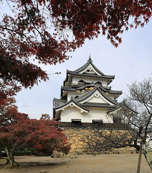 Hikone castle Historic site, Hikone12 km S
-
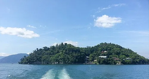 Chikubu Island Island, Japan12 km W
-
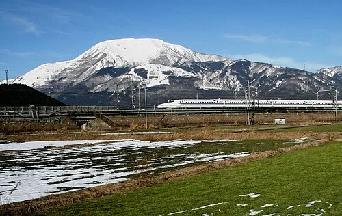 Mount Ibuki Mountain, Maibara-shi13 km E
-
Mount Ryōzen Mountain, Taga Chō15 km SE
-
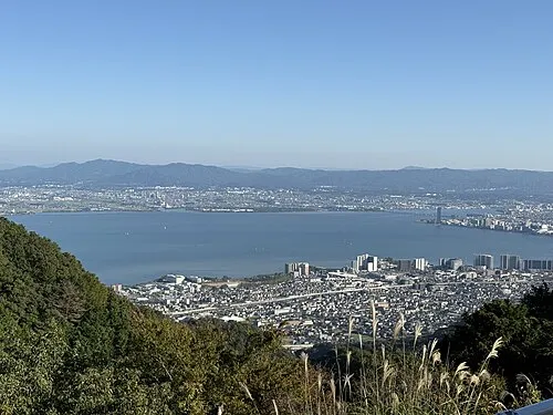 Lake Biwa Lake, Shiga Prefecture22 km SW
Sources & licences
Data last updated: · 2 independent sources