- Elevation
- 1 m
- above sea level
- Local time
- UTC+09:00
- Asia/Tokyo · UTC+09:00
- Airports
- FSZ Mount Fuji Shizuoka Airport24 km
- OIM Oshima Airport89 km
About Abe River
Abe River is a river. Location: Shizuoka, Japan.
The Abe River (安倍川, Abe-kawa) is a Class A river in Shizuoka Prefecture in central Japan. It is 53.3 kilometres (33.1 mi) long and has a drainage basin of 567 square kilometres (219 sq mi). Approximately 170,000 people live in the basin area. The river rises in the Akaishi Mountains, which stretch over the boundary between Yamanashi and Shizuoka Prefectures, and flows into Suruga Bay in the Pacific Ocean. It is known for its clear stream and forms part of the main water supply for Shizuoka city.
Read more on Wikipedia Text: Wikipedia contributors · CC BY-SA 4.0 · shortened
At a glance
- Length
- 53 km
Source: Wikidata
Climate of Abe River
Best months for sightseeingBest months for sightseeing: May–June, October.
Bars: average monthly low and high temperature. Below: precipitation. Monthly averages for 1970–2000 at about 18 km resolution, adjusted for elevation. Highlighted months are mild and relatively dry. Source: WorldClim 2.1 (CC BY 4.0).
Show values as a table
| Month | Jan | Feb | Mar | Apr | May | Jun | Jul | Aug | Sep | Oct | Nov | Dec |
|---|---|---|---|---|---|---|---|---|---|---|---|---|
| Average high (°C) | 11° | 12° | 14° | 19° | 23° | 25° | 29° | 30° | 27° | 23° | 18° | 14° |
| Average low (°C) | 2° | 2° | 5° | 10° | 14° | 19° | 22° | 23° | 20° | 15° | 9° | 4° |
| Precipitation (mm) | 72 | 98 | 178 | 211 | 209 | 291 | 245 | 251 | 253 | 168 | 119 | 66 |
Airports nearest to Abe River
- Mount Fuji Shizuoka Airport (FSZ) Makinohara / Shimada 24 km
- Oshima Airport (OIM) Izu Oshima 89 km
- Nagoya Airport / JASDF Komaki Air Base (NKM) Nagoya 139 km
Straight-line distance; airports with scheduled flights only. Source: OurAirports (public domain).
Nearest towns and villages
Nearby attractions & nature
Everything nearby-
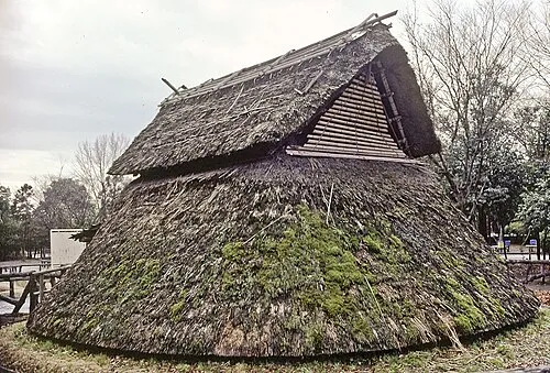 Toro Iseki Historic site, Suruga Ku3.1 km N
-
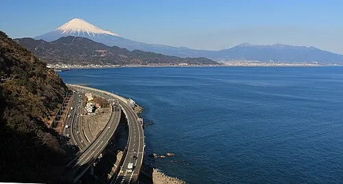 Suruga Bay Natural site, Tokyo16 km SE
-
Oi River River, Shizuoka21 km SW
More lakes, rivers and coasts in Japan
-
Shiba River River, Shizuoka33 km NE
-
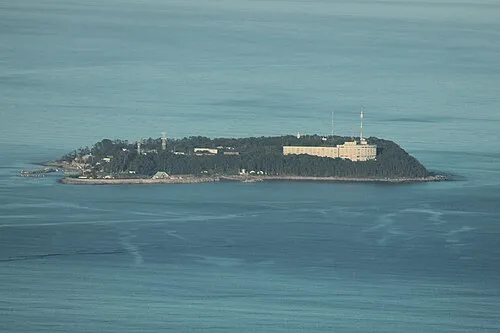 Hatsu-shima Island, Shizuoka71 km E
-
Kano River River, Shizuoka45 km E
-
Kiku River River, Shizuoka44 km SW
-
Tenryu River River, Shizuoka64 km SW
Sources & licences
Data last updated: · 2 independent sources