
- Elevation
- 109 m
- above sea level
- Local time
- UTC+09:00
- Asia/Tokyo · UTC+09:00
- Population
- 1,018
- 1K
About Iwo Jima
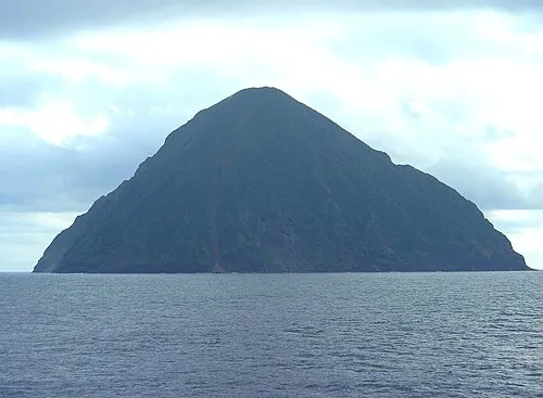
Iwo Jima is an island. Location: Tokyo, Japan. Population: 1,018.
Iwo Jima (Japanese: 硫黄島, Hepburn: Iōjima; English: , Japanese: [ì.ó̞ó̞.(ɟ̟͡)ʑí.mä́], lit. 'Sulfur Island'), officially named Iwo Tō (硫黄島, Iōtō; [ì.ó̞ó̞.tó̞ó̞]), is one of the Japanese Volcano Islands, which lie south of the Bonin Islands and together with them make up the Ogasawara Archipelago. Together with the Izu Islands, they make up Japan's Nanpō Islands. Although 1,200 km (750 mi) south of Tokyo on Honshu, Iwo Jima is administered as part of the Ogasawara Subprefecture of the Tokyo Metropolitan Government.
Read more on Wikipedia Text: Wikipedia contributors · CC BY-SA 4.0 · shortened
At a glance
- Area
- 23.7 km²
Source: Wikidata
Climate of Iwo Jima
Best months for sightseeingBest months for sightseeing: December–April.
Bars: average monthly low and high temperature. Below: precipitation. Monthly averages for 1970–2000 at about 18 km resolution, adjusted for elevation. Highlighted months are mild and relatively dry. Source: WorldClim 2.1 (CC BY 4.0).
Show values as a table
| Month | Jan | Feb | Mar | Apr | May | Jun | Jul | Aug | Sep | Oct | Nov | Dec |
|---|---|---|---|---|---|---|---|---|---|---|---|---|
| Average high (°C) | 22° | 21° | 23° | 25° | 26° | 29° | 30° | 30° | 30° | 29° | 26° | 23° |
| Average low (°C) | 18° | 18° | 19° | 21° | 23° | 25° | 26° | 26° | 26° | 25° | 23° | 20° |
| Precipitation (mm) | 82 | 70 | 54 | 89 | 110 | 83 | 163 | 166 | 125 | 162 | 122 | 117 |
Other places to visit in this season: January February March April December
More lakes, rivers and coasts in Japan
-
 Volcano Islands Island, Tokyo40 km NW
-
 San Alexander Island, Tokyo72 km N
-
 San-Augustine Island, Tokyo63 km S
Sources & licences
Data last updated: · 2 independent sources