Volcano Islands
Local name: 火山列島
Located in Tokyo, Japan Coordinates: 25°00′00″ N 141°00′00″ E

- Elevation
- 916 m
- above sea level
- Local time
- UTC+09:00
- Asia/Tokyo · UTC+09:00
- Population
- 380
- 380
About Volcano Islands
Volcano Islands is an island. Location: Tokyo, Japan. Population: 380.
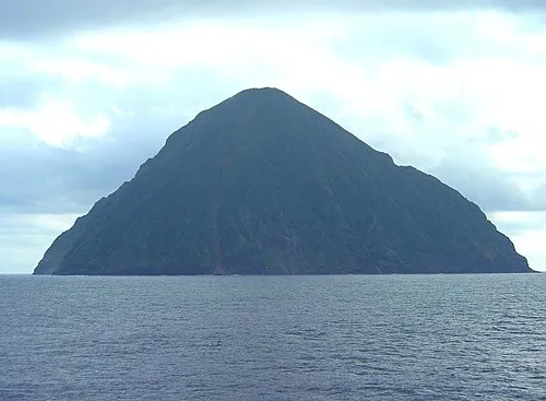
The Volcano Islands (火山列島, Kazan Rettō), also known as Iwo Islands (硫黄列島, Iō Rettō) are a group of three Japanese islands in the Northwestern Pacific Ocean. They lie southwest of the Ogasawara Islands and are administered as part of them. The islands are all active volcanoes lying atop the Izu–Bonin–Mariana Arc that stretches south to the Marianas. They have an area of 32.55 square kilometres (12.57 mi2), and a population of 380.
Read more on Wikipedia Text: Wikipedia contributors · CC BY-SA 4.0 · shortened
At a glance
- Area
- 32.5 km²
Source: Wikidata
Climate of Volcano Islands
Best months for sightseeingBest months for sightseeing: May–June, August–November.
Bars: average monthly low and high temperature. Below: precipitation. Monthly averages for 1970–2000 at about 18 km resolution, adjusted for elevation. Highlighted months are mild and relatively dry. Source: WorldClim 2.1 (CC BY 4.0).
Show values as a table
| Month | Jan | Feb | Mar | Apr | May | Jun | Jul | Aug | Sep | Oct | Nov | Dec |
|---|---|---|---|---|---|---|---|---|---|---|---|---|
| Average high (°C) | 16° | 16° | 17° | 19° | 21° | 23° | 25° | 24° | 24° | 23° | 21° | 18° |
| Average low (°C) | 13° | 13° | 14° | 16° | 17° | 20° | 21° | 20° | 20° | 20° | 18° | 15° |
| Precipitation (mm) | 82 | 70 | 54 | 89 | 110 | 83 | 163 | 166 | 125 | 162 | 122 | 117 |
Other places to visit in this season: May June August September October November
More lakes, rivers and coasts in Japan
-
 Iwo Jima Island, Tokyo40 km SE
-
 San Alexander Island, Tokyo56 km NE
-
 San-Augustine Island, Tokyo97 km SE
Sources & licences
Data last updated: · 2 independent sources