- Population
- 5,658
- 5.7K
- Elevation
- 1,337 m
- above sea level
- Local time
- UTC+09:00
- Asia/Tokyo · UTC+09:00
- Places inside
- 1
- listed under Okutama-machi
- Airports
- HND Tokyo Haneda International Airport73 km
- MMJ Shinshu-Matsumoto Airport109 km
About Okutama-machi
Okutama-machi is a municipality. Location: Nishitama-gun, Tokyo. Population: 5,658. Elevation: 1,337 m.
Okutama (奥多摩町, Oku-Tama-machi) is a town located in the western portion of Tokyo Metropolis, Japan, at a distance of roughly 60 kilometres (37 mi) west-northwest of Tokyo Imperial Palace. As of 1 April 2021, the town had an estimated population of 4,949, and a population density of 22 persons per km2. The total area of the town is 225.53 square kilometres (87.08 sq mi).
Source: Wikipedia · CC BY-SA 4.0
Travel notes for Okutama-machi
From Wikivoyage
Okutama (奥多摩) is a mountainous region along the Tama River, at the extreme western end of Tokyo.
Understand+
Tourist information site:
The local tourist association has a Japanese-only guide site with integrated Google Translate.
Get in+
By train:
1 Oku-Tama Station (note the hyphen, or else you won't find it in route searches) is located at the end of the JR Ome Line. From Tokyo and Shinjuku, take a Chuo Line rapid service to Ome (which might require a transfer at Tachikawa, depending on which rapid train you catch), then change trains in Ome for Oku-Tama. The trip from central Tokyo takes around 1¾-2 hours and costs ¥1,080.
Source: Wikivoyage · CC BY-SA 4.0 · abridged
Places bordering Okutama-machi
- Ōme
- Akiruno Shi
- Hinohara-mura
- Chichibu
- Hannō
- Uenohara-shi
- Kosuge Village
- Tabayama Village
Population of Okutama-machi over time
| 2010 | 6,045 | |
|---|---|---|
| 2015 | 5,234 | |
| 2021 | 4,787 |
Censuses and official estimates; source: Wikidata.
Climate of Okutama-machi
Best months for sightseeingBest months for sightseeing: July–August.
This month · November
A cold month
Day 9° · Night -1° · Rain 70 mm
Better nearby cities in November
- Kofu · 47 km west17°
- Isehara · 52 km southeast18°
- Odawara · 64 km south19°
- Hottest month
- August (day 23°)
- Coldest month
- January (night -9°)
- Wettest month
- August (233 mm)
- Driest month
- December (31 mm)
Bars: average monthly low and high temperature. Below: precipitation. Monthly averages for 1970–2000 at about 18 km resolution, adjusted for elevation. Highlighted months are mild and relatively dry. Source: WorldClim 2.1 (CC BY 4.0).
Show values as a table
| Month | Jan | Feb | Mar | Apr | May | Jun | Jul | Aug | Sep | Oct | Nov | Dec |
|---|---|---|---|---|---|---|---|---|---|---|---|---|
| Average high (°C) | 2° | 2° | 5° | 11° | 16° | 18° | 21° | 23° | 19° | 14° | 9° | 5° |
| Average low (°C) | -9° | -8° | -5° | 1° | 5° | 10° | 14° | 15° | 11° | 5° | -1° | -6° |
| Precipitation (mm) | 35 | 50 | 83 | 106 | 128 | 190 | 167 | 233 | 224 | 156 | 70 | 31 |
How to get to Okutama-machi
The nearest airport is Tokyo Haneda International Airport (HND), 73 km to the southeast as the crow flies. The nearest large city is Ōme, 17 km to the east.
Airports
- Tokyo Haneda International Airport (HND) Tokyo 73 kmsoutheast
- Shinshu-Matsumoto Airport (MMJ) Matsumoto 109 kmwest
- Oshima Airport (OIM) Izu Oshima 119 kmsouth
Nearby large cities
- Ōme Population: 133.5K 17 kmeast
- Iruma Population: 147.2K 28 kmeast
- Hachiōji Population: 579.4K 31 kmsoutheast
- Akishima Population: 113.9K 31 kmeast
- Sayama Population: 160.8K 32 kmeast
Straight-line distances; road distances are longer. Airport data: OurAirports.
Day trips from Okutama-machi
Within 100 km: 51 historic and cultural sites, 56 natural sites, 47 lakes, rivers and coasts.
0–25 km6 places
- Mount Bukō Mountain 15 kmN
- Chichibu Tama Kai National Park Natural site 20 kmW
- Mitake-san Mountain 10 kmSE
- Okutama-ko Lake 5 kmS
25–60 km32 places
- Saitama Super Arena Landmark 53 kmE
- Iruma River River 45 kmE
- Mount Ryōkami Mountain 29 kmNW
- Mount Ogura Mountain 47 kmNW
60–100 km116 places
- Honshu Island 97 kmW
- Jōga Shima Island 92 kmSE
- Enoshima Island 70 kmSE
- Hatsu-shima Island 87 kmS
Straight-line distances.
Places in Okutama-machi
1 place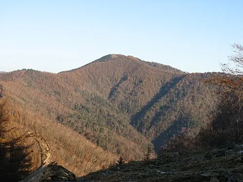
Nearby attractions & nature
Everything nearby-
 Okutama-ko Lake, Tokyo5.1 km S
-
 Mitake-san Mountain, Ōme-shi9.6 km SE
-
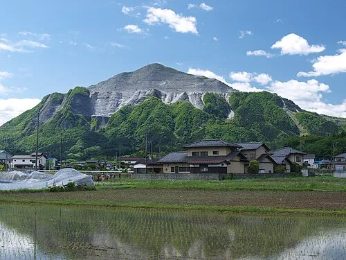 Mount Bukō Mountain, Chichibu-gun15 km N
-
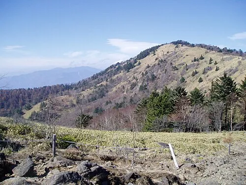 Mount Daibosatsu Mountain, Tabayama Village20 km SW
-
Chichibu Tama Kai National Park Natural site, Kōshū Shi20 km W
Sources & licences
Data last updated: · 2 independent sources