- Population
- 5,345
- 5.3K
- Elevation
- 429 m
- above sea level
- Local time
- UTC+09:00
- Asia/Tokyo · UTC+09:00
- Airports
- YGJ Yonago Kitaro Airport / JASDF Miho Air Base37 km
- IZO Izumo Enmusubi Airport44 km
About Nichinan Chō
Nichinan Chō is a municipality. Location: Hino Gun, Tottori. Population: 5,345. Elevation: 429 m.
Nichinan (日南町, Nichinan-chō) is a town located in Hino District, Tottori Prefecture, Japan. As of 31 December 2021, the town had an estimated population of 4,144 in 1903 households and a population density of 12 persons per km2. The total area of the town is 340.962 square kilometres (131.646 sq mi), representing 10% of the total area of Tottori Prefecture.Over 90% of the town is covered by mountains and forest, and 5% of the land is arable. Areas of Nichinan are part of Hiba-Dogo-Taishaku Quasi-National Park.
Source: Wikipedia · CC BY-SA 4.0
Places bordering Nichinan Chō
- Shōbara
- Niimi
- Nanbu Chō
- Hino Chō
- Yasugichō
- Okuizumo Chō
Population of Nichinan Chō over time
| 2010 | 5,460 | |
|---|---|---|
| 2015 | 4,765 | |
| 2021 | 4,033 |
Censuses and official estimates; source: Wikidata.
Climate of Nichinan Chō
Best months for sightseeingBest months for sightseeing: May–June, September–October.
This month · November
Outside the best season
Day 14° · Night 5° · Rain 85 mm
Better nearby cities in November
- Kochi · 181 km south18°
- Ōita · 263 km southwest18°
- Beppu · 265 km southwest17°
- Hottest month
- August (day 29°)
- Coldest month
- February (night -2°)
- Wettest month
- July (275 mm)
- Driest month
- December (77 mm)
Bars: average monthly low and high temperature. Below: precipitation. Monthly averages for 1970–2000 at about 18 km resolution, adjusted for elevation. Highlighted months are mild and relatively dry. Source: WorldClim 2.1 (CC BY 4.0).
Show values as a table
| Month | Jan | Feb | Mar | Apr | May | Jun | Jul | Aug | Sep | Oct | Nov | Dec |
|---|---|---|---|---|---|---|---|---|---|---|---|---|
| Average high (°C) | 5° | 5° | 10° | 16° | 21° | 24° | 28° | 29° | 25° | 19° | 14° | 8° |
| Average low (°C) | -2° | -2° | 1° | 7° | 11° | 16° | 21° | 22° | 17° | 11° | 5° | 1° |
| Precipitation (mm) | 89 | 93 | 112 | 142 | 151 | 246 | 275 | 171 | 217 | 120 | 85 | 77 |
Other places to visit in this season: May June September October
How to get to Nichinan Chō
The nearest airport is Yonago Kitaro Airport / JASDF Miho Air Base (YGJ), 37 km to the north as the crow flies. For international flights: Okayama Momotaro Airport (OKJ) (71 km). The nearest large city is Yonago, 31 km to the north.
Airports
- Yonago Kitaro Airport / JASDF Miho Air Base (YGJ) Yonago 37 kmnorth
- Izumo Enmusubi Airport (IZO) Izumo 44 kmnorthwest
- Okayama Momotaro Airport (OKJ) Okayama 71 kmsoutheast
Nearby large cities
- Yonago Population: 148.7K 31 kmnorth
- Matsue Population: 203.6K 40 kmnorthwest
- Izumo Population: 172.8K 50 kmnorthwest
- Tsuyama Population: 102.3K 69 kmeast
- Fukuyama Population: 468.8K 76 kmsouth
Straight-line distances; road distances are longer. Airport data: OurAirports.
Day trips from Nichinan Chō
Within 100 km: 5 historic and cultural sites, 10 natural sites, 22 lakes, rivers and coasts.
0–25 km4 places
- Mount Hiba Mountain 22 kmSW
- Mount Sentsū Mountain 7 kmW
- Mount Dōgo Mountain 10 kmS
- Mount Hōbutsu Mountain 21 kmNE
25–60 km8 places
- Hino River River 34 kmN
- Daikon Island Island 38 kmN
- Shinji Ko Lake 42 kmNW
- Lake Nakaumi Lake 34 kmN
60–100 km25 places
- Ikuchi Jima Island 98 kmS
- Shiwaku Islands Island 96 kmSE
- Manabe Island Island 94 kmS
- Sendai River River 95 kmNE
Straight-line distances.
Nearby attractions & nature
Everything nearby-
Mount Sentsū Mountain, Shimane7.5 km W
-
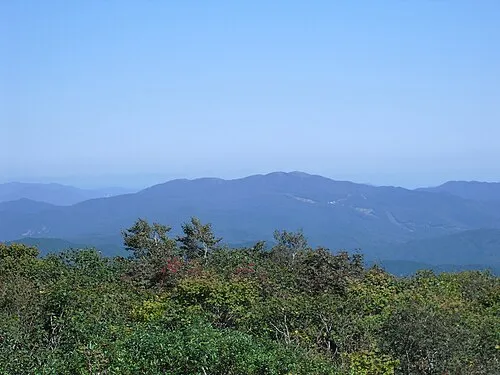 Mount Dōgo Mountain, Shobara10 km S
-
 Mount Hōbutsu Mountain, Kōfu Chō21 km NE
-
Mount Hiba Mountain, Shobara22 km SW
Sources & licences
Data last updated: · 2 independent sources