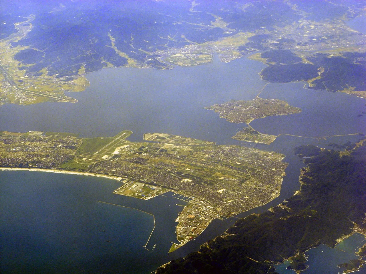
- Population
- 36,324
- 36.3K
- Elevation
- 1 m
- above sea level
- Local time
- UTC+09:00
- Asia/Tokyo · UTC+09:00
- Airports
- YGJ Yonago Kitaro Airport / JASDF Miho Air Base5 km
- IZO Izumo Enmusubi Airport34 km
About Sakaiminato
Sakaiminato is a city. Location: Sakaiminato Shi, Tottori. Population: 36,324. Elevation: 1 m. The best months to visit are May–June, September–October. The nearest airport is Yonago Kitaro Airport / JASDF Miho Air Base (5 km). Nearby sights include Daikon Island and Lake Nakaumi.
Photos of Sakaiminato
-

Suikotei · CC BY 4.0 -

shikabane taro · CC BY 3.0 -

C2revenge · CC BY-SA 4.0 -

C2revenge · CC BY-SA 4.0 -

Mti · CC BY-SA 3.0


Travel notes for Sakaiminato
From Wikivoyage
Sakaiminato (境港市 Sakaiminato-shi) on the western border of Tottori Prefecture is an active fishing port and host to a Japanese Self Defense Forces base. The locally-caught crab is especially good, but the big attraction is as the home of Mizuki Shigeru, creator of the popular manga Ge Ge Ge no Kitaro.
Understand+
Tourist Information Site:
The local tourist association has a Japanese-only guide site which contains a partly English map.
Get in+
By plane:
1 Miho-Yonago Airport (米子鬼太郎空港 YGJ IATA), 1634 Sainokamicho (Straddles the border of Yonago and Sakaiminato, about 15 km from central Yonago), ☏ +81 859-45-6121. In spite of its name, Yonago Airport is actually located here in Sakaiminato, not Yonago. ANA operates flights to/from Tokyo and ASIANA operates flights from Seoul three days a week.
By train:
Sakaiminato can easily be reached by train. All train stations in the city are located along the JR Sakai Line, which connects to Yonago.
By boat:
1 DBS Ferry Terminal, ☏ +81 859-30-2332, dbsferry@dbsferry.com. Overnight ferries depart twice a week from Sakaiminato to Donghae, Korea and then on to Vladivostok, Russia a day later. ¥15,000 to Donghae. (updated Jun 2020)
Source: Wikivoyage · CC BY-SA 4.0 · abridged
Climate of Sakaiminato
Best months for sightseeingBest months for sightseeing: May–June, September–October.
This month · November
A wet month
Day 16° · Night 8° · Rain 117 mm
Better nearby cities in November
- Kochi · 223 km south18°
- Ōita · 297 km southwest18°
- Beppu · 297 km southwest17°
- Hottest month
- August (day 30°)
- Coldest month
- February (night 1°)
- Wettest month
- September (201 mm)
- Driest month
- April (108 mm)
Bars: average monthly low and high temperature. Below: precipitation. Monthly averages for 1970–2000 at about 18 km resolution, adjusted for elevation. Highlighted months are mild and relatively dry. Source: WorldClim 2.1 (CC BY 4.0).
Show values as a table
| Month | Jan | Feb | Mar | Apr | May | Jun | Jul | Aug | Sep | Oct | Nov | Dec |
|---|---|---|---|---|---|---|---|---|---|---|---|---|
| Average high (°C) | 8° | 8° | 12° | 18° | 22° | 25° | 29° | 30° | 26° | 21° | 16° | 11° |
| Average low (°C) | 2° | 1° | 3° | 8° | 13° | 18° | 22° | 23° | 19° | 13° | 8° | 4° |
| Precipitation (mm) | 124 | 116 | 111 | 108 | 112 | 174 | 192 | 124 | 201 | 123 | 117 | 109 |
Other places to visit in this season: May June September October
How to get to Sakaiminato
The nearest airport is Yonago Kitaro Airport / JASDF Miho Air Base (YGJ), 5 km to the south as the crow flies. The nearest large city is Yonago, 15 km to the southeast.
Airports
- Yonago Kitaro Airport / JASDF Miho Air Base (YGJ) Yonago 5 kmsouth
- Izumo Enmusubi Airport (IZO) Izumo 34 kmsouthwest
- Oki Global Geopark Airport (OKI) Okinoshima 72 kmnorth
Nearby large cities
- Yonago Population: 148.7K 15 kmsoutheast
- Matsue Population: 203.6K 17 kmwest
- Izumo Population: 172.8K 46 kmsouthwest
- Tsuyama Population: 102.3K 88 kmsoutheast
- Tottori-shi Population: 188.5K 91 kmeast
Straight-line distances; road distances are longer. Airport data: OurAirports.
Day trips from Sakaiminato
Within 100 km: 2 historic and cultural sites, 8 natural sites, 13 lakes, rivers and coasts.
0–25 km4 places
- Hino River River 16 kmSE
- Daikon Island Island 7 kmSW
- Lake Nakaumi Lake 8 kmS
- Miho Bay Natural site 10 kmSE
25–60 km9 places
- Chiburi Shima Island 56 kmN
- Shinji Ko Lake 27 kmW
- Mount Hiba Mountain 57 kmS
- Mount Sentsū Mountain 43 kmS
60–100 km10 places
- Oki Islands Island 79 kmN
- Sendai River River 87 kmE
- Tottori Castle ruins Historic site 92 kmE
- Nishino Shima Island 64 kmN
Straight-line distances.
Nearby attractions & nature
Everything nearby-
Daikon Island Island, Shimane6.9 km SW
-
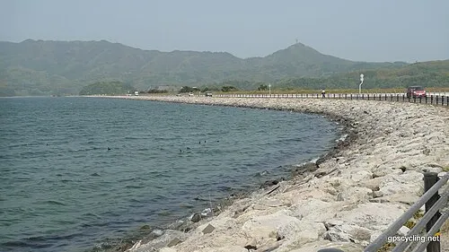 Lake Nakaumi Lake, Shimane8.4 km S
-
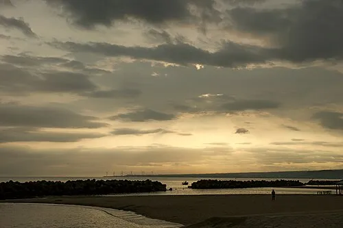 Miho Bay Natural site, Tottori10 km SE
-
Hino River River, Tottori16 km SE
Sources & licences
Data last updated: