- Population
- 20,134
- 20.1K
- Elevation
- 129 m
- above sea level
- Local time
- UTC+00:00
- Africa/Casablanca · UTC+00:00
- Airports
- MLN Melilla Airport15 km
- NDR Nador Al Aaroui International Airport18 km
About Zeghanghane
Zeghanghane is a municipality. Location: Nador Province, Oriental. Population: 20,134. Elevation: 129 m. The best months to visit are March–June, October–November. The nearest airport is Melilla Airport (15 km). Nearby sights include Melilla Lighthouse and Cabo Trapana.
Climate of Zeghanghane
Best months for sightseeingBest months for sightseeing: March–June, October–November.
This month · November
A good month to visit
Day 20° · Night 11° · Rain 19 mm
- Hottest month
- August (day 31°)
- Coldest month
- January (night 7°)
- Wettest month
- April (48 mm)
- Driest month
- July (1 mm)
Bars: average monthly low and high temperature. Below: precipitation. Monthly averages for 1970–2000 at about 18 km resolution, adjusted for elevation. Highlighted months are mild and relatively dry. Source: WorldClim 2.1 (CC BY 4.0).
Show values as a table
| Month | Jan | Feb | Mar | Apr | May | Jun | Jul | Aug | Sep | Oct | Nov | Dec |
|---|---|---|---|---|---|---|---|---|---|---|---|---|
| Average high (°C) | 16° | 17° | 19° | 21° | 24° | 27° | 31° | 31° | 29° | 24° | 20° | 17° |
| Average low (°C) | 7° | 8° | 10° | 11° | 14° | 17° | 20° | 20° | 18° | 15° | 11° | 9° |
| Precipitation (mm) | 47 | 37 | 35 | 48 | 27 | 6 | 1 | 4 | 14 | 23 | 19 | 36 |
Other places to visit in this season: March April May June October November
How to get to Zeghanghane
The nearest airport is Melilla Airport (MLN), 15 km to the north as the crow flies. For international flights: Nador Al Aaroui International Airport (NDR) (18 km). The nearest large city is Al Hoceima, 85 km to the west.
Airports
- Melilla Airport (MLN) Melilla 15 kmnorth
- Nador Al Aaroui International Airport (NDR) Al Aaroui 18 kmsouth
- Cherif Al Idrissi Airport (AHU) Al Hoceima 75 kmwest
Nearby large cities
- Al Hoceima Population: 395.6K 85 kmwest
- Almería Population: 196.9K 194 kmnorth
- Málaga Population: 592.3K 215 kmnorthwest
- Tétouan Population: 415.8K 219 kmwest
- Marbella Population: 156.3K 227 kmnorthwest
Straight-line distances; road distances are longer. Airport data: OurAirports.
Day trips from Zeghanghane
Within 100 km: 30 historic and cultural sites, 9 natural sites, 16 lakes, rivers and coasts.
0–25 km39 places
- Playa de San Lorenzo Beach 16 kmNE
- Playa de los Cárabos Beach 16 kmNE
- Playa de la Hípica Beach 16 kmNE
- Playa de Horcas Coloradas Beach 18 kmN
25–60 km7 places
- Chafarinas Islands Island 53 kmE
- Isabel II Island Lighthouse Landmark 53 kmE
- Isla del Rey Island 54 kmE
- Isabel II Island Island 53 kmE
60–100 km9 places
- Oued Moulouya River 61 kmE
- Isla de Mar Island 81 kmW
- Peñón de Alhucemas Island 80 kmW
- Alhucemas Lighthouse Landmark 80 kmW
Straight-line distances.
Nearby attractions & nature
Everything nearby-
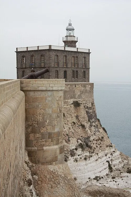 Melilla Lighthouse Landmark, Melilla Municipality17 km NE
-
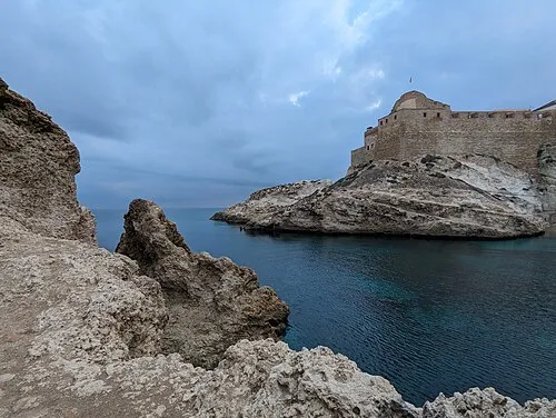 Cabo Trapana Natural site, Melilla Municipality18 km NE
-
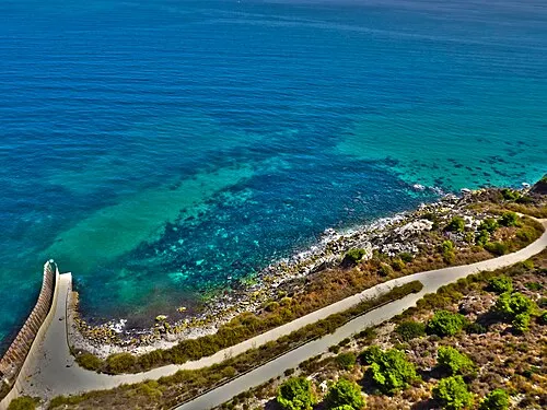 Playa del Quemado Beach, Melilla Municipality19 km N
-
Finca Salama Mediumwave Transmitter Landmark, Melilla Municipality15 km N
-
Parque Forestal Juan Carlos I Natural site, Melilla Municipality15 km NE
-
Melilla Mediumwave Transmitter ( 1485 kHz) Landmark, Melilla Municipality15 km N
-
Agustín Jerez Park Natural site, Melilla Municipality16 km NE
-
Estadio Municipal de Fútbol Alvarez Claro Landmark, Melilla Municipality16 km N
Other cities and towns in Nador Province
-
Iksane Municipality, Nador Province7.1 km S
-
 Beni Enzar Town, Nador Province14 km NE
-
Nador Municipality, Nador Province7.4 km E
-
 Bni Chiker Municipality, Nador Province18 km N
-
 Al Aaroui Municipality, Nador Province15 km S
-
Iaazzanene Municipality, Nador Province14 km NW
Sources & licences
Data last updated: