- Population
- 2,971
- 3K
- Elevation
- 52 m
- above sea level
- Local time
- UTC−01:00
- Atlantic/Azores · UTC−01:00
- Airports
- PDL João Paulo II Airport1 km
- SMA Santa Maria Airport97 km
About Santa Clara
Santa Clara is a municipality. Location: Ponta Delgada, Azores. Population: 2,971. Elevation: 52 m. The best months to visit are May–October. The nearest airport is João Paulo II Airport (1 km). Nearby sights include Church of the Jesuit College and Rocha Quebrada.
Photos of Santa Clara
-
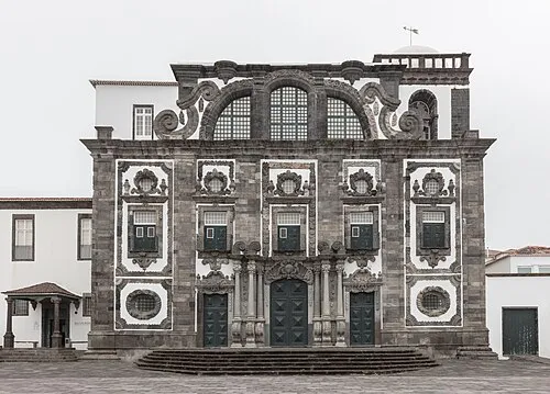
Church of the Jesuit College Diego Delso · CC BY-SA 4.0

Climate of Santa Clara
Best months for sightseeingBest months for sightseeing: May–October.
This month · November
A wet month
Day 20° · Night 15° · Rain 134 mm
- Hottest month
- August (day 26°)
- Coldest month
- February (night 12°)
- Wettest month
- November (134 mm)
- Driest month
- July (35 mm)
Bars: average monthly low and high temperature. Below: precipitation. Monthly averages for 1970–2000 at about 18 km resolution, adjusted for elevation. Highlighted months are mild and relatively dry. Source: WorldClim 2.1 (CC BY 4.0).
Show values as a table
| Month | Jan | Feb | Mar | Apr | May | Jun | Jul | Aug | Sep | Oct | Nov | Dec |
|---|---|---|---|---|---|---|---|---|---|---|---|---|
| Average high (°C) | 17° | 17° | 18° | 18° | 20° | 22° | 25° | 26° | 25° | 22° | 20° | 18° |
| Average low (°C) | 13° | 12° | 13° | 13° | 14° | 17° | 19° | 20° | 19° | 17° | 15° | 14° |
| Precipitation (mm) | 120 | 104 | 95 | 74 | 64 | 48 | 35 | 56 | 96 | 119 | 134 | 133 |
Other places to visit in this season: May June July August September October
How to get to Santa Clara
The nearest airport is João Paulo II Airport (PDL), 1 km to the west as the crow flies.
Airports
- João Paulo II Airport (PDL) Ponta Delgada 1 kmwest
- Santa Maria Airport (SMA) Vila do Porto 97 kmsoutheast
- Lajes Airport (TER) Praia da Vitória 167 kmnorthwest
Straight-line distances; road distances are longer. Airport data: OurAirports.
Day trips from Santa Clara
Within 100 km: 1 historic or cultural site, 8 natural sites, 3 lakes, rivers and coasts.
0–25 km7 places
- Pico do Boi Mountain 9 kmN
- Ilhéu de Vila Franca Island 22 kmE
- Church of the Jesuit College Attraction 2 kmE
- Lagoa do Pilar Mountain 19 kmNW
25–60 km4 places
- Pico da Senhora Mountain 32 kmE
- Praia do Fogo Beach 33 kmE
- Bartholomeu Mountain 46 kmE
- Ferro Mountain 31 kmE
60–100 km1 place
- Santa Maria Island Island 99 kmSE
Straight-line distances.
Nearby attractions & nature
Everything nearby-
Church of the Jesuit College Attraction, Ponta Delgada (São Sebastião)1.7 km E
-
Rocha Quebrada Mountain, Relva5.5 km NW
-
Pico Grande Mountain, Fenais da Luz7.4 km NE
-
Pico do Boi Mountain, Arrifes8.8 km N
-
Pico da Cruz Mountain, Santa Bárbara13 km NW
-
Lagoa do Pilar Mountain, Pilar da Bretanha19 km NW
-
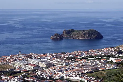 Ilhéu de Vila Franca Island, Vila Franca do Campo (São Pedro)22 km E
Sources & licences
Data last updated: