Cardosas
Located in Arruda dos Vinhos Municipality, Lisbon District Coordinates: 38°58′24″ N 9°02′22″ W
- Population
- 819
- 819
- Elevation
- 193 m
- above sea level
- Local time
- UTC+00:00
- Europe/Lisbon · UTC+00:00
- Airports
- LIS Lisbon Humberto Delgado Airport23 km
- CAT Cascais Airport39 km
About Cardosas
Cardosas is a municipality. Location: Arruda dos Vinhos Municipality, Lisbon District. Population: 819. Elevation: 193 m.
Cardosas is a civil parish in the municipality of Arruda dos Vinhos, Portugal. The population in 2011 was 836, in an area of 6.01 km2.
Source: Wikipedia · CC BY-SA 4.0
At a glance
- Area
- 6 km²
Source: Wikidata
Climate of Cardosas
Best months for sightseeingBest months for sightseeing: June–October.
This month · November
A wet month
Day 17° · Night 10° · Rain 104 mm
- Hottest month
- August (day 27°)
- Coldest month
- January (night 7°)
- Wettest month
- December (116 mm)
- Driest month
- July (6 mm)
Bars: average monthly low and high temperature. Below: precipitation. Monthly averages for 1970–2000 at about 18 km resolution, adjusted for elevation. Highlighted months are mild and relatively dry. Source: WorldClim 2.1 (CC BY 4.0).
Show values as a table
| Month | Jan | Feb | Mar | Apr | May | Jun | Jul | Aug | Sep | Oct | Nov | Dec |
|---|---|---|---|---|---|---|---|---|---|---|---|---|
| Average high (°C) | 14° | 15° | 17° | 18° | 20° | 24° | 27° | 27° | 25° | 21° | 17° | 14° |
| Average low (°C) | 7° | 8° | 9° | 10° | 12° | 15° | 16° | 17° | 16° | 13° | 10° | 8° |
| Precipitation (mm) | 105 | 86 | 51 | 64 | 57 | 20 | 6 | 7 | 28 | 81 | 104 | 116 |
Other places to visit in this season: June July August September October
How to get to Cardosas
The nearest airport is Lisbon Humberto Delgado Airport (LIS), 23 km to the south as the crow flies. The nearest large city is Lisbon, 29 km to the south.
Airports
- Lisbon Humberto Delgado Airport (LIS) Lisbon 23 kmsouth
- Cascais Airport (CAT) Cascais 39 kmsouthwest
- Badajoz Airport (BJZ) Badajoz 193 kmeast
Nearby large cities
- Lisbon Population: 517.8K 29 kmsouth
- Setúbal Population: 118.2K 52 kmsouth
- Badajoz Population: 150.5K 180 kmeast
- Porto Population: 252.7K 244 kmnorth
- Huelva Population: 144.3K 264 kmsoutheast
Straight-line distances; road distances are longer. Airport data: OurAirports.
Day trips from Cardosas
Within 100 km: 44 historic and cultural sites, 166 natural sites, 8 lakes, rivers and coasts.
0–25 km29 places
- Outeiro do Vento Mountain 21 kmNW
- Três Cabeços Mountain 19 kmW
- Alto da Toupeira Mountain 18 kmSW
- Picoto da Teixugueira Mountain 24 kmN
25–60 km132 places
- Convento de Santa Teresa de Jesus de Setúbal Attraction 52 kmS
- Castelo dos Mouros (Arrábida) Historic site 54 kmS
- Galápos Beach Beach 55 kmS
- Alpertuche Beach Beach 56 kmS
60–100 km57 places
- Vale do Corvo Natural site 70 kmE
- Vale Costado Natural site 66 kmE
- Cabeço Gordo Mountain 66 kmN
- Cabeço Gordo Mountain 60 kmNE
Straight-line distances.
Nearby attractions & nature
Everything nearby-
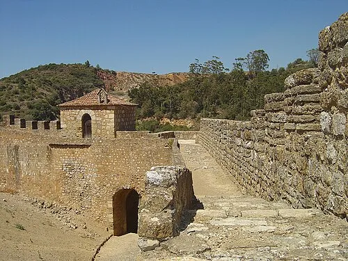 Castelo de Alenquer Historic site, União das freguesias de Alenquer (Santo Estêvão e Triana)9.8 km N
-
Alto das Covas Mountain, União das freguesias de Alenquer (Santo Estêvão e Triana)11 km N
-
Serves Mountain, Vialonga9.9 km SW
-
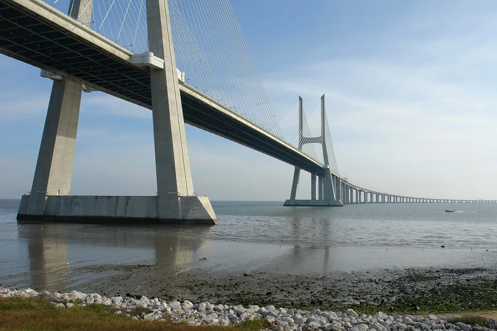 Vasco-da-Gama-bridge Landmark, Setúbal District23 km S
-
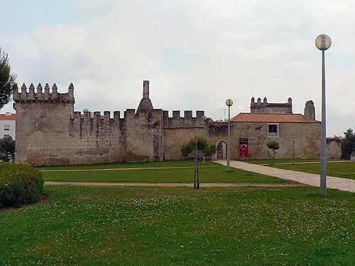 Castelo de Pirescoxe Historic site, União das freguesias de Santa Iria de Azoia, São João da Talha e Bobadela16 km S
-
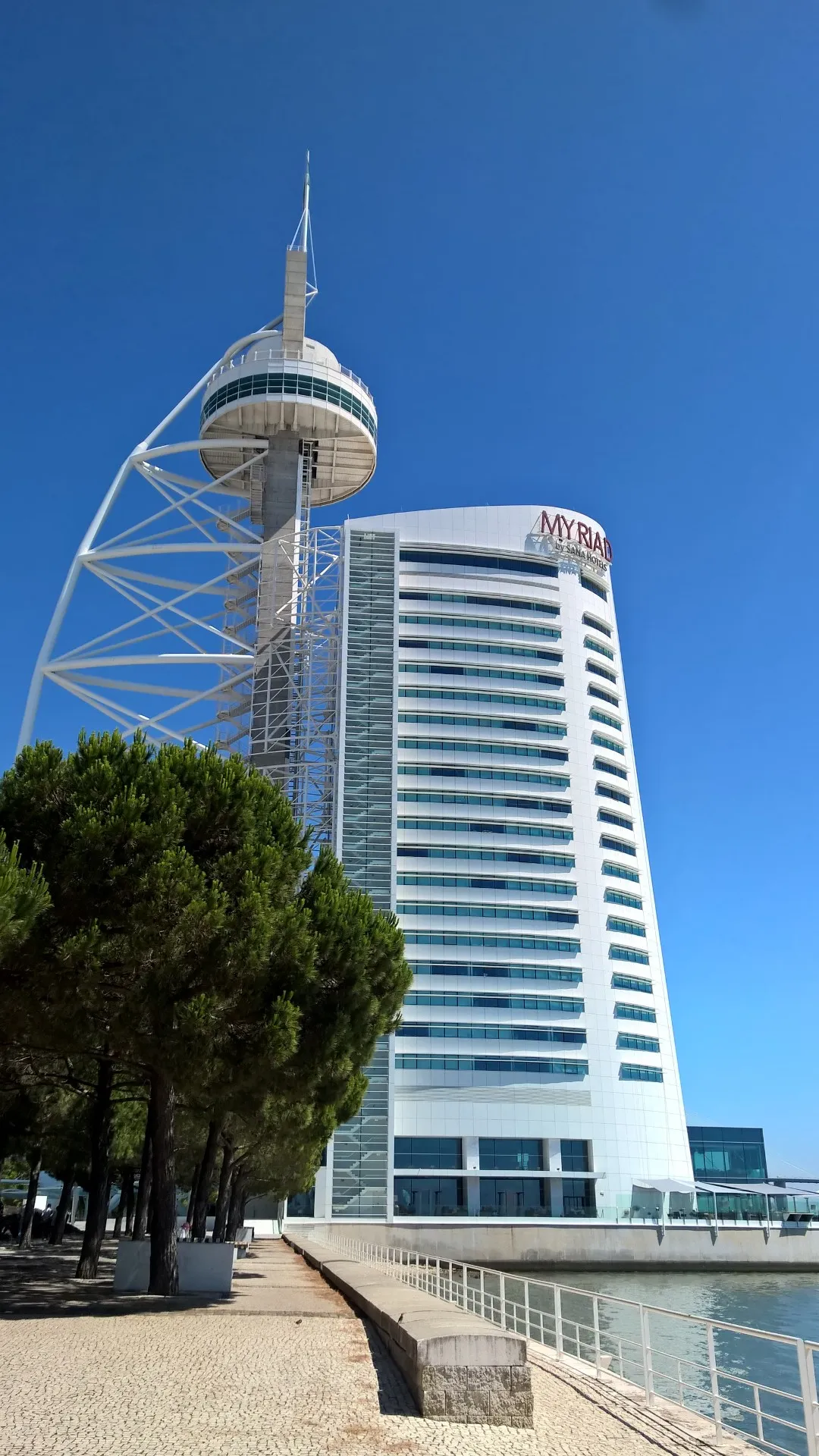 Vasco da Gama tower Landmark, Parque das Nações23 km S
-
Atalaia Mountain, União das freguesias de Enxara do Bispo, Gradil e Vila Franca do Rosário15 km W
-
Serra da Atouguia Mountain, Ota16 km N
Sources & licences
Data last updated: · 2 independent sources