Serra de Grândola
Located in Setúbal District, Portugal Coordinates: 38°05′58″ N 8°37′41″ W
- Elevation
- 260 m
- above sea level
- Local time
- UTC+00:00
- Europe/Lisbon · UTC+00:00
- Airports
- LIS Lisbon Humberto Delgado Airport88 km
- CAT Cascais Airport94 km
About Serra de Grândola
Serra de Grândola is a mountain. Location: Setúbal District, Portugal. Elevation: 260 m. The best months to visit are May–October. The nearest airport is Lisbon Humberto Delgado Airport (88 km). Nearby sights include Vale da Chafurda and Vale de Coelheiros.
Climate of Serra de Grândola
Best months for sightseeingBest months for sightseeing: May–October.
This month · November
Outside the best season
Day 17° · Night 9° · Rain 90 mm
- Hottest month
- August (day 28°)
- Coldest month
- January (night 6°)
- Wettest month
- December (108 mm)
- Driest month
- July (4 mm)
Bars: average monthly low and high temperature. Below: precipitation. Monthly averages for 1970–2000 at about 18 km resolution, adjusted for elevation. Highlighted months are mild and relatively dry. Source: WorldClim 2.1 (CC BY 4.0).
Show values as a table
| Month | Jan | Feb | Mar | Apr | May | Jun | Jul | Aug | Sep | Oct | Nov | Dec |
|---|---|---|---|---|---|---|---|---|---|---|---|---|
| Average high (°C) | 13° | 14° | 17° | 18° | 21° | 25° | 28° | 28° | 26° | 22° | 17° | 14° |
| Average low (°C) | 6° | 7° | 8° | 9° | 11° | 13° | 15° | 15° | 14° | 13° | 9° | 7° |
| Precipitation (mm) | 92 | 73 | 49 | 58 | 45 | 17 | 4 | 5 | 24 | 68 | 90 | 108 |
Other places to visit in this season: May June July August September October
How to get to Serra de Grândola
The nearest airport is Lisbon Humberto Delgado Airport (LIS), 88 km to the northwest as the crow flies. The nearest large city is Setúbal, 52 km to the northwest.
Airports
- Lisbon Humberto Delgado Airport (LIS) Lisbon 88 kmnorthwest
- Cascais Airport (CAT) Cascais 94 kmnorthwest
- Portimão Airport (PRM) Portimão 106 kmsouth
Nearby large cities
- Setúbal Population: 118.2K 52 kmnorthwest
- Lisbon Population: 517.8K 83 kmnorthwest
- Badajoz Population: 150.5K 168 kmnortheast
- Huelva Population: 144.3K 175 kmsoutheast
- Seville Population: 686.7K 247 kmeast
Straight-line distances; road distances are longer. Airport data: OurAirports.
Nearest towns and villages
-
São Francisco da Serra Municipality, Santiago do Cacém Municipality3.5 km SW
-
União das freguesias de Grândola e Santa Margarida da Serra Municipality, Grândola Municipality11 km NE
-
União das freguesias de Santiago do Cacém, Santa Cruz e São Bartolomeu da Serra Municipality, Santiago do Cacém Municipality12 km S
-
Santo André Municipality, Santiago do Cacém Municipality13 km W
-
Melides Municipality, Grândola Municipality12 km NW
-
Santo André Town, Santo André14 km W
Nearby attractions & nature
Everything nearby-
Vale da Chafurda Natural site, Setúbal District21 km N
-
Vale de Coelheiros Natural site, Setúbal District21 km N
-
Morro do Paneiro Mountain, Cercal22 km S
More nature in Portugal
-
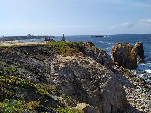 Cape Sines Natural site, Setúbal District28 km SW
-
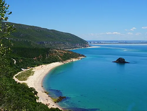 Serra da Arrábida Mountain, União das freguesias de Azeitão (São Lourenço e São Simão)53 km NW
-
Vale da Gran Natural site, Setúbal District35 km N
-
S. Formosinho Mountain, Sado48 km N
-
Serra do Cercal Mountain, Setúbal District38 km S
-
Alto do Monte Abraão Mountain, União das freguesias de Azeitão (São Lourenço e São Simão)52 km NW
Sources & licences
Data last updated: · 2 independent sources