Bitlis Province
Local name: Bitlis ili
Located in Turkey Coordinates: 38°20′31″ N 42°23′29″ E
- Population
- 353,988
- 354K
- Elevation
- 2,084 m
- above sea level
- Local time
- UTC+03:00
- Europe/Istanbul · UTC+03:00
- Places inside
- 136
- listed under Bitlis Province
- Airports
- MSR Muş Airport78 km
- VAN Van Ferit Melen Airport83 km
About Bitlis Province
Bitlis Province is a region. Location: Turkey. Population: 353,988.
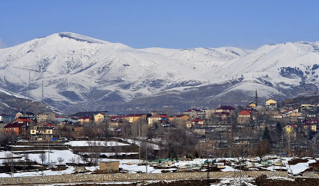
Bitlis Province (Turkish: Bitlis ili; Armenian: Բաղեշի մարզ, romanized: Bagheshi marz; Kurdish: Parêzgeha Bidlîsê) is a province of eastern Turkey, located to the west of Lake Van. It takes its name from the central city, Bitlis. Its area is 8,294 km2, and its population is 353,988 (2022). The province was part of Moxoene of the Kingdom of Armenia. Before the Armenian genocide, the area was part of the Six Armenian Vilayets and considered part of Western Armenia by Armenians.
Source: Wikipedia · CC BY-SA 4.0
Places bordering Bitlis Province
Climate of Bitlis Province
Best months for sightseeingBest months for sightseeing: June–September.
This month · November
A cold month
Day 8° · Night 0° · Rain 95 mm
Better nearby cities in November
- Cizre · 114 km south20°
- Silopi · 122 km south20°
- Kızıltepe · 205 km southwest19°
- Hottest month
- August (day 27°)
- Coldest month
- January (night -7°)
- Wettest month
- April (117 mm)
- Driest month
- July (8 mm)
Bars: average monthly low and high temperature. Below: precipitation. Monthly averages for 1970–2000 at about 18 km resolution, adjusted for elevation. Highlighted months are mild and relatively dry. Source: WorldClim 2.1 (CC BY 4.0).
Show values as a table
| Month | Jan | Feb | Mar | Apr | May | Jun | Jul | Aug | Sep | Oct | Nov | Dec |
|---|---|---|---|---|---|---|---|---|---|---|---|---|
| Average high (°C) | 0° | 1° | 3° | 9° | 15° | 21° | 26° | 27° | 22° | 15° | 8° | 2° |
| Average low (°C) | -7° | -6° | -3° | 1° | 6° | 10° | 14° | 14° | 10° | 5° | 0° | -4° |
| Precipitation (mm) | 75 | 90 | 99 | 117 | 85 | 28 | 8 | 8 | 14 | 78 | 95 | 83 |
Other places to visit in this season: June July August September
How to get to Bitlis Province
The nearest airport is Muş Airport (MSR), 78 km to the northwest as the crow flies. The nearest large city is Siirt, 60 km to the southwest.
Airports
- Muş Airport (MSR) Muş 78 kmnorthwest
- Van Ferit Melen Airport (VAN) Van 83 kmeast
- Şırnak Şerafettin Elçi Airport (NKT) Şırnak 112 kmsouth
Nearby large cities
- Siirt Population: 114K 60 kmsouthwest
- Van Population: 525K 88 kmeast
- Cizre Population: 134K 114 kmsouth
- Batman Population: 452.2K 121 kmsouthwest
- Silopi Population: 114.6K 122 kmsouth
Straight-line distances; road distances are longer. Airport data: OurAirports.
Places in Bitlis Province
136 places- 1 Tatvan İlçesi 84.2K
- 2 Bitlis 66.1K
- 3 Güroymak İlçesi 45.9K
- 4 Hizan İlçesi 37.9K
- 5 Ahlat İlçesi 37.9K
- 6 Mutki İlçesi 33.8K
- 7 Adilcevaz İlçesi 31.4K
Bar: population relative to the most populous place in this list.
Cities & villages10
- Adilcevaz Bucağı · Municipality
- Ahlat Bucağı · Municipality
- Akşar Bucağı · Municipality
- Baltacık · Village
- Bölükyazı Bucağı · Municipality
- Bozpınar · Village
- Erdoğan · Village
- Geyikpınar Bucağı · Municipality
- Göldüzü Bucağı · Municipality
- Güroymak Bucağı · Municipality
Mountains & nature9
- Atgölü Pınarı · Natural site
- Bayramhoca Pınarı · Natural site
- Birke Pınarı · Natural site
- Çayır Pınarı · Natural site
- Çeykor Dağı · Mountain
- Çılkayan Pınarları · Natural site
- Dıkan Pınarı · Natural site
- Garan Pınarı · Natural site
- Gorgora Pınarı · Natural site
Lakes, rivers & coasts34
- Ada Dere · River
- Ağırkan Deresi · River
- Ahkis Deresi · River
- Ahliz Deresi · River
- Alaattinçayı Deresi · River
- Aveberhan Deresi · River
- Aygır Gölü · Lake
- Bahçesaray Çayı · River
- Batmış Gölü · Lake
- Beribuşkul Deresi · River
- Büyük Dere · River
- Çalı Dere · River
- Çalıdüzü Deresi · River
- Çam Deresi · River
- Çay Deresi · River
- Çayır Dere · River
- Cemeceli Deresi · River
- Cenikesin Deresi · River
- Ceviz Deresi · River
- Dam Deresi · River
- Darabi Deresi · River
- Değirmenaltı Deresi · River
- Dipsiz Göl · Lake
- Ekinözü Deresi · River
- Geli Deresi · River
- Geliduli Deresi · River
- Gümüşkanal Çayı · River
- Güzel Dere · River
- Güzel Dere · River
- Güzel Dere · River
- Hanikan Deresi · River
- Hapukan Deresi · River
- Hart Deresi · River
- Hindanik Deresi · River
Largest cities and towns
Nature and heritage in Bitlis Province
Other regions in Turkey
-
 Siirt Province Region, Turkey58 km SW
-
Şırnak Province Region, Turkey94 km S
-
Muş Province Region, Turkey92 km NW
-
Batman Province Region, Turkey100 km W
-
Bahçesaray İlçesi District, Van Province43 km SE
-
Şirvan İlçesi District, Siirt Province44 km SW
Sources & licences
Data last updated: · 2 independent sources