- Population
- 767,848
- 767.8K
- Elevation
- 1,914 m
- above sea level
- Local time
- UTC+03:00
- Europe/Istanbul · UTC+03:00
- Airports
- ERZ Erzurum International Airport11 km
- BGG Bingöl Airport130 km
About Erzurum
Erzurum is a city. Location: Erzurum Province, Turkey. Population: 767,848. Elevation: 1,914 m.
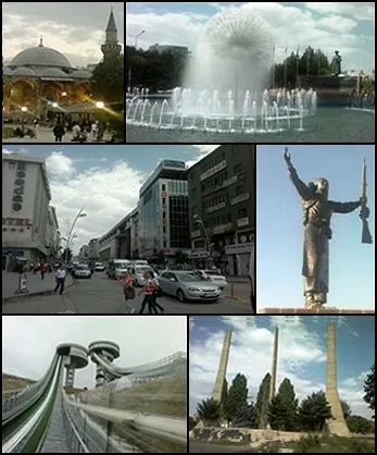
Erzurum (Armenian: Կարին, romanized: Karin; Kurdish: Erzîrom) is a city in eastern Turkey. It is the largest city and capital of Erzurum Province and is 1,900 meters (6,233 feet) above sea level. Erzurum had a population of 367,250 in 2010. It is the site of ancient Theodosiopolis. The city uses the double-headed eagle as its coat-of-arms, a motif that has been a common symbol throughout Anatolia since the Bronze Age.
Source: Wikipedia · CC BY-SA 4.0
Photos of Erzurum
-

sondurum · CC BY 3.0 -

Er.rufai · CC BY-SA 4.0 -

Volker Höhfeld · CC BY-SA 4.0 -

Mehrdad Sarhangi · CC BY 3.0 -

Bilalie.13 · CC BY-SA 4.0


Travel notes for Erzurum
From Wikivoyage
Erzurum is one of the largest cities in Eastern Anatolia, with a population of about 363,000 in 2023, half that of Erzurum Province. It's at high altitude and has a ski resort.
Understand+
Armies have to come this way between Anatolia and the Caucasus, so a series of conquerors have passed through. Those who stayed long enough to influence its architecture included the Seljuks, who first captured it in 1071 AD. They also trashed the neighbouring city of Artze, whose inhabitants fled here and called it the Roman Artze, hence Artze Rum or Erzurum. It was captured by the Ottomans in 1514 and became their military base in the east, although three times occupied by Russia as the late Ottoman empire crumbled. Support for the advancing Russians was the pretext for the 1915 genocide of the city's 40,000 Armenians.
Erzurum stands at an altitude of 1890 m and is bitter cold in winter, often below -10°C by day and -20°C at night. So agriculture is limited and the town's main activities are services, education and natural gas - a pipeline from the Caspian terminates here. Snowfall is limited as winters are dry - early summer is wettest - but whatever falls tends to linger. There are skiing and other winter sports facilities on Palandöken, the mountain just south of the city.
Get in+
By plane:
1 Erzurum Airport (ERZ IATA) (15 km northwest of city center), ☏ +90 442 327 2837. Frequent flights from Istanbul (both IST and SAW), also from Izmir, Ankara and Antalya. No international flights except winter specials from Russia and Germany. A local bus may run to city centre, otherwise take a taxi. (updated Sep 2025)
By train:
Doğu Express runs daily from Ankara, departing at 18:00 and taking 22 hours via Kayseri, Sivas, Erzincan and Divriği. From Erzurum it continues at 16:00 to Kars, another 4 hours. The return train leaves Kars at 08:00 and Erzurum at noon to reach Ankara at 10:15 next morning. There are couchettes and a buffet but no sleeping cars. For tickets see TCDD.
A tourist version of this train runs three times a week in winter. It makes long stops for sightseeing eastbound at İliç (for Kemaliye), Erzincan and Erzurum; the westbound train calls at Erzurum around 02:00 then makes long stops at Divriği and Bostankaya. You're tied to the schedule without flexibility of stopover. The accommodation is in standard sleeping cars, which have been purloined from the conventional train, so the travel experience on that has been degraded.
A high-speed railway is under construction from Ankara towards Erzurum and Kars, and is already in service as far as Sivas. This has not reduced journey times to Erzurum, as trains east of Sivas are so chronically late that it's impractical to schedule a connection.
2 Erzurum railway station is north end of city centre. It's within walking distance of hotels and other amenities.
By bus:
Buses from Istanbul run six times a day, taking 15 hours via Bolu. From Ankara is 12 hours, from Trabzon is 4 hr 30 min via Gümüşhane, and from Diyarbakır is 5 hours.
They run three times a day from Hopa on the border with Georgia, taking 7 hr 30 min via Rize and Artvin.
Bus lines on these routes include Metro Turizm, Flixbus and Yeşil Artvin Ekspres.
Source: Wikivoyage · CC BY-SA 4.0 · abridged
Climate of Erzurum
Best months for sightseeingBest months for sightseeing: June–September.
This month · November
A cold month
Day 5° · Night -5° · Rain 42 mm
Better nearby cities in November
- Cizre · 297 km south20°
- Kızıltepe · 309 km south19°
- Silopi · 314 km south20°
- Hottest month
- August (day 27°)
- Coldest month
- January (night -14°)
- Wettest month
- May (74 mm)
- Driest month
- August (18 mm)
Bars: average monthly low and high temperature. Below: precipitation. Monthly averages for 1970–2000 at about 18 km resolution, adjusted for elevation. Highlighted months are mild and relatively dry. Source: WorldClim 2.1 (CC BY 4.0).
Show values as a table
| Month | Jan | Feb | Mar | Apr | May | Jun | Jul | Aug | Sep | Oct | Nov | Dec |
|---|---|---|---|---|---|---|---|---|---|---|---|---|
| Average high (°C) | -5° | -3° | 1° | 10° | 16° | 21° | 26° | 27° | 22° | 14° | 5° | -2° |
| Average low (°C) | -14° | -13° | -7° | -1° | 4° | 7° | 11° | 10° | 6° | 1° | -5° | -10° |
| Precipitation (mm) | 30 | 33 | 41 | 64 | 74 | 47 | 24 | 18 | 23 | 50 | 42 | 32 |
Other places to visit in this season: June July August September
How to get to Erzurum
The nearest airport is Erzurum International Airport (ERZ), 11 km to the northwest as the crow flies. The nearest large city is Bingoel, 132 km to the southwest.
Airports
- Erzurum International Airport (ERZ) Erzurum 11 kmnorthwest
- Bingöl Airport (BGG) Bingöl 130 kmsouthwest
- Muş Airport (MSR) Muş 133 kmsouth
Nearby large cities
- Bingoel Population: 128.9K 132 kmsouthwest
- Rize Population: 119.8K 139 kmnorthwest
- Ağrı Population: 124.5K 153 kmeast
- Erzincan Population: 150.7K 154 kmwest
- Trabzon Population: 244.1K 179 kmnorthwest
Straight-line distances; road distances are longer. Airport data: OurAirports.
Day trips from Erzurum
Within 100 km: 10 historic and cultural sites, 934 natural sites, 467 lakes, rivers and coasts.
0–25 km53 places
- Yıldırım Dağı Mountain 22 kmS
- Karakaya Tepesi Mountain 17 kmS
- Yayla Tepesi Mountain 16 kmN
- Oluklu Dağ Mountain 17 kmNE
25–60 km846 places
- Taşlı Göl Lake 50 kmSW
- Büyük Göl Lake 50 kmSW
- Medek Gölleri Lake 52 kmSW
- Dipsiz Gölü Lake 49 kmSW
60–100 km512 places
- Seki Gölü Lake 77 kmS
- Lake Akdoğan Lake 94 kmSE
- Tortum Gölü Lake 86 kmN
- Bahri Gölü Lake 68 kmS
Straight-line distances.
Erzurum and similar cities
Side by side with cities of similar size in the same country: population, elevation and climate.
| Measure | Erzurum | Malatya | Küçükçekmece | Çankaya |
|---|---|---|---|---|
| Population | 767.8K | 750.5K | 792K | 792.2K |
| Elevation | 1,914 m | 963 m | 63 m | 850 m |
| Summer day (hottest month) | 27° | 34° | 28° | 30° |
| Winter night (coldest month) | -14° | -4° | 3° | -4° |
| Annual rainfall | 478 mm | 442 mm | 692 mm | 400 mm |
| Best months | Jun–Sep | May, Oct | May–Oct | May–Jun, Sep–Oct |
| Distance | — | 309 km | 1,067 km | 719 km |
Climate values are 1970–2000 monthly averages; straight-line distance.
Nearby attractions & nature
Everything nearby-
Erzurum Kalesi Historic site, Yakutiye0.2 km E
-
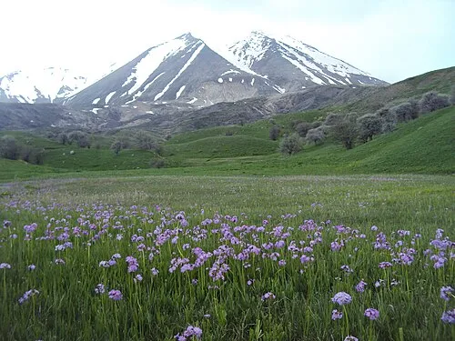 Karasu - Aras Dağları Mountain, Erzurum Province8.7 km S
-
Sultanseki Tepesi Mountain, Palandöken6.4 km S
-
Akyıldırım Dağı Mountain, Palandöken7.8 km E
-
Büyükejder Tepesi Mountain, Palandöken8.7 km S
-
Yıldırım Dağı Mountain, Palandöken9 km S
-
Eğerli Dağı Mountain, Palandöken9.4 km S
-
Palandöken Dağları Mountain, Erzurum Province14 km S
Other cities and towns in Erzurum Province
-
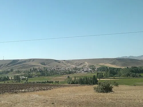 Ilıca Town, Aziziye16 km W
-
Dadaşkent Bucağı Municipality, Erzurum Province4.6 km NW
-
Palandöken City, Palandöken2.2 km S
-
Dadaşköy City, Yakutiye4.5 km NW
-
Ilıca Bucağı Municipality, Erzurum Province16 km W
-
Dumlu Bucağı Municipality, Erzurum Province19 km NE
Sources & licences
Data last updated: · 2 independent sources