Kayseri Province
Local name: Kayseri ili
Located in Turkey Coordinates: 38°44′13″ N 35°29′49″ E
- Population
- 1,452,458
- 1.5M
- Elevation
- 1,052 m
- above sea level
- Local time
- UTC+03:00
- Europe/Istanbul · UTC+03:00
- Places inside
- 157
- listed under Kayseri Province
- Airports
- ASR Kayseri Erkilet International Airport4 km
- NAV Nevşehir Kapadokya Airport84 km
About Kayseri Province
Kayseri Province is a region. Location: Turkey. Population: 1,452,458.
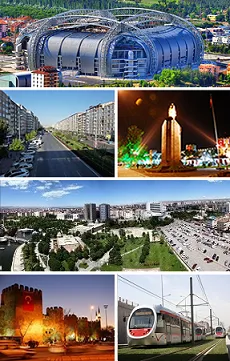
Kayseri (Turkish pronunciation: [ˈkajseɾi]) is a large city in Central Anatolia, Turkey, and the capital of Kayseri province. Historically known as Caesarea, it has been the historical capital of Cappadocia since ancient times. The Kayseri Metropolitan Municipality area is composed of five districts: the two central districts of Kocasinan and Melikgazi, and since 2004, also outlying Hacılar, İncesu, and Talas. Kayseri has been selected by TURKSOY as the Cultural Capital of the Turkic World for 2027.
Source: Wikipedia · CC BY-SA 4.0
Photos of Kayseri Province
-
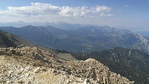
Tahtalı Dağları Joonas Plaan · CC BY 2.0 -
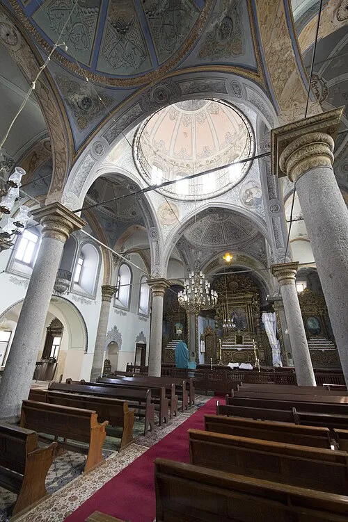
Saint Gregory the Illuminator Church Dosseman · CC BY-SA 4.0


Twin towns and sister cities of Kayseri Province
- Eindhoven Municipality· The Netherlands
Source: Wikidata. Only places with a page on this site are shown.
Population of Kayseri Province over time
| 1813 | 25,000 | |
|---|---|---|
| 1834 | 60,000 | |
| 1970 | 168,000 | |
| 1985 | 378,000 | |
| 1990 | 421,000 | |
| 1994 | 484,000 | |
| 2018 | 1,389,680 |
Censuses and official estimates; source: Wikidata.
Climate of Kayseri Province
Best months for sightseeingBest months for sightseeing: May–June, September–October.
This month · November
Outside the best season
Day 12° · Night -1° · Rain 37 mm
Better nearby cities in November
- Adana · 195 km south21°
- Osmaniye · 196 km south21°
- Tarsus · 209 km south22°
- Hottest month
- July (day 30°)
- Coldest month
- January (night -6°)
- Wettest month
- April (54 mm)
- Driest month
- August (6 mm)
Bars: average monthly low and high temperature. Below: precipitation. Monthly averages for 1970–2000 at about 18 km resolution, adjusted for elevation. Highlighted months are mild and relatively dry. Source: WorldClim 2.1 (CC BY 4.0).
Show values as a table
| Month | Jan | Feb | Mar | Apr | May | Jun | Jul | Aug | Sep | Oct | Nov | Dec |
|---|---|---|---|---|---|---|---|---|---|---|---|---|
| Average high (°C) | 4° | 6° | 11° | 17° | 22° | 26° | 30° | 30° | 27° | 20° | 12° | 6° |
| Average low (°C) | -6° | -5° | -1° | 4° | 8° | 11° | 13° | 12° | 8° | 4° | -1° | -4° |
| Precipitation (mm) | 35 | 30 | 40 | 54 | 52 | 36 | 10 | 6 | 13 | 30 | 37 | 42 |
Other places to visit in this season: May June September October
How to get to Kayseri Province
The nearest airport is Kayseri Erkilet International Airport (ASR), 4 km to the north as the crow flies. The nearest large city is Kayseri, 1 km to the southwest.
Airports
- Kayseri Erkilet International Airport (ASR) Kayseri 4 kmnorth
- Nevşehir Kapadokya Airport (NAV) Nevşehir 84 kmwest
- Sivas Nuri Demirağ Airport (VAS) Sivas 170 kmnortheast
Nearby large cities
- Kayseri Population: 1.5M 1 kmsouthwest
- Kırşehir Population: 150.7K 124 kmwest
- Aksaray Population: 327.6K 134 kmwest
- Sivas Population: 264K 173 kmnortheast
- Kahramanmaraş Population: 385K 179 kmsoutheast
Straight-line distances; road distances are longer. Airport data: OurAirports.
Places in Kayseri Province
157 places- 1 Kayseri 1.5M
- 2 Melikgazi 594.3K
- 3 Kocasinan 409K
- 4 Talas İlçesi 119.8K
- 5 Develi 66.8K
- 6 Yahyali 35.5K
- 7 Bünyan İlçesi 29.1K
- 8 Pınarbaşı İlçesi 26.6K
- 9 Tomarza İlçesi 25K
- 10 Incesu 24.3K
- 11 Yesilhisar 15.5K
- 12 Sarıoğlan İlçesi 15K
- 13 Hacılar İlçesi 12.4K
- 14 Sarız İlçesi 10.6K
- 15 Felahiye İlçesi 7K
- 16 Akkışla İlçesi 6.7K
- 17 Özvatan İlçesi 4.5K
Bar: population relative to the most populous place in this list.
Cities & villages6
- Akkışla Bucağı · Municipality
- Bahçeköy · Village
- Bakırdağı Bucağı · Municipality
- Bünyan Bucağı · Municipality
- Develi Bucağı · Municipality
- Elbaşı Bucağı · Municipality
Mountains & nature11
- Akarca Pınarı · Natural site
- Ataltı Pınar · Natural site
- Beşik Tepe · Mountain
- Biçim Boğazı · Natural site
- Binboğa Dağları · Mountain
- Çal Tepe · Mountain
- Cavlak Pınarı · Natural site
- Çorak Pınar · Natural site
- Duran Pınarı · Natural site
- Eğrikaya Tepesi · Mountain
- Elmalı Dağ · Mountain
Lakes, rivers & coasts26
- Ağıl Dere · River
- Ağıl Dere · River
- Akçay Deresi · River
- Ambar Suyu · River
- Asarak · River
- Asmaca Deresi · River
- Ayan Deresi · River
- Berçin Deresi · River
- Boğa Deresi · River
- Borandere · River
- Bünyan Çayı · River
- Büyük Dere · River
- Camız Gölü · Lake
- Çat Dere · River
- Çayırözününaltı Deresi · River
- Çiftlikköy Deresi · River
- Cipil Deresi · River
- Çörümşek Deresi · River
- Değirmen Deresi · River
- Değirmentaşı Deresi · River
- Dekulsuyu · River
- Deliçay · River
- Devetaşı Deresi · River
- Doğan Deresi · River
- Dumanlı Dere · River
- Engir Gölü · Lake
Largest cities and towns
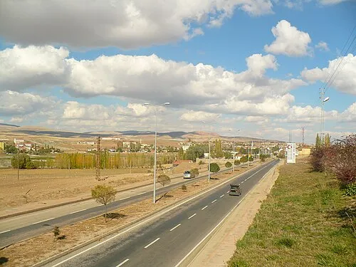
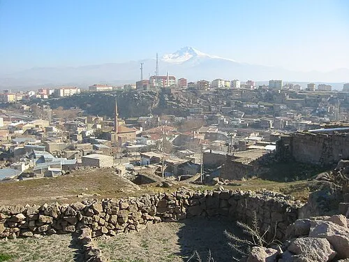
Nature and heritage in Kayseri Province
Sources & licences
Data last updated: · 2 independent sources