
- Population
- 634,924
- 634.9K
- Elevation
- 1,412 m
- above sea level
- Local time
- UTC+03:00
- Europe/Istanbul · UTC+03:00
- Places inside
- 327
- listed under Sivas Province
- Airports
- VAS Sivas Nuri Demirağ Airport9 km
- TJK Tokat Airport79 km
About Sivas Province
Sivas Province is a region. Location: Turkey. Population: 634,924.
Sivas Province (Turkish: Sivas ili) is a province of Turkey. It is located in the eastern part of the Central Anatolia region of Turkey. Its area is 28,164 km2 (the second largest province after Konya), and its population is 634,924 (2022). Its adjacent provinces are Yozgat to the west, Kayseri to the southwest, Kahramanmaraş to the south, Malatya to the southeast, Erzincan to the east, Giresun to the northeast, and Ordu to the north. Its capital is Sivas.
Source: Wikipedia · CC BY-SA 4.0
Places bordering Sivas Province
Population of Sivas Province over time
| 2018 | 646,608 | |
|---|---|---|
| 2021 | 588,673 | |
| 2022 | 634,924 |
Censuses and official estimates; source: Wikidata.
Climate of Sivas Province
Best months for sightseeingBest months for sightseeing: June–September.
This month · November
A cold month
Day 9° · Night -2° · Rain 40 mm
Better nearby cities in November
- Osmaniye · 309 km south21°
- Suruç · 337 km south20°
- Adana · 344 km southwest21°
- Hottest month
- August (day 27°)
- Coldest month
- January (night -7°)
- Wettest month
- May (63 mm)
- Driest month
- August (8 mm)
Bars: average monthly low and high temperature. Below: precipitation. Monthly averages for 1970–2000 at about 18 km resolution, adjusted for elevation. Highlighted months are mild and relatively dry. Source: WorldClim 2.1 (CC BY 4.0).
Show values as a table
| Month | Jan | Feb | Mar | Apr | May | Jun | Jul | Aug | Sep | Oct | Nov | Dec |
|---|---|---|---|---|---|---|---|---|---|---|---|---|
| Average high (°C) | 0° | 1° | 7° | 14° | 19° | 23° | 27° | 27° | 24° | 17° | 9° | 3° |
| Average low (°C) | -7° | -6° | -3° | 2° | 6° | 9° | 11° | 11° | 7° | 3° | -2° | -5° |
| Precipitation (mm) | 39 | 37 | 45 | 62 | 63 | 38 | 9 | 8 | 16 | 34 | 40 | 47 |
Other places to visit in this season: June July August September
How to get to Sivas Province
The nearest airport is Sivas Nuri Demirağ Airport (VAS), 9 km to the west as the crow flies. The nearest large city is Sivas, 5 km to the south.
Airports
- Sivas Nuri Demirağ Airport (VAS) Sivas 9 kmwest
- Tokat Airport (TJK) Tokat 79 kmnorthwest
- Ordu–Giresun Airport (OGU) Ordu 160 kmnortheast
Nearby large cities
- Sivas Population: 264K 5 kmsouth
- Tokat Province Population: 129.7K 69 kmnorthwest
- Turhal Population: 110.9K 103 kmnorthwest
- Amasya Population: 114.9K 138 kmnorthwest
- Ordu Population: 229.2K 152 kmnortheast
Straight-line distances; road distances are longer. Airport data: OurAirports.
Places in Sivas Province
327 places- 1 Sivas 348.6K
- 2 Yıldızeli İlçesi 40.5K
- 3 Şarkışla İlçesi 38.1K
- 4 Gemerek İlçesi 26.2K
- 5 Suşehri İlçesi 26.1K
- 6 Zara 23.9K
- 7 Kangal İlçesi 23.1K
- 8 Gürün İlçesi 20K
- 9 Divriği İlçesi 16.1K
- 10 Koyulhisar İlçesi 14.3K
- 11 Altınyayla İlçesi 9.7K
- 12 Ulaş İlçesi 9.6K
- 13 Hafik İlçesi 9.4K
- 14 İmranlı İlçesi 8K
- 15 Akıncılar İlçesi 5.3K
- 16 Gölova İlçesi 3.5K
- 17 Doğanşar İlçesi 2.9K
- 18 Alicik 859
Bar: population relative to the most populous place in this list.
Cities & villages9
- Akcakışla Bucağı · Municipality
- Akıncılar Bucağı · Municipality
- Akkaya · Village
- Akoluk · Village
- Alacahan Bucağı · Municipality
- Altınyayla Bucağı · Municipality
- Bahçebaşı · Village
- Bedirli Bucağı · Municipality
- Belpınar · Village
Mountains & nature4
- Aslan Pınarı · Natural site
- Asma Dağı · Mountain
- Aygan Pınarı · Natural site
- Bektaş Pınarı · Natural site
Lakes, rivers & coasts29
- Abdal Deresi · River
- Acı Çay · River
- Acıçayır Deresi · River
- Acı Dere · River
- Acıırmak Deresi · River
- Acısu · River
- Acısu · River
- Acısu Çayı · River
- Acısu Irmağı · River
- Ağıllar Deresi · River
- Akçakışla Dere · River
- Akşar Çayı · River
- Aktoprak Deresi · River
- Akyar Deresi · River
- Alahacılı Çayı · River
- Albastı Deresi · River
- Alimpınarı Deresi · River
- Alman Suyu · River
- Argos Çayı · River
- Armutlusuyu Deresi · River
- Aşağıtepecik Gölü · Lake
- Bağ Deresi · River
- Bahçecik Deresi · River
- Bahtiyar Dere · River
- Balıklar Çayı · River
- Balucan Deresi · River
- Baymehmet Deresi · River
- Behram Deresi · River
- Beydilliözü Deresi · River
Largest cities and towns
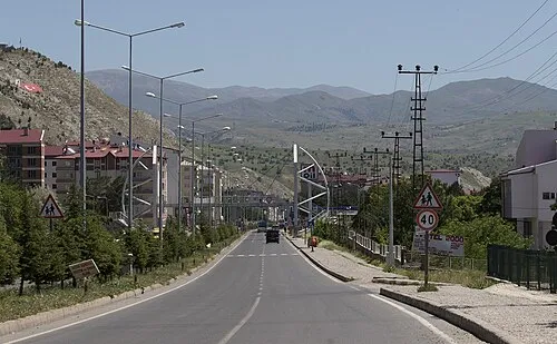
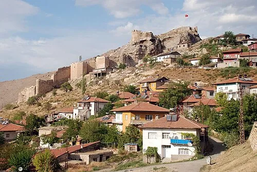
Nature and heritage in Sivas Province
Sources & licences
Data last updated: · 2 independent sources