- Elevation
- 560 m
- above sea level
- Local time
- UTC+01:00
- Europe/Bratislava · UTC+01:00
- Airports
- KSC Košice International Airport90 km
- RZE Rzeszów-Jasionka Airport110 km
About Zvala
Zvala is a village. Location: Snina District, Prešov Region. Elevation: 560 m. The best months to visit are June–August. The nearest airport is Košice International Airport (90 km). Nearby sights include Rypi Wierch and Gmyszów Wierch.
Climate of Zvala
Best months for sightseeingBest months for sightseeing: June–August.
This month · November
A cold month
Day 5° · Night -1° · Rain 66 mm
- Hottest month
- July (day 21°)
- Coldest month
- January (night -7°)
- Wettest month
- June (116 mm)
- Driest month
- February (48 mm)
Bars: average monthly low and high temperature. Below: precipitation. Monthly averages for 1970–2000 at about 18 km resolution, adjusted for elevation. Highlighted months are mild and relatively dry. Source: WorldClim 2.1 (CC BY 4.0).
Show values as a table
| Month | Jan | Feb | Mar | Apr | May | Jun | Jul | Aug | Sep | Oct | Nov | Dec |
|---|---|---|---|---|---|---|---|---|---|---|---|---|
| Average high (°C) | 0° | 1° | 6° | 12° | 17° | 20° | 21° | 21° | 17° | 12° | 5° | 1° |
| Average low (°C) | -7° | -6° | -2° | 2° | 6° | 10° | 11° | 10° | 7° | 3° | -1° | -5° |
| Precipitation (mm) | 50 | 48 | 50 | 64 | 88 | 116 | 116 | 91 | 76 | 64 | 66 | 68 |
How to get to Zvala
The nearest airport is Košice International Airport (KSC), 90 km to the southwest as the crow flies. For international flights: Rzeszów-Jasionka Airport (RZE) (110 km). The nearest large city is Košice, 85 km to the southwest.
Airports
- Košice International Airport (KSC) Košice 90 kmsouthwest
- Rzeszów-Jasionka Airport (RZE) Jasionka 110 kmnorth
- Poprad-Tatry Airport (TAT) Poprad 146 kmwest
Nearby large cities
- Košice Population: 225K 85 kmsouthwest
- Nyíregyháza Population: 117.7K 136 kmsouth
- Satu Mare Population: 112.5K 155 kmsouth
- Miskolc Population: 154.5K 157 kmsouthwest
- Debrecen Population: 202.4K 184 kmsouth
Straight-line distances; road distances are longer. Airport data: OurAirports.
Day trips from Zvala
Within 100 km: 19 historic and cultural sites, 155 natural sites, 10 lakes, rivers and coasts.
0–25 km42 places
- Morské Oko Lake 24 kmS
- Łopienik Mountain 15 kmNE
- Ptasza - 1162 m npm Bieszczady Mountain 13 kmE
- Dziurkowiec - 1188 m npm Bieszczady Mountain 15 kmE
25–60 km73 places
- Zemplínska šírava Lake 41 kmS
- Veľká Domaša Lake 41 kmW
- Vihorlatské Vrchy Mountain 27 kmS
- Topľa River 56 kmSW
60–100 km69 places
- Branisko Mountain 96 kmW
- Cigelka River 85 kmW
- Kolanin Mountain 73 kmNW
- Slanské Pohorie Mountain 70 kmSW
Straight-line distances.
Nearby attractions & nature
Everything nearby-
Rypi Wierch Mountain, Poland6.4 km E
-
Gmyszów Wierch Mountain, Subcarpathian Voivodeship8.1 km NW
-
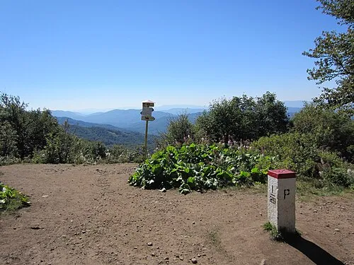 Okrąglik Mountain, Cisna9.8 km E
-
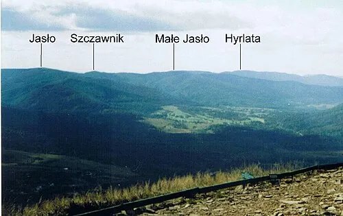 Małe Jasło Mountain, Cisna9.7 km NE
-
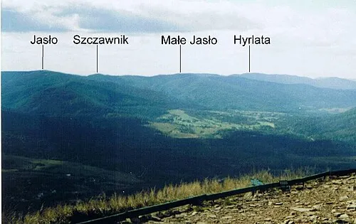 Jasło Mountain, Cisna9.7 km E
-
Worwosoka Mountain, Cisna9.4 km NE
Sources & licences
Data last updated: