Snina District
Local name: okres Snina
Located in Prešov Region, Slovakia Coordinates: 48°59′09″ N 22°09′02″ E
- Population
- 36,610
- 36.6K
- Elevation
- 213 m
- above sea level
- Local time
- UTC+01:00
- Europe/Bratislava · UTC+01:00
- Places inside
- 37
- listed under Snina District
- Airports
- KSC Košice International Airport76 km
- RZE Rzeszów-Jasionka Airport125 km
About Snina District
Snina District is a district. Location: Prešov Region, Slovakia. Population: 36,610.
Snina District (Slovak: okres Snina) is a district in the Prešov Region of eastern Slovakia. Until 1918, the district was part of the county of Kingdom of Hungary of Zemplín. It's the easternmost district in Slovakia, and includes the easternmost point of the whole country, Kremenec. Snina, the district's administrative center is the only town in the district, and the easternmost town in Slovakia.
Source: Wikipedia · CC BY-SA 4.0
At a glance
- Area
- 805 km²
Source: Wikidata
Places bordering Snina District
- Sobrance District
- Humenné District
Population of Snina District over time
| 2017 | 36,610 | |
|---|---|---|
| 2021 | 35,125 | |
| 2024 | 33,792 | |
| 2025 | 33,425 |
Censuses and official estimates; source: Wikidata.
Climate of Snina District
Best months for sightseeingBest months for sightseeing: May–September.
This month · November
A cold month
Day 7° · Night 1° · Rain 63 mm
- Hottest month
- July (day 24°)
- Coldest month
- January (night -5°)
- Wettest month
- July (108 mm)
- Driest month
- February (44 mm)
Bars: average monthly low and high temperature. Below: precipitation. Monthly averages for 1970–2000 at about 18 km resolution, adjusted for elevation. Highlighted months are mild and relatively dry. Source: WorldClim 2.1 (CC BY 4.0).
Show values as a table
| Month | Jan | Feb | Mar | Apr | May | Jun | Jul | Aug | Sep | Oct | Nov | Dec |
|---|---|---|---|---|---|---|---|---|---|---|---|---|
| Average high (°C) | 2° | 3° | 9° | 14° | 20° | 22° | 24° | 24° | 19° | 14° | 7° | 3° |
| Average low (°C) | -5° | -4° | 0° | 4° | 9° | 12° | 13° | 13° | 9° | 5° | 1° | -3° |
| Precipitation (mm) | 46 | 44 | 46 | 62 | 83 | 106 | 108 | 85 | 73 | 60 | 63 | 63 |
Other places to visit in this season: May June July August September
How to get to Snina District
The nearest airport is Košice International Airport (KSC), 76 km to the southwest as the crow flies. For international flights: Rzeszów-Jasionka Airport (RZE) (125 km). The nearest large city is Košice, 72 km to the southwest.
Airports
- Košice International Airport (KSC) Košice 76 kmsouthwest
- Rzeszów-Jasionka Airport (RZE) Jasionka 125 kmnorth
- Poprad-Tatry Airport (TAT) Poprad 140 kmwest
Nearby large cities
- Košice Population: 225K 72 kmsouthwest
- Nyíregyháza Population: 117.7K 119 kmsouth
- Miskolc Population: 154.5K 141 kmsouthwest
- Satu Mare Population: 112.5K 142 kmsouth
- Debrecen Population: 202.4K 166 kmsouth
Straight-line distances; road distances are longer. Airport data: OurAirports.
Day trips from Snina District
Within 100 km: 12 historic and cultural sites, 154 natural sites, 11 lakes, rivers and coasts.
0–25 km17 places
- Zemplínska šírava Lake 24 kmSW
- Morské Oko Lake 9 kmSE
- Vihorlatské Vrchy Mountain 10 kmS
- Cirocha River 17 kmW
25–60 km85 places
- Veľká Domaša Lake 35 kmW
- Slanské Pohorie Mountain 58 kmW
- Topľa River 39 kmSW
- Laborec River 56 kmS
60–100 km75 places
- Branisko Mountain 91 kmW
- Cigelka River 86 kmNW
- Kolanin Mountain 80 kmNW
- Čerhov Mountain 75 kmW
Straight-line distances.
Places in Snina District
37 places- 1 Snina 19.9K
- 2 Belá nad Cirochou 3.4K
- 3 Stakčín 2.3K
- 4 Dlhé nad Cirochou 1.9K
- 5 Zemplínske Hámre 1.3K
- 6 Ulič 802
- 7 Ubľa 760
- 8 Pichne 572
- 9 Kolonica 566
- 10 Pčoliné 560
- 11 Kalná Roztoka 556
- 12 Klenová 492
- 13 Stakčínska Roztoka 318
- 14 Hostovice 285
- 15 Ladomirov 267
- 16 Zboj 253
- 17 Nová Sedlica 231
- 18 Uličské Krivé 225
- 19 Dúbrava 222
- 20 Čukalovce 168
- 21 Topoľa 159
- 22 Osadné 157
- 23 Strihovce 153
- 24 Ruský Potok 135
- 25 Ruská Volová 97
- 26 Šmigovec 85
- 27 Runina 80
- 28 Michajlov 77
- 29 Kolbasov 75
- 30 Jalová 64
- 31 Hrabová Roztoka 62
- 32 Príslop 54
- 33 Brezovec 34
- 34 Parihuzovce 27
Bar: population relative to the most populous place in this list.
Cities & villages3
- Starina · Village
- Veľká Poľana · Village
- Zvala · Village
Nearby attractions & nature
Everything nearby-
Morské Oko Lake, Košice Region8.5 km SE
-
Vihorlatské Vrchy Mountain, Slovakia9.7 km S
-
Cirocha River, Prešov Region17 km W
-
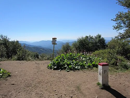 Okrąglik Mountain, Cisna24 km NE
-
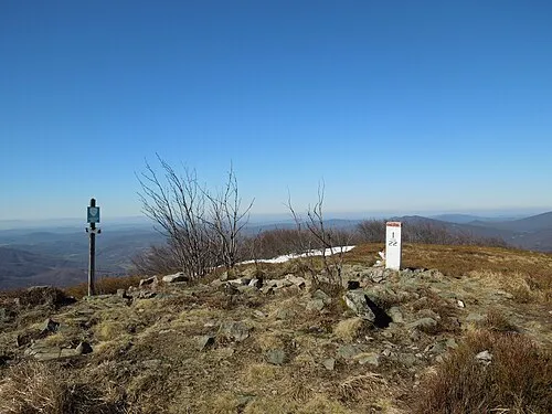 Plaša Mountain, Poland24 km NE
-
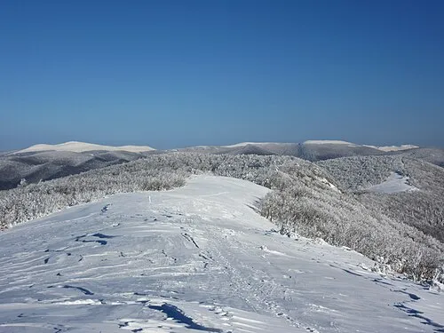 Rabia Skała - 1199 m npm Bieszczady Mountain, Cisna25 km NE
Sources & licences
Data last updated: · 2 independent sources