- Elevation
- 4 m
- above sea level
- Local time
- UTC+01:00
- Europe/Madrid · UTC+01:00
- Airports
- GIB Gibraltar Airport35 km
- TNG Tangier Ibn Battuta Airport41 km
About Playa Paloma Baja
Playa Paloma Baja is a beach. Location: Tarifa, Cadiz. The best months to visit are May–June, October. The nearest airport is Gibraltar Airport (35 km). Nearby sights include Playa Valdevaqueros and Sierra de San Bartolomé.
Climate of Playa Paloma Baja
Best months for sightseeingBest months for sightseeing: May–June, October.
This month · November
A wet month
Day 20° · Night 13° · Rain 140 mm
Better nearby cities in November
- Dos Hermanas · 137 km north20°
- Málaga · 138 km northeast20°
- Seville · 148 km north20°
- Hottest month
- August (day 30°)
- Coldest month
- January (night 9°)
- Wettest month
- December (142 mm)
- Driest month
- July (0 mm)
Bars: average monthly low and high temperature. Below: precipitation. Monthly averages for 1970–2000 at about 18 km resolution, adjusted for elevation. Highlighted months are mild and relatively dry. Source: WorldClim 2.1 (CC BY 4.0).
Show values as a table
| Month | Jan | Feb | Mar | Apr | May | Jun | Jul | Aug | Sep | Oct | Nov | Dec |
|---|---|---|---|---|---|---|---|---|---|---|---|---|
| Average high (°C) | 16° | 17° | 19° | 20° | 23° | 27° | 30° | 30° | 28° | 24° | 20° | 17° |
| Average low (°C) | 9° | 10° | 11° | 12° | 14° | 17° | 20° | 20° | 19° | 16° | 13° | 10° |
| Precipitation (mm) | 126 | 127 | 117 | 71 | 32 | 13 | 0 | 2 | 19 | 76 | 140 | 142 |
How to get to Playa Paloma Baja
The nearest airport is Gibraltar Airport (GIB), 35 km to the east as the crow flies. The nearest large city is Algeciras, 26 km to the east.
Airports
- Gibraltar Airport (GIB) Gibraltar 35 kmeast
- Tangier Ibn Battuta Airport (TNG) Tangier 41 kmsouthwest
- Sania Ramel Airport (TTU) Tétouan 64 kmsoutheast
Nearby large cities
- Algeciras Population: 121.4K 26 kmeast
- Cadiz Population: 117K 72 kmnorthwest
- Jerez de la Frontera Population: 212.9K 78 kmnorthwest
- Marbella Population: 156.3K 91 kmnortheast
- Dos Hermanas Population: 122.9K 137 kmnorth
Straight-line distances; road distances are longer. Airport data: OurAirports.
Day trips from Playa Paloma Baja
Within 100 km: 273 historic and cultural sites, 170 natural sites, 282 lakes, rivers and coasts.
0–25 km62 places
- Playa de Atlanterra Beach 11 kmNW
- Zahara de los Atunes. Beach 14 kmNW
- Playa del Cañuelo Beach 8 kmW
- Island of the Doves Island 11 kmSE
25–60 km280 places
- Playa de Zahora Beach 33 kmNW
- Playa de San Amaro Beach 43 kmSE
- Playa de Benítez Beach 40 kmSE
- Playa de Benzú Beach 36 kmSE
60–100 km383 places
- Playa de la Victoria Beach 70 kmNW
- Playa de Levante Beach 71 kmNW
- Caleta Beach Beach 74 kmNW
- Playa de las Tres Piedras Beach 96 kmNW
Straight-line distances.
Nearest towns and villages
-
EL Chaparral Village, Tarifa2.7 km NW
-
Valdevaqueros Village, Tarifa4.5 km E
-
Bolonia Village, Tarifa5.3 km NW
-
Tarifa Town, Tarifa12 km SE
-
Facinas Village, Tarifa9.3 km N
-
Zahara de los Atunes Village, Barbate14 km NW
Nearby attractions & nature
Everything nearby-
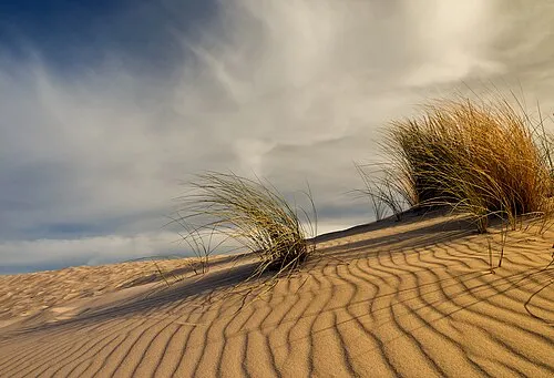 Playa Valdevaqueros Beach, Tarifa2.9 km E
-
Sierra de San Bartolomé Mountain, Tarifa2.6 km N
-
Ensenada de Valdevaqueros Natural site, Tarifa3.1 km E
-
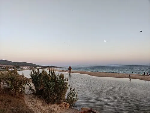 Playa Bolonia Beach, Tarifa5.2 km NW
-
Río del Valle River, Tarifa3.3 km E
-
Duna de Bolonia Natural site, Tarifa6 km NW
-
Ensenada de Bolonia Natural site, Tarifa5.2 km NW
-
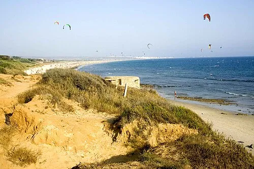 Playa de los Lances Beach, Tarifa8.5 km E
More lakes, rivers and coasts in Spain
-
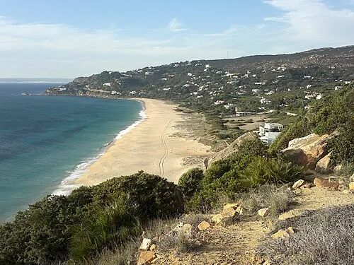 Playa de los Alemanes Beach, Tarifa8.9 km NW
-
Playa del Cañuelo Beach, Tarifa7.7 km W
-
Playa de Atlanterra Beach, Tarifa11 km NW
-
Arroyo del Aciscar River, Tarifa13 km N
-
Río Almodóvar River, Tarifa15 km N
-
Arroyo de los Molinos River, Tarifa8.5 km E
Sources & licences
Data last updated: · 2 independent sources