- Elevation
- 512 m
- above sea level
- Local time
- UTC+00:00
- Atlantic/Canary · UTC+00:00
- Airports
- LPA Gran Canaria Airport14 km
- TFN Tenerife Norte-Ciudad de La Laguna Airport99 km
About La Atalaya
La Atalaya is a village. Location: Santa Brígida, Las Palmas. Elevation: 512 m. The best months to visit are May–November. The nearest airport is Gran Canaria Airport (14 km). Nearby sights include Casa Museo del Vino and Caldera de Bandama.
Photos of La Atalaya
-
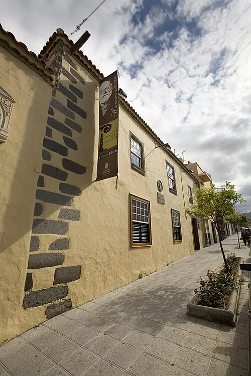
Casa-Museo León y Castillo Raycojimenezg · CC BY-SA 3.0 -
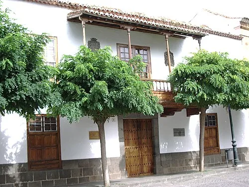
Casa Museo de los Patronos de la Virgen The original uploader was Mauroonline at Italian Wikipedia · CC BY 2.5


Climate of La Atalaya
Best months for sightseeingBest months for sightseeing: May–November.
This month · November
A good month to visit
Day 20° · Night 14° · Rain 33 mm
- Hottest month
- August (day 26°)
- Coldest month
- January (night 11°)
- Wettest month
- December (42 mm)
- Driest month
- July (1 mm)
Bars: average monthly low and high temperature. Below: precipitation. Monthly averages for 1970–2000 at about 18 km resolution, adjusted for elevation. Highlighted months are mild and relatively dry. Source: WorldClim 2.1 (CC BY 4.0).
Show values as a table
| Month | Jan | Feb | Mar | Apr | May | Jun | Jul | Aug | Sep | Oct | Nov | Dec |
|---|---|---|---|---|---|---|---|---|---|---|---|---|
| Average high (°C) | 17° | 18° | 19° | 20° | 21° | 23° | 25° | 26° | 25° | 23° | 20° | 18° |
| Average low (°C) | 11° | 11° | 11° | 12° | 13° | 15° | 16° | 17° | 17° | 16° | 14° | 12° |
| Precipitation (mm) | 35 | 36 | 26 | 19 | 6 | 2 | 1 | 1 | 11 | 22 | 33 | 42 |
Other places to visit in this season: May June July August September October November
How to get to La Atalaya
The nearest airport is Gran Canaria Airport (LPA), 14 km to the southeast as the crow flies. The nearest large city is Telde, 7 km to the southeast.
Airports
- Gran Canaria Airport (LPA) Gran Canaria Island 14 kmsoutheast
- Tenerife Norte-Ciudad de La Laguna Airport (TFN) Tenerife 99 kmnorthwest
- Tenerife Sur Airport (TFS) Tenerife 108 kmwest
Nearby large cities
- Telde Population: 123.3K 7 kmsoutheast
- Las Palmas de Gran Canaria Population: 383.5K 10 kmnortheast
- Santa Cruz de Tenerife Population: 211.4K 90 kmnorthwest
- San Cristóbal de La Laguna Population: 150.7K 97 kmnorthwest
Straight-line distances; road distances are longer. Airport data: OurAirports.
Day trips from La Atalaya
Within 100 km: 123 historic and cultural sites, 154 natural sites, 90 lakes, rivers and coasts.
0–25 km151 places
- Canary Islands Island 4 kmSW
- Gran Canaria Island 12 kmSW
- Pico de la Cogolla Mountain 25 kmSW
- Necrópolis de Arteara Historic site 22 kmSW
25–60 km72 places
- Playa de las Mujeres Beach 35 kmS
- Playa de San Agustín Beach 29 kmS
- Playa del Inglés Beach 32 kmS
- Playa de Arguineguín Beach 36 kmSW
60–100 km144 places
- Playa de las Teresitas Beach 87 kmNW
- Playa de San Roque Beach 93 kmNW
- Playa de Samarines Beach 94 kmW
- Playa de Ijuana Beach 86 kmNW
Straight-line distances.
Nearby attractions & nature
Everything nearby-
Casa Museo del Vino Museum, Santa Brígida1.9 km W
-
Caldera de Bandama Natural site, Santa Brígida2.4 km E
-
Parroquia de Santa Brígida Attraction, Santa Brígida2.2 km W
-
Canary Islands Island, Canary Islands3.7 km SW
-
Jardín Botánico Viera y Clavijo Attraction, Las Palmas4.6 km NE
-
Caldera de Pino Santo Natural site, Vega de San Mateo5.4 km W
Sources & licences
Data last updated: