- Population
- 10,000
- 10K
- Elevation
- 16 m
- above sea level
- Local time
- UTC+00:00
- Atlantic/Canary · UTC+00:00
- Airports
- ACE César Manrique-Lanzarote Airport24 km
- FUE Fuerteventura Airport46 km
About Playa Blanca
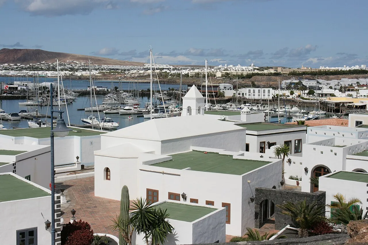
Playa Blanca is a town. Location: Yaiza, Las Palmas. Population: 10,000. Elevation: 16 m.
Playa Blanca (Spanish for "White Beach") is the southernmost town of the Spanish island of Lanzarote. It is the newest resort on the island, and is part of the municipality of Yaiza. In 2025 Playa Blanca had 14,276 residents.
Source: Wikipedia · CC BY-SA 4.0
Photos of Playa Blanca
-

Mike Peel · CC BY-SA 4.0 -

Bengt Nyman · CC BY-SA 4.0 -

Bengt Nyman · CC BY 3.0 -

BrotherDarksoul · CC BY-SA 3.0 -

BrotherDarksoul · CC BY-SA 3.0


Travel notes for Playa Blanca
From Wikivoyage
Playa Blanca is a beach resort and ferry port on the south coast of Lanzarote, some 50 km southwest of the capital Arrecife. It's part of the municipality of Yaiza, but with a population of 12,960 in 2021 it has far outgrown that village.
Understand+
The resort is named for the central white beach - Playa Blanca - in a 9-km wide bay on the south coast of Lanzarote. Playa Flamingo is the western beach within the bay and Playa Dorada the eastern. These are mostly sandy, and sheltered by volcanic hills from the Atlantic wind and waves, so they're good for swimming and sunbathing. They're backed by restaurants, retail and hotels (mostly low rise) and there's a ferry port and a leisure marina. What's called "Papagayo Beach" is a series of sandy coves 3 km southeast of town.
Get in+
Highway LZ-2 runs from Arrecife and the airport to Playa Blanca, about 40 km.
Bus 60 / 62 runs from Arrecife via Intercambiador, Playa Honda, Tías, Uga and Yaiza to Playa Blanca ferry pier, every 30 min M-F and hourly Saturday and Sunday.
Bus 161 runs from Arrecife Airport (ACE IATA) T1 and T2 via Puerto del Carmen and Yaiza to the ferry pier. It costs €3.30 (Jan 2023) and runs M-F every 30 min, Saturday hourly and Sunday every 2 hours. On Sunday it might be quicker to take Bus 23 towards Arrecife and change at the Intercambiador west edge of the city for Bus 60 / 62.
1 Estacion de Guaguas the bus station is a roof covered drop-off and bus parking lot with squalid toilets. Buses towards Puerto del Carmen, the airport and Arrecife stop across the road, on the northbound carriageway of Av de las Canarias.
2 Playa Blanca Port is the landing point for Fred Olsen car ferries from Corralejo on Fuerteventura. These sail hourly and take 30 min, for a fare in 2023 of €32 per adult foot passenger, €45 per car plus driver.
Lineas Romero ferries compete on this route, sailing five times a day for €20 per adult, foot passengers only.
Source: Wikivoyage · CC BY-SA 4.0 · abridged
Climate of Playa Blanca
Best months for sightseeingBest months for sightseeing: October–June.
This month · November
A good month to visit
Day 24° · Night 17° · Rain 20 mm
- Hottest month
- August (day 29°)
- Coldest month
- January (night 14°)
- Wettest month
- December (31 mm)
- Driest month
- July (0 mm)
Bars: average monthly low and high temperature. Below: precipitation. Monthly averages for 1970–2000 at about 18 km resolution, adjusted for elevation. Highlighted months are mild and relatively dry. Source: WorldClim 2.1 (CC BY 4.0).
Show values as a table
| Month | Jan | Feb | Mar | Apr | May | Jun | Jul | Aug | Sep | Oct | Nov | Dec |
|---|---|---|---|---|---|---|---|---|---|---|---|---|
| Average high (°C) | 21° | 22° | 23° | 24° | 25° | 26° | 28° | 29° | 28° | 27° | 24° | 22° |
| Average low (°C) | 14° | 14° | 15° | 15° | 16° | 18° | 20° | 20° | 20° | 18° | 17° | 15° |
| Precipitation (mm) | 27 | 22 | 16 | 8 | 3 | 1 | 0 | 1 | 5 | 9 | 20 | 31 |
Other places to visit in this season: January February March April May June October November December
How to get to Playa Blanca
The nearest airport is César Manrique-Lanzarote Airport (ACE), 24 km to the northeast as the crow flies. The nearest large city is Las Palmas de Gran Canaria, 177 km to the southwest.
Airports
- César Manrique-Lanzarote Airport (ACE) San Bartolomé 24 kmnortheast
- Fuerteventura Airport (FUE) El Matorral 46 kmsouth
- Gran Canaria Airport (LPA) Gran Canaria Island 184 kmsouthwest
Nearby large cities
- Las Palmas de Gran Canaria Population: 383.5K 177 kmsouthwest
- Telde Population: 123.3K 183 kmsouthwest
- Santa Cruz de Tenerife Population: 211.4K 241 kmwest
- San Cristóbal de La Laguna Population: 150.7K 247 kmwest
Straight-line distances; road distances are longer. Airport data: OurAirports.
Day trips from Playa Blanca
Within 100 km: 71 historic and cultural sites, 99 natural sites, 93 lakes, rivers and coasts.
0–25 km80 places
- Lanzarote Island 24 kmNE
- Playa de Matagorda Beach 23 kmE
- Fariones Playa Beach 17 kmE
- Playa Dorada Beach 1 kmSE
25–60 km132 places
- Fuerteventura Island 57 kmS
- Graciosa Island 53 kmNE
- Playa de las Conchas Beach 55 kmNE
- Playa Del Risco Beach 50 kmNE
60–100 km51 places
- Risco Falso Mountain 66 kmNE
- Alegranza Island 67 kmNE
- Montaña de La Caldera Mountain 66 kmNE
- Faro de Punta Delgada Landmark 68 kmNE
Straight-line distances.
Nearby attractions & nature
Everything nearby-
Nuestra Senora del Carmen Attraction, Yaiza0.2 km SE
-
Playa Blanca Beach, Yaiza0.2 km SW
-
Playa Dorada Beach, Las Palmas0.5 km SE
-
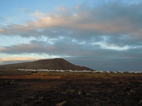 Monte Roja Mountain, Yaiza2.8 km W
-
Castillo de las Coloradas Historic site, Yaiza1.9 km SE
-
Playa Blanca bay Beach, Las Palmas1.5 km SW
-
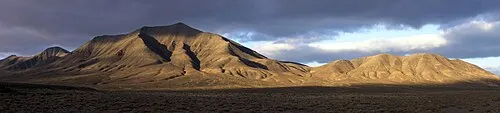 Monte Hacha Grande Mountain, Yaiza5.1 km NE
-
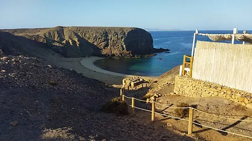 Playa del Papagayo Beach, Yaiza4.6 km SE
Sources & licences
Data last updated: · 2 independent sources