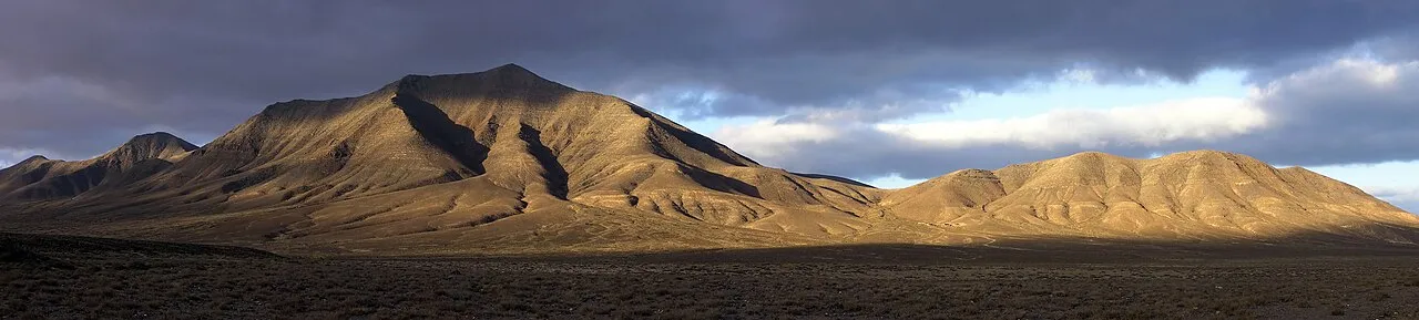
- Elevation
- 518 m
- above sea level
- Local time
- UTC+00:00
- Atlantic/Canary · UTC+00:00
- Airports
- ACE César Manrique-Lanzarote Airport18 km
- FUE Fuerteventura Airport49 km
About Monte Hacha Grande
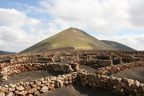
Monte Hacha Grande is a mountain. Location: Yaiza, Las Palmas. Elevation: 518 m.
Hacha Grande is a mountain on the Canary Island of Lanzarote, with an elevation of 562 m (1844 ft) above sea level. Its name is Spanish meaning Large Axe. It is located in the municipality of Yaiza in the south-west of the island, near the resort of Playa Blanca and the Punta de Papagayo. The mountain makes up part of the highest mountain range on the island, Los Ajaches, which is designated a Special Protection Area (SPA) under the European Union's Birds Directive.
Source: Wikipedia · CC BY-SA 4.0
Photos of Monte Hacha Grande
-

Ina Ludwig · CC BY-SA 4.0 -

Dguendel · CC BY 4.0 -

Dguendel · CC BY 4.0 -

Frank Vincentz · CC BY-SA 3.0 -

Frank Vincentz · CC BY-SA 3.0


Climate of Monte Hacha Grande
Best months for sightseeingBest months for sightseeing: March–November.
This month · November
A good month to visit
Day 21° · Night 13° · Rain 20 mm
- Hottest month
- August (day 26°)
- Coldest month
- January (night 10°)
- Wettest month
- December (31 mm)
- Driest month
- July (0 mm)
Bars: average monthly low and high temperature. Below: precipitation. Monthly averages for 1970–2000 at about 18 km resolution, adjusted for elevation. Highlighted months are mild and relatively dry. Source: WorldClim 2.1 (CC BY 4.0).
Show values as a table
| Month | Jan | Feb | Mar | Apr | May | Jun | Jul | Aug | Sep | Oct | Nov | Dec |
|---|---|---|---|---|---|---|---|---|---|---|---|---|
| Average high (°C) | 18° | 19° | 20° | 21° | 21° | 23° | 25° | 26° | 25° | 23° | 21° | 19° |
| Average low (°C) | 10° | 11° | 11° | 12° | 13° | 15° | 16° | 17° | 16° | 15° | 13° | 11° |
| Precipitation (mm) | 27 | 22 | 16 | 8 | 3 | 1 | 0 | 1 | 5 | 9 | 20 | 31 |
Other places to visit in this season: March April May June July August September October November
How to get to Monte Hacha Grande
The nearest airport is César Manrique-Lanzarote Airport (ACE), 18 km to the east as the crow flies. The nearest large city is Las Palmas de Gran Canaria, 182 km to the southwest.
Airports
- César Manrique-Lanzarote Airport (ACE) San Bartolomé 18 kmeast
- Fuerteventura Airport (FUE) El Matorral 49 kmsouth
- Gran Canaria Airport (LPA) Gran Canaria Island 190 kmsouthwest
Nearby large cities
- Las Palmas de Gran Canaria Population: 383.5K 182 kmsouthwest
- Telde Population: 123.3K 189 kmsouthwest
- Santa Cruz de Tenerife Population: 211.4K 246 kmwest
- San Cristóbal de La Laguna Population: 150.7K 252 kmwest
Straight-line distances; road distances are longer. Airport data: OurAirports.
Day trips from Monte Hacha Grande
Within 100 km: 71 historic and cultural sites, 97 natural sites, 89 lakes, rivers and coasts.
0–25 km94 places
- Lanzarote Island 19 kmNE
- Playa de Matagorda Beach 18 kmE
- Fariones Playa Beach 12 kmE
- Playa Dorada Beach 5 kmSW
25–60 km115 places
- Graciosa Island 48 kmNE
- Playa de las Conchas Beach 50 kmNE
- Playa Del Risco Beach 45 kmNE
- Playa del Puerto Beach 47 kmNE
60–100 km48 places
- Fuerteventura Island 61 kmSW
- Risco Falso Mountain 61 kmNE
- Alegranza Island 63 kmNE
- Montaña de La Caldera Mountain 62 kmNE
Straight-line distances.
Nearest towns and villages
-
 Femés Village, Yaiza2.9 km N
-
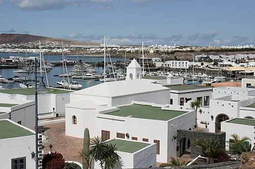 Playa Blanca Town, Yaiza5.1 km SW
-
Yaiza Town, Yaiza8 km N
-
 Uga Village, Yaiza8 km NE
-
 Playa Quemada Village, Yaiza5.3 km NE
-
Las Breñas Village, Yaiza4.7 km NW
Nearby attractions & nature
Everything nearby-
Pico Redondo Mountain, Yaiza1.9 km N
-
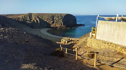 Playa del Papagayo Beach, Yaiza4.9 km S
-
Bahía de Ávila Natural site, Yaiza4.1 km E
-
Playa Mujeres Beach, Yaiza3.8 km S
-
Playa La Casa Beach, Las Palmas3.6 km E
-
Playa Dorada Beach, Las Palmas4.8 km SW
-
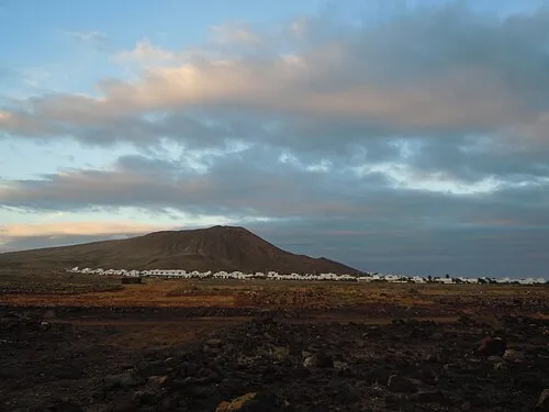 Monte Roja Mountain, Yaiza7.6 km W
-
Playa Blanca Beach, Yaiza5.3 km SW
More nature in Spain
-
 Guardilama Mountain, Yaiza11 km NE
-
Moñtaña de la Cinta Mountain, Yaiza6.7 km N
-
Caldera Riscada Natural site, Yaiza6.7 km NE
-
Tremesana Mountain, Yaiza11 km N
-
Pico Redondo Mountain, Yaiza9.2 km N
-
Montaña Bermeja Mountain, Yaiza9.4 km NW
Sources & licences
Data last updated: · 2 independent sources