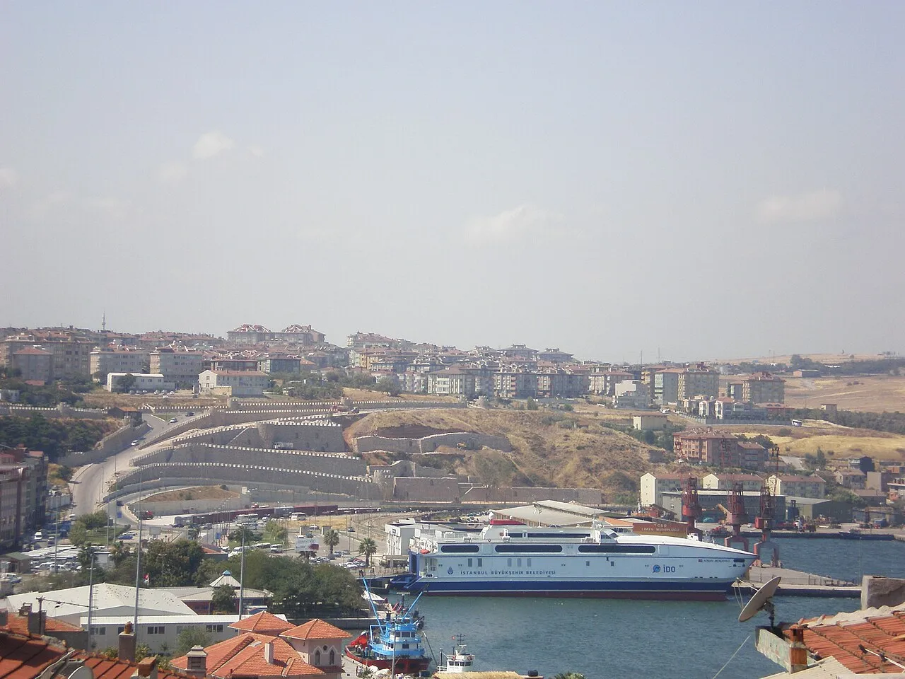
- Population
- 107,631
- 107.6K
- Elevation
- 40 m
- above sea level
- Local time
- UTC+03:00
- Europe/Istanbul · UTC+03:00
- Airports
- BZI Balıkesir Airport81 km
- TEQ Tekirdağ Çorlu Airport87 km
About Bandırma
Bandırma is a city. Location: Bandırma İlçesi, Balıkesir Province. Population: 107,631. Elevation: 40 m.
Bandırma (Turkish: [banˈdɯɾma]) is a city, municipality and district of Balıkesir Province, northwestern Turkey. Its area is 755 km2, and its population is 167,363 (2024). Bandırma is located in the south of the Marmara Sea, in the bay with the same name, and is an important port city. It is approximately two hours away from Istanbul, İzmir and Bursa. Bandırma may be reached by land, sea, air and rail. Regular ship trips are made to Tekirdağ and Istanbul from Bandırma every day.
Source: Wikipedia · CC BY-SA 4.0
Photos of Bandırma
-

United Kingdom Hydrographic Office · Public domain -

Olga Taş · CC BY-SA 4.0 -

Aerdemsenturk · CC BY-SA 4.0 -

Nevit Dilmen · CC BY-SA 3.0 -

Kızıldeniz · CC BY-SA 4.0


Travel notes for Bandırma
From Wikivoyage
Bandırma is a city in Southern Marmara Region of Turkey. It's a large freight and ferry port, with a population of 149,469 in 2016, and most visitors are just passing through. The main attraction is the bird life on the lake to the south.
Understand+
Bandırma has a short sea crossing from Istanbul and a low coastline, easy to traverse by road, so it's long been a transit hub. It was founded around the 9th century BC and has been held by the Persians, the Byzantine Romans and the Ottomans, but almost nothing remains of all that. The town was wrecked in the fighting between Greece and Turkey that followed the First World War, so its buildings are modern, though some are in retro-Ottoman style. The closing shots of that conflict rang out here, then an Armistice was signed at Mudanya, followed by the 1923 Treaty of Lausanne.
Bandırma was also the name of the freighter in which Mustafa Kemal sailed to Samsun, under orders to disband the Ottoman army after Turkey's 1918 defeat. Instead he organised the fightback that escalated into the War of Independence, and led to his sobriquet of "Atatürk".
Get in+
There's no airport nearby. International travellers can fly into Istanbul then take the bus or ferry.
İDO ferries sail daily from Istanbul Kadıköy (Asia-side) and Yenikapı (Europe-side, near Sultanahmet) and take 2 hr 30 min, for a single fare of 150 TL. BUDO ferries don't sail this route, but ply from Istanbul to Mudanya near Bursa.
Marmara RoRo sail twice a day from Tekirdağ Ceyport on the far mainland coast.
A daily train runs from Izmir Basmane, taking almost six hours via Manisa and Balıkesir. It leaves Izmir around 09:00 and is called 6 Eylül Ekspresi, "6th of September Express", returning south from Bandırma at 16:00 when it's called 17 Eylül Ekspresi.
A high speed line from Ankara and Istanbul has been under construction for years, and its supposed completion date of 2023 looks implausible.
1 Bandırma railway station is by the harbour, within 200 m of the ferry piers.
Buses run hourly from Istanbul Anadolu station, taking 4 hours for a fare of 180 TL. Bus lines competing on this route are Metro Turizm, Pamukkale and Flixbus. From Ankara or Konya it's quickest to take the YHT high speed train to Eskişehir, which connects with a bus to Bursa. Frequent buses between Bursa and Bandırma take two hours for a fare of 60 TL - many of these continue west to Çanakkale, for Troy and Gallipoli.
2 Bandırma bus station is 5 km south of town on D200 the highway from Bursa.
By road from Istanbul follow O7 east to Gebze then O5 across the bridge and west via Bursa onto D200.
Source: Wikivoyage · CC BY-SA 4.0 · abridged
Climate of Bandırma
Best months for sightseeingBest months for sightseeing: May–October.
This month · November
Outside the best season
Day 15° · Night 8° · Rain 87 mm
Better nearby cities in November
- Aydin · 279 km south19°
- Hottest month
- July (day 27°)
- Coldest month
- January (night 3°)
- Wettest month
- December (115 mm)
- Driest month
- July (17 mm)
Bars: average monthly low and high temperature. Below: precipitation. Monthly averages for 1970–2000 at about 18 km resolution, adjusted for elevation. Highlighted months are mild and relatively dry. Source: WorldClim 2.1 (CC BY 4.0).
Show values as a table
| Month | Jan | Feb | Mar | Apr | May | Jun | Jul | Aug | Sep | Oct | Nov | Dec |
|---|---|---|---|---|---|---|---|---|---|---|---|---|
| Average high (°C) | 9° | 9° | 12° | 17° | 21° | 26° | 27° | 27° | 24° | 20° | 15° | 11° |
| Average low (°C) | 3° | 3° | 4° | 8° | 12° | 16° | 19° | 19° | 16° | 12° | 8° | 5° |
| Precipitation (mm) | 99 | 70 | 65 | 58 | 40 | 29 | 17 | 19 | 36 | 64 | 87 | 115 |
Other places to visit in this season: May June July August September October
How to get to Bandırma
The nearest airport is Balıkesir Airport (BZI), 81 km to the south as the crow flies. For international flights: İstanbul Airport (IST) (121 km). The nearest large city is Mustafakemalpaşa, 51 km to the southeast.
Airports
- Balıkesir Airport (BZI) Balıkesir 81 kmsouth
- Tekirdağ Çorlu Airport (TEQ) Çorlu 87 kmnorth
- İstanbul Airport (IST) Istanbul 121 kmnortheast
Nearby large cities
- Mustafakemalpaşa Population: 101.4K 51 kmsoutheast
- Balıkesir Population: 238.2K 78 kmsouth
- Tekirdağ Population: 122.3K 80 kmnorthwest
- Nilufer Population: 536.4K 81 kmeast
- Beylikduzu Population: 415.3K 90 kmnortheast
Straight-line distances; road distances are longer. Airport data: OurAirports.
Day trips from Bandırma
Within 100 km: 39 historic and cultural sites, 161 natural sites, 275 lakes, rivers and coasts.
0–25 km46 places
- Sedef Adası Island 17 kmNE
- Tavşan Adası Island 16 kmW
- Mola Adaları Island 15 kmNE
- Haliada Island 15 kmNE
25–60 km118 places
- Yeniköy Plaj Beach 35 kmE
- Avşa Adası Island 43 kmNW
- Paşalimanı Adası Island 33 kmNW
- Kuş Adası Island 37 kmW
60–100 km311 places
- Mutlu Adası Island 60 kmE
- Değirmencik Adası Island 74 kmW
- Büyükada Island 73 kmW
- Küçükada Island 73 kmW
Straight-line distances.
Bandırma and similar cities
Side by side with cities of similar size in the same country: population, elevation and climate.
| Measure | Bandırma | Arsuz | Turhal | Kilis |
|---|---|---|---|---|
| Population | 107.6K | 109.6K | 110.9K | 111.6K |
| Elevation | 40 m | 6 m | 538 m | 660 m |
| Summer day (hottest month) | 27° | 32° | 29° | 36° |
| Winter night (coldest month) | 3° | 7° | -2° | 0° |
| Annual rainfall | 699 mm | 931 mm | 453 mm | 526 mm |
| Best months | May–Oct | Apr–May, Nov | May–Jun, Sep–Oct | Apr–May, Oct |
| Distance | — | 818 km | 688 km | 893 km |
Climate values are 1970–2000 monthly averages; straight-line distance.
Nearby attractions & nature
Everything nearby-
Zambak Adacık Island, Balıkesir Province6.5 km NW
-
Köy Deresi River, Balıkesir Province7.2 km SE
-
Höyücek Tepesi Mountain, Bandırma İlçesi13 km SW
-
Dedebayır Tepesi Mountain, Bandırma İlçesi11 km SE
-
Bandırma Körfezi Natural site, Balıkesir Province7.4 km N
-
Dilek Tepesi Mountain, Bandırma İlçesi12 km W
-
Ağa Deresi River, Balıkesir Province8.2 km SW
-
Naldöken Tepesi Mountain, Bandırma İlçesi13 km E
Sources & licences
Data last updated: · 2 independent sources