- Elevation
- 6 m
- above sea level
- Local time
- UTC+00:00
- Europe/London · UTC+00:00
- Places inside
- 9
- listed under Pilling
- Airports
- LPL Liverpool John Lennon Airport66 km
- MAN Manchester Airport76 km
About Pilling
Pilling is a village. Location: Wyre District, Lancashire. Elevation: 6 m. The best months to visit are June–September. The nearest airport is Liverpool John Lennon Airport (66 km). Nearby sights include River Cocker and Cockerham Lighthouse.
Climate of Pilling
Best months for sightseeingBest months for sightseeing: June–September.
This month · November
A wet month
Day 10° · Night 4° · Rain 123 mm
- Hottest month
- August (day 19°)
- Coldest month
- February (night 2°)
- Wettest month
- October (124 mm)
- Driest month
- May (61 mm)
Bars: average monthly low and high temperature. Below: precipitation. Monthly averages for 1970–2000 at about 18 km resolution, adjusted for elevation. Highlighted months are mild and relatively dry. Source: WorldClim 2.1 (CC BY 4.0).
Show values as a table
| Month | Jan | Feb | Mar | Apr | May | Jun | Jul | Aug | Sep | Oct | Nov | Dec |
|---|---|---|---|---|---|---|---|---|---|---|---|---|
| Average high (°C) | 7° | 7° | 9° | 11° | 15° | 17° | 19° | 19° | 17° | 13° | 10° | 7° |
| Average low (°C) | 2° | 2° | 3° | 4° | 7° | 10° | 12° | 12° | 10° | 7° | 4° | 3° |
| Precipitation (mm) | 108 | 70 | 86 | 63 | 61 | 71 | 73 | 93 | 103 | 124 | 123 | 119 |
Other places to visit in this season: June July August September
How to get to Pilling
The nearest airport is Liverpool John Lennon Airport (LPL), 66 km to the south as the crow flies. The nearest large city is Blackpool, 16 km to the southwest.
Airports
- Liverpool John Lennon Airport (LPL) Liverpool 66 kmsouth
- Manchester Airport (MAN) Manchester, Greater Manchester 76 kmsoutheast
- Leeds Bradford Airport (LBA) Leeds, West Yorkshire 81 kmeast
Nearby large cities
- Blackpool Population: 145K 16 kmsouthwest
- Preston Population: 313.3K 22 kmsoutheast
- Blackburn Population: 146.5K 33 kmsoutheast
- Burnley Population: 149.4K 45 kmeast
- Wigan Population: 175.4K 46 kmsouth
Straight-line distances; road distances are longer. Airport data: OurAirports.
Day trips from Pilling
Within 100 km: 630 historic and cultural sites, 1,808 natural sites, 246 lakes, rivers and coasts.
0–25 km150 places
- St Anne's Beach Beach 22 kmSW
- Foulney Island Island 22 kmNW
- Roa Island Island 25 kmNW
- Fair Snape Fell Mountain 18 kmE
25–60 km930 places
- Great Britain Island 59 kmE
- High Moor Mountain 36 kmNW
- Formby Beach Beach 43 kmS
- Ainsdale Beach Beach 38 kmS
60–100 km1,604 places
- British Isles Island 73 kmW
- Thurstaston Beach Beach 68 kmS
- St. Bees Beach Seafront Beach 78 kmNW
- The Island Island 88 kmNE
Straight-line distances.
Places in Pilling
9 placesCities & villages8
- Dam Side · Village
- Eagland Hill · Village
- Fisher's Row · Village
- Moss Side · Village
- Pilling · Village
- Scronkey · Village
- Smallwood Hey · Village
- Stake Pool · Village
Heritage & sights1
- St William of York Roman Catholic Church · Attraction
Nearby attractions & nature
Everything nearby-
River Cocker River, England4.5 km NW
-
Cockerham Lighthouse Landmark, Cockerham5.6 km N
-
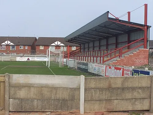 Highbury Stadium Landmark, Fleetwood9 km W
-
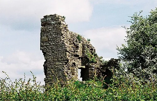 Greenhalgh Castle Historic site, Barnacre-with-Bonds9 km E
-
St Bernard of Clairvaux Roman Catholic Church Attraction, Preesall6.5 km W
-
River Lune River, Overton6.1 km N
Sources & licences
Data last updated: