Newcastle upon Tyne
Located in Newcastle upon Tyne, England Coordinates: 54°58′24″ N 1°36′50″ W
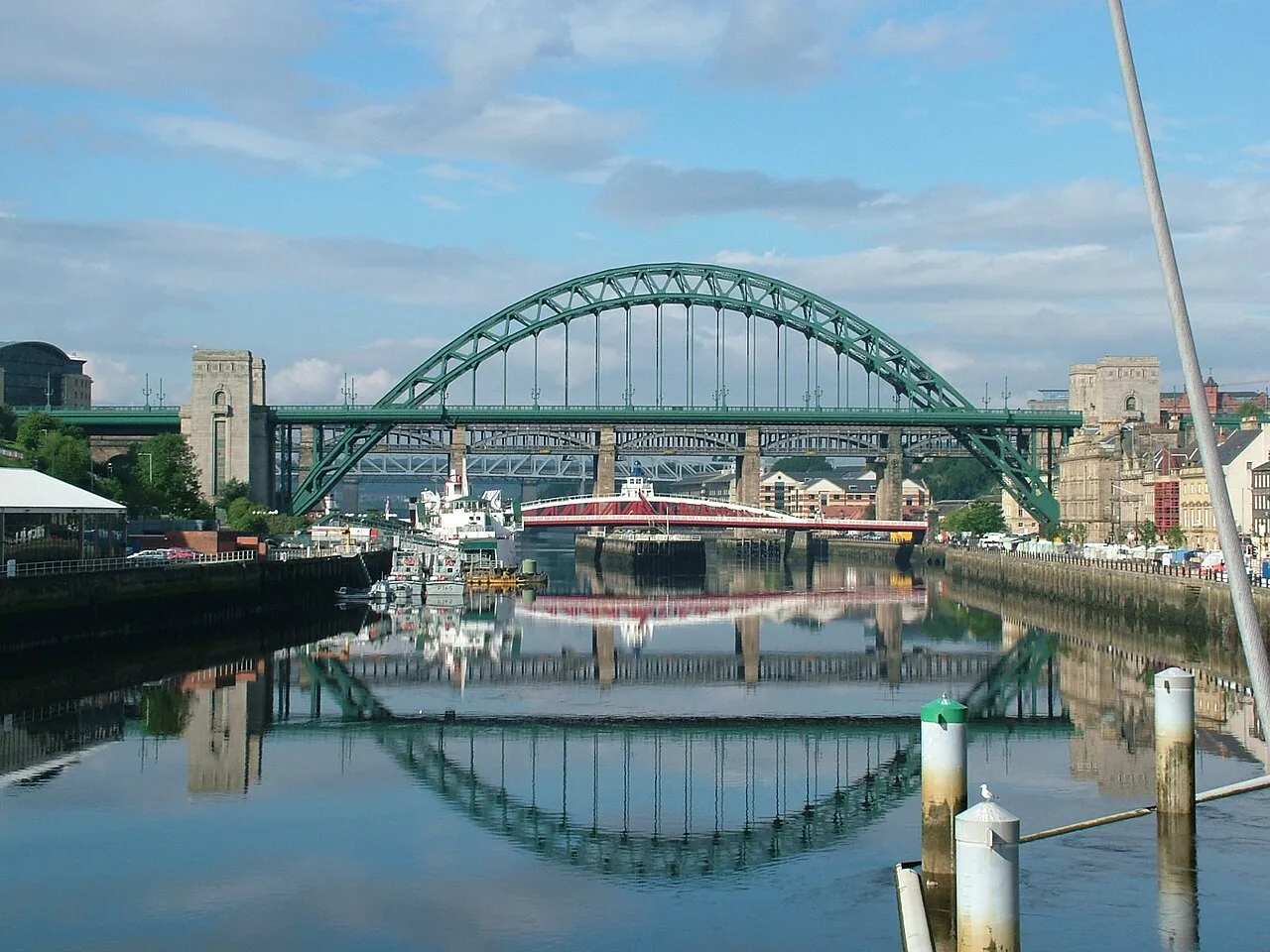
- Population
- 300,125
- 300.1K
- Elevation
- 54 m
- above sea level
- Local time
- UTC+00:00
- Europe/London · UTC+00:00
- Airports
- NCL Newcastle International Airport9 km
- MME Teesside International Airport53 km
About Newcastle upon Tyne
Newcastle upon Tyne is a city. Location: Newcastle upon Tyne, England. Population: 300,125. Elevation: 54 m.
Newcastle upon Tyne, or simply Newcastle ( new-KASS-əl, RP: NEW-kah-səl), is a city and metropolitan borough, in Tyne and Wear, England. While the hyphenated form of the name, Newcastle-upon-Tyne, is seen sometimes, correct usage is generally unhyphenated. It is England's northernmost city, sited on the river Tyne's northern bank opposite Gateshead to the south. It is the most populous settlement in the Tyneside conurbation and North East England.
Source: Wikipedia · CC BY-SA 4.0
Photos of Newcastle upon Tyne
-

David Medcalf · CC BY-SA 2.0 -

Anthony Foster · CC BY-SA 2.0 -

Anthony Foster · CC BY-SA 2.0 -
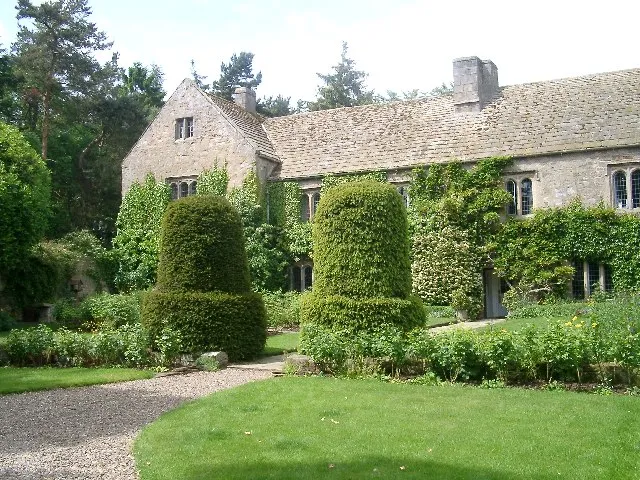
Ogle Castle Pat Pierpoint · CC BY-SA 2.0 -
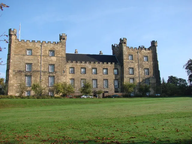
Lumley Castle Bill Henderson · CC BY-SA 2.0


Travel notes for Newcastle upon Tyne
From Wikivoyage
Newcastle upon Tyne is a city in Tyne and Wear in the north-east of England. It's an industrial but lively, cultural place on the north bank of the River Tyne, with a population of just over 300,000 in 2019, and another half a million residing in its outlying areas.
Newcastle formed its own county or borough as early as 1400, between Northumberland to the north and County Durham to the south. In 1974 the nearby urban areas of those counties were combined with Newcastle to form the new metropolis of Tyne and Wear.
Understand+
Roman forces established a fort at what is now Newcastle upon Tyne, known as Pons Aelius, beside a bridge across the River Tyne. Nearby, at South Shields, the fort of Arbeia guarded the river’s mouth and served as an important military supply base for Hadrian’s Wall. Its later garrison included the Tigris Boatmen, a unit recruited from the region of the Tigris in what is now Iraq, and the fort was given the name Arbeia, traditionally interpreted as meaning “place of the Arabs.”
Supplies arriving by sea at Arbeia could then be transported inland to the forts along Hadrian’s Wall, including Pons Aelius at Newcastle. Hadrian’s Wall was begun in AD 122, although the fort at Newcastle was built later, in the late second or early third century.
Roman rule in Britain ended in the early fifth century. In the centuries that followed, the area around Newcastle became part of the Anglo-Saxon kingdom of Northumbria, although the history of the settlement between the end of Roman rule and the Norman Conquest remains comparatively obscure. The Roman fort at Pons Aelius was eventually overlain by an Anglo-Saxon cemetery and later by the Norman castle.
In 1080, Robert Curthose, son of William the Conqueror, founded a motte-and-bailey castle on the same strategic high ground as the Roman fort. This “new castle” gave the town its name, Newcastle. The medieval town subsequently developed around this stronghold and its important crossing of the River Tyne.
Robert Curthose obliged in 1080, fearing attack by Scots or rebels, though he mostly warred with his own family. (He was the eldest son of William the Conqueror but was disinherited, to spend his last 20 years in dungeons.) His wooden Novum Castellum was soon replaced by a stone castle, then another in 1172 which is the ruin you see today. Its walls were extended to protect the entire town, which stood out against the Scots and for several months against Cromwell; the region was Royalist in the Civil Wars then fell to assault.
Get in+
By plane:
1 Newcastle International Airport (NCL IATA). This has flights from London Heathrow, Amsterdam, Paris CDG, Brussels, Copenhagen, Dublin, other European cities and the Mediterranean: Ryanair, Jet2 and Easyjet all fly here. Dubai is the only intercontinental route. Train easily beats plane for London, so you'd only use the British Airways flight to connect. Other UK destinations are Belfast, Aberdeen, Bristol, Exeter and Southampton. The airport is a compact single terminal with the usual facilities. Currency exchange is by Travelex, with poor rates, change money downtown if possible. Car rental desks are Avis, Enterprise, Europcar and Sixt, with others available to pick up or drop off by booking. See "Get in by car" below for contact details. (updated Jan 2022)
Manchester Airport (MAN IATA) has a great range of long-haul flights, saving the hassle of a change in Heathrow or Amsterdam. From the airport railway station, it's 3 hours to Newcastle: you may need to change at Manchester Piccadilly or York.
To and from the city:
By Metro: A journey on the Tyne and Wear Metro takes around 20–25 minutes, with up to 5 trains per hour running during the day and up to 4 trains per hour running in the evening and on Sunday. As of July 2022, a single three-zone ticket costs £3.90 and an all-day three-zone ticket costs £5.70.
By bus: Stagecoach operate the half-hourly X78 service, which runs express to Eldon Square via Ponteland Road, with an average journey time of around 20–25 minutes.
By taxi: There is a taxi rank at the airport, with an average fare of around £15.00–£20.00.
By car: The airport is situated off the A696, which can be reached easily from a number of principal routes, including the A1, A68 & A69. The estimated journey time to the city centre from Newcastle International Airport is 15–20 minutes, with an increased travel time during peak hours.
By train:
Source: Wikivoyage · CC BY-SA 4.0 · abridged
Twin towns and sister cities of Newcastle upon Tyne
- Atlanta· United States
- Little Rock· United States
Source: Wikidata. Only places with a page on this site are shown.
Population of Newcastle upon Tyne over time
| 2012 | 282,442 | |
|---|---|---|
| 2014 | 276,960 | |
| 2017 | 281,842 | |
| 2018 | 300,196 | |
| 2024 | 320,605 |
Censuses and official estimates; source: Wikidata.
Climate of Newcastle upon Tyne
Best months for sightseeingBest months for sightseeing: June–September.
This month · November
A cold month
Day 10° · Night 4° · Rain 58 mm
- Hottest month
- July (day 20°)
- Coldest month
- January (night 2°)
- Wettest month
- August (62 mm)
- Driest month
- February (39 mm)
Bars: average monthly low and high temperature. Below: precipitation. Monthly averages for 1970–2000 at about 18 km resolution, adjusted for elevation. Highlighted months are mild and relatively dry. Source: WorldClim 2.1 (CC BY 4.0).
Show values as a table
| Month | Jan | Feb | Mar | Apr | May | Jun | Jul | Aug | Sep | Oct | Nov | Dec |
|---|---|---|---|---|---|---|---|---|---|---|---|---|
| Average high (°C) | 7° | 7° | 9° | 11° | 14° | 17° | 20° | 20° | 17° | 13° | 10° | 8° |
| Average low (°C) | 2° | 2° | 2° | 3° | 6° | 9° | 11° | 11° | 9° | 7° | 4° | 3° |
| Precipitation (mm) | 56 | 39 | 53 | 46 | 49 | 50 | 48 | 62 | 56 | 54 | 58 | 58 |
Other places to visit in this season: June July August September
How to get to Newcastle upon Tyne
The nearest airport is Newcastle International Airport (NCL), 9 km to the northwest as the crow flies. The nearest large city is Sunderland, 17 km to the southeast.
Airports
- Newcastle International Airport (NCL) Newcastle upon Tyne, Tyne and Wear 9 kmnorthwest
- Teesside International Airport (MME) Darlington, Durham 53 kmsouth
- Leeds Bradford Airport (LBA) Leeds, West Yorkshire 123 kmsouth
Nearby large cities
- Sunderland Population: 170.1K 17 kmsoutheast
- Middlesbrough Population: 142.7K 50 kmsoutheast
- York Population: 156.1K 118 kmsouth
- Leeds Population: 536.3K 131 kmsouth
- Bradford Population: 366.2K 132 kmsouth
Straight-line distances; road distances are longer. Airport data: OurAirports.
Day trips from Newcastle upon Tyne
Within 100 km: 682 historic and cultural sites, 1,178 natural sites, 251 lakes, rivers and coasts.
0–25 km160 places
- Saint Mary’s Island Island 15 kmNE
- Castle Island Island 21 kmN
- Match Island Island 8 kmSE
- Rocky Island Island 15 kmNE
25–60 km480 places
- Longhoughton Beach Beach 51 kmN
- Seaton Carew Beach Beach 45 kmSE
- Redcar Beach Beach 52 kmSE
- Coquet Island Island 41 kmN
60–100 km1,471 places
- Cocklawburn Beach Beach 87 kmN
- Cheswick Sands Beach 85 kmN
- Whitby Beach Beach 82 kmSE
- The Island Island 82 kmS
Straight-line distances.
Newcastle upon Tyne and similar cities
Side by side with cities of similar size in the same country: population, elevation and climate.
| Measure | Newcastle upon Tyne | Swansea | Southend-on-Sea | Preston |
|---|---|---|---|---|
| Population | 300.1K | 300.4K | 295.3K | 313.3K |
| Elevation | 54 m | 18 m | 31 m | 34 m |
| Summer day (hottest month) | 20° | 21° | 22° | 19° |
| Winter night (coldest month) | 2° | 3° | 2° | 1° |
| Annual rainfall | 629 mm | 1,124 mm | 519 mm | 1,049 mm |
| Best months | Jun–Sep | Jun–Aug | Jun–Sep | Jun–Aug |
| Distance | — | 404 km | 413 km | 152 km |
Climate values are 1970–2000 monthly averages; straight-line distance.
Nearby attractions & nature
Everything nearby-
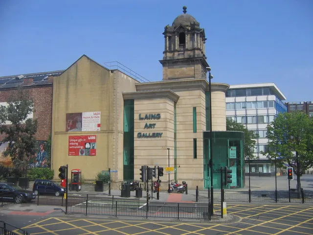 Laing Art Gallery Museum, Newcastle upon Tyne0.3 km NE
-
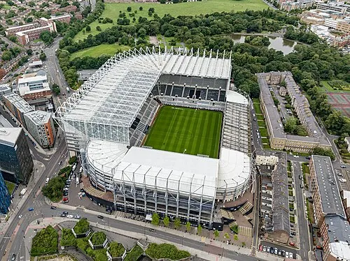 St James' Park Landmark, Newcastle upon Tyne0.5 km NW
-
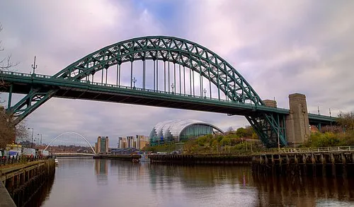 Tyne Bridge Landmark, Gateshead0.8 km SE
-
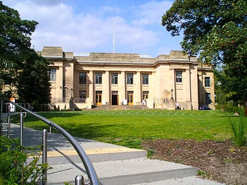 Hancock Museum Museum, Newcastle upon Tyne0.8 km N
-
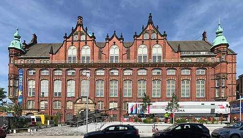 Discovery Museum Museum, Newcastle upon Tyne0.8 km SW
-
Blackfriars Friary Historic site, Newcastle upon Tyne0.4 km SW
-
Newcastle upon Tyne Castle Historic site, Newcastle upon Tyne0.6 km S
-
Newcastle upon Tyne Town Wall Historic site, Newcastle upon Tyne0.7 km E
Other cities and towns in Newcastle upon Tyne
-
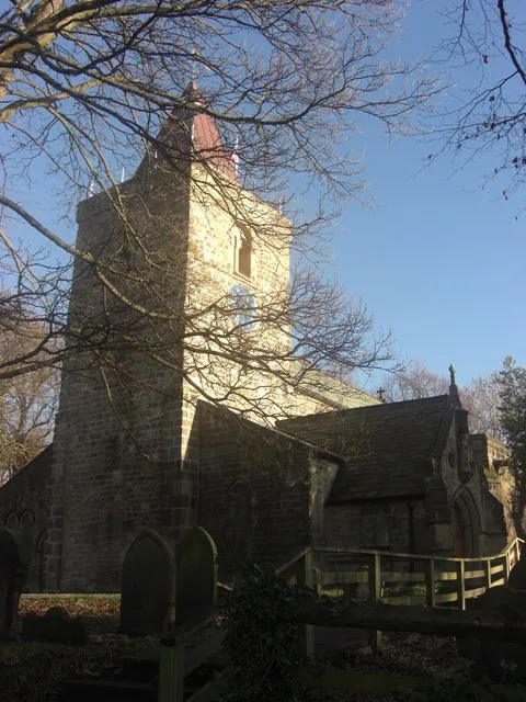 Newburn Town, Newcastle upon Tyne8.5 km W
-
Benwell Town, Blakelaw and North Fenham3.5 km W
-
Blakelaw and North Fenham Municipality, Newcastle upon Tyne4.4 km NW
-
North Gosforth Municipality, Newcastle upon Tyne5.8 km N
-
Woolsington Municipality, Newcastle upon Tyne8 km NW
-
Hazlerigg Municipality, Newcastle upon Tyne7 km N
Sources & licences
Data last updated: · 2 independent sources