- Population
- 165,645
- 165.6K
- Elevation
- 20 m
- above sea level
- Local time
- UTC+00:00
- Europe/London · UTC+00:00
- Places inside
- 121
- listed under South Somerset District
- Airports
- BRS Bristol Airport44 km
- EXT Exeter International Airport57 km
About South Somerset District
South Somerset District is a municipality. Location: Somerset, England. Population: 165,645. Elevation: 20 m. The best months to visit are June–August. The nearest airport is Bristol Airport (44 km). Nearby sights include River Yeo and Sherborne Abbey.
Photos of South Somerset District
-
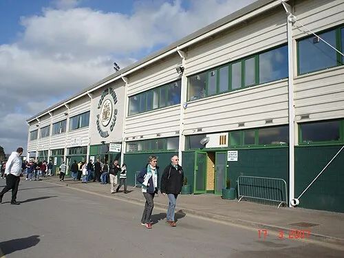
Huish Park Ytfc23 · Public domain

Climate of South Somerset District
Best months for sightseeingBest months for sightseeing: June–August.
This month · November
A cold month
Day 11° · Night 5° · Rain 80 mm
- Hottest month
- July (day 21°)
- Coldest month
- February (night 2°)
- Wettest month
- December (92 mm)
- Driest month
- April (55 mm)
Bars: average monthly low and high temperature. Below: precipitation. Monthly averages for 1970–2000 at about 18 km resolution, adjusted for elevation. Highlighted months are mild and relatively dry. Source: WorldClim 2.1 (CC BY 4.0).
Show values as a table
| Month | Jan | Feb | Mar | Apr | May | Jun | Jul | Aug | Sep | Oct | Nov | Dec |
|---|---|---|---|---|---|---|---|---|---|---|---|---|
| Average high (°C) | 9° | 8° | 10° | 13° | 16° | 19° | 21° | 21° | 18° | 15° | 11° | 9° |
| Average low (°C) | 3° | 2° | 4° | 4° | 7° | 10° | 12° | 12° | 10° | 8° | 5° | 3° |
| Precipitation (mm) | 89 | 67 | 64 | 55 | 55 | 58 | 55 | 63 | 70 | 78 | 80 | 92 |
How to get to South Somerset District
The nearest airport is Bristol Airport (BRS), 44 km to the north as the crow flies. The nearest large city is Bath, 50 km to the northeast.
Airports
- Bristol Airport (BRS) Bristol 44 kmnorth
- Exeter International Airport (EXT) Exeter, Devon 57 kmsouthwest
- Cardiff International Airport (CWL) Cardiff 64 kmnorthwest
Nearby large cities
- Bath Population: 101.6K 50 kmnortheast
- Bristol Population: 479K 53 kmnorth
- Poole Population: 151.5K 59 kmsoutheast
- Cardiff Population: 372.1K 64 kmnorthwest
- Exeter Population: 130.7K 65 kmsouthwest
Straight-line distances; road distances are longer. Airport data: OurAirports.
Day trips from South Somerset District
Within 100 km: 484 historic and cultural sites, 1,208 natural sites, 141 lakes, rivers and coasts.
0–25 km111 places
- Glastonbury Tor Mountain 18 kmN
- Corton Hill Beacon Mountain 13 kmE
- Lewesdon Hill Mountain 21 kmS
- Telegraph Hill Mountain 21 kmSE
25–60 km563 places
- Chesil Beach Beach 40 kmS
- Man O'War Beach Beach 51 kmSE
- Charmouth Beach Beach 31 kmSW
- Kilve Beach Beach 43 kmNW
60–100 km1,159 places
- Brownsea Island Island 61 kmSE
- Avon Beach Beach 74 kmE
- Goodrington Sands Beach 88 kmSW
- Studland Beach Beach 64 kmSE
Straight-line distances.
South Somerset District and similar cities
Side by side with cities of similar size in the same country: population, elevation and climate.
| Measure | South Somerset District | Slough | Bournemouth | Peterborough |
|---|---|---|---|---|
| Population | 165.6K | 164.8K | 163.6K | 163.4K |
| Elevation | 20 m | 33 m | 19 m | 12 m |
| Summer day (hottest month) | 21° | 23° | 22° | 22° |
| Winter night (coldest month) | 2° | 2° | 2° | 1° |
| Annual rainfall | 826 mm | 655 mm | 805 mm | 580 mm |
| Best months | Jun–Aug | Jun–Aug | Jun–Aug | Jun–Aug |
| Distance | — | 159 km | 65 km | 245 km |
Climate values are 1970–2000 monthly averages; straight-line distance.
Places in South Somerset District
121 placesCities & villages60
- Abbas and Templecombe · Village
- Alford · Village
- Aller · Village
- Ansford · Village
- Ash · Village
- Ashill · Village
- Babcary · Village
- Barrington · Village
- Barton St David · Village
- Barwick · Village
- Beercrocombe · Village
- Bratton Seymour · Village
- Brewham · Village
- Broadway · Village
- Bruton · Village
- Brympton · Village
- Buckland St. Mary · Village
- Castle Cary · Village
- Chaffcombe · Village
- Chard Town · Village
- Charlton Horethorne · Village
- Charlton Mackrell · Village
- Charlton Musgrove · Village
- Chillington · Village
- Chilthorne Domer · Village
- Chilton Cantelo · Village
- Chiselborough · Village
- Closworth · Village
- Combe St. Nicholas · Village
- Compton Dundon · Village
- Compton Pauncefoot · Village
- Corton Denham · Village
- Crewkerne · Village
- Cricket St. Thomas · Village
- Cucklington · Village
- Cudworth · Village
- Curry Mallet · Village
- Curry Rivel · Village
- Dinnington · Village
- Donyatt · Village
- Dowlish Wake · Village
- Drayton · Village
- East Chinnock · Village
- East Coker · Village
- Fivehead · Village
- Hambridge and Westport · Village
- Hardington Mandeville · Village
- Haselbury Plucknett · Village
- Henstridge · Village
- High Ham · Village
- Hinton St. George · Village
- Holton · Village
- Horsington · Village
- Horton · Village
- Huish Episcopi · Village
- Ilchester · Village
- Ilminster · Village
- Ilton · Village
- Isle Abbotts · Village
- Isle Brewers · Village
Nearby attractions & nature
Everything nearby-
River Yeo River, Somerset9.6 km NW
-
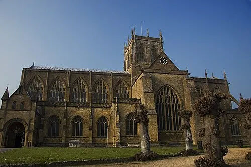 Sherborne Abbey Attraction, Sherborne14 km E
-
River Isle River, Somerset9.7 km NW
-
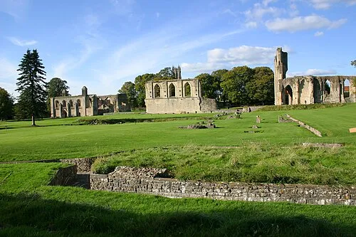 Glastonbury Abbey Attraction, Glastonbury18 km N
-
Babylon Hill Mountain, Nether Compton10 km SE
-
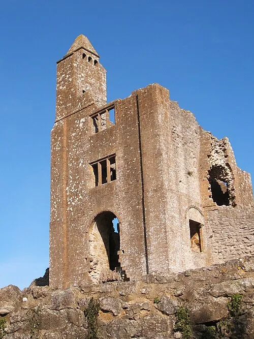 Sherborne Old Castle Historic site, Castleton15 km E
-
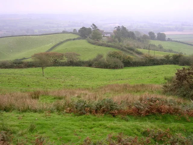 Pilsdon Pen Mountain, Pilsdon22 km SW
-
Mohun Castle Historic site, South Perrott15 km S
Other cities and towns in Somerset
-
Yeovil Town, Yeovil7.1 km SE
-
Mendip District Municipality, Somerset26 km NE
-
Sedgemoor District Municipality, Somerset29 km NW
-
Taunton Deane District Municipality, Somerset31 km W
-
Crewkerne Town, Crewkerne13 km SW
-
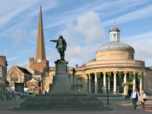 Bridgwater Town, Bridgwater26 km NW
Sources & licences
Data last updated: