- Elevation
- 51 m
- above sea level
- Local time
- UTC+00:00
- Europe/London · UTC+00:00
- Airports
- ABZ Aberdeen International Airport41 km
- WIC Wick John O'Groats Airport123 km
About Cuttyhill
Cuttyhill is a village. Location: Aberdeenshire, Scotland. Elevation: 51 m. The best months to visit are June–September. The nearest airport is Aberdeen International Airport (41 km). Nearby sights include South Ugie Water and North Ugie Water.
Climate of Cuttyhill
Best months for sightseeingBest months for sightseeing: June–September.
This month · November
A cold month
Day 7° · Night 2° · Rain 77 mm
- Hottest month
- July (day 18°)
- Coldest month
- January (night -2°)
- Wettest month
- November (77 mm)
- Driest month
- February (49 mm)
Bars: average monthly low and high temperature. Below: precipitation. Monthly averages for 1970–2000 at about 18 km resolution, adjusted for elevation. Highlighted months are mild and relatively dry. Source: WorldClim 2.1 (CC BY 4.0).
Show values as a table
| Month | Jan | Feb | Mar | Apr | May | Jun | Jul | Aug | Sep | Oct | Nov | Dec |
|---|---|---|---|---|---|---|---|---|---|---|---|---|
| Average high (°C) | 4° | 6° | 9° | 11° | 14° | 16° | 18° | 17° | 15° | 11° | 7° | 5° |
| Average low (°C) | -2° | -1° | 2° | 3° | 5° | 9° | 10° | 9° | 8° | 5° | 2° | 0° |
| Precipitation (mm) | 68 | 49 | 53 | 51 | 49 | 54 | 57 | 61 | 70 | 73 | 77 | 68 |
Other places to visit in this season: June July August September
How to get to Cuttyhill
The nearest airport is Aberdeen International Airport (ABZ), 41 km to the southwest as the crow flies. The nearest large city is Aberdeen, 46 km to the south.
Airports
- Aberdeen International Airport (ABZ) Aberdeen 41 kmsouthwest
- Wick John O'Groats Airport (WIC) Wick 123 kmnorthwest
- Inverness Airport (INV) Inverness, Highland 127 kmwest
Nearby large cities
- Aberdeen Population: 198.6K 46 kmsouth
- Dundee Population: 148.2K 135 kmsouthwest
- Edinburgh Population: 515K 193 kmsouthwest
- Glasgow Population: 626.4K 235 kmsouthwest
- Newcastle upon Tyne Population: 300.1K 287 kmsouth
Straight-line distances; road distances are longer. Airport data: OurAirports.
Day trips from Cuttyhill
Within 100 km: 46 historic and cultural sites, 857 natural sites, 148 lakes, rivers and coasts.
0–25 km75 places
- Keith Inch Island 11 kmSE
- The Donnons Island 16 kmS
- Inch Geck Island 23 kmS
- Dundonnie Island 13 kmSE
25–60 km277 places
- Balbithan Island Island 41 kmSW
- Sunnyside Beach Beach 53 kmW
- Newburgh Seals Beach Beach 26 kmS
- Aberdeen Beach Beach 44 kmS
60–100 km699 places
- Findlays Seat Mountain 76 kmW
- Lossiemouth East Beach Beach 83 kmW
- Island of Dundurcas Island 75 kmW
- Heathery Isle Island 76 kmW
Straight-line distances.
Nearby attractions & nature
Everything nearby-
South Ugie Water River, Aberdeenshire2.1 km SE
-
North Ugie Water River, Aberdeenshire2.1 km SE
-
Hill of Fetterangus Mountain, Aberdeenshire7.1 km W
-
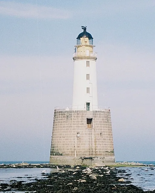 Rattray Head Lighthouse Landmark, Aberdeenshire10 km NE
-
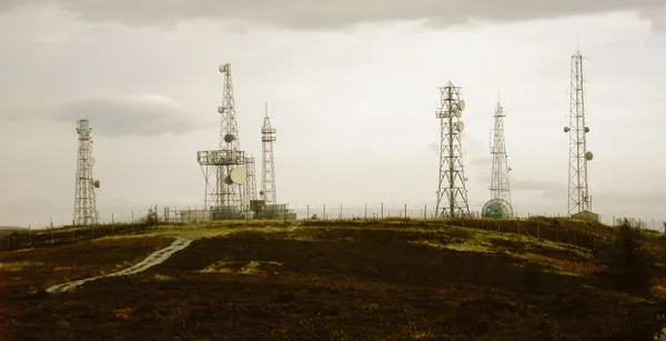 Mormond Hill Mountain, Aberdeenshire10 km NW
-
Hill of Longhaven Mountain, Aberdeenshire9 km SE
Sources & licences
Data last updated: