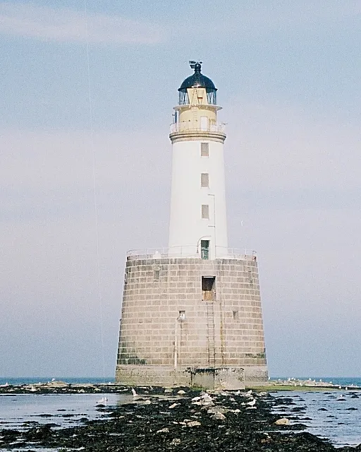
Rattray Head Lighthouse
Located in Aberdeenshire, Scotland Coordinates: 57°36′36″ N 1°48′59″ W
- Local time
- UTC+00:00
- Europe/London · UTC+00:00
- Airports
- ABZ Aberdeen International Airport51 km
- WIC Wick John O'Groats Airport121 km
About Rattray Head Lighthouse
Rattray Head Lighthouse is a landmark. Location: Aberdeenshire, Scotland.
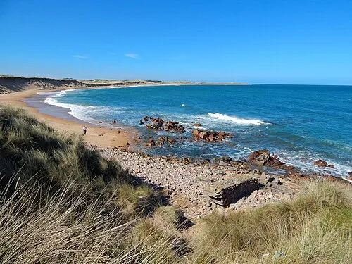
Rattray Head (), historically Rattray Point, is a headland in Buchan, Aberdeenshire, on the north-east coast Scotland. To north lies Strathbeg Bay and Rattray Bay is to its south. The dunes at Rattray Head beach can be up to 75 feet (23 m) high and stretch 17 miles (27 km) from St Combs to Peterhead.
Source: Wikipedia · CC BY-SA 4.0
At a glance
- Built
- 1895
- Heritage designation
- category B listed building
- Height
- 34 m
Source: Wikidata
Photos of Rattray Head Lighthouse
-

Director General of the Ordnance Survey, Chessington, Surrey, UK · Public domain -

The Crabbit Photographer · CC BY-SA 4.0 -

JoanaImages · CC BY-SA 4.0 -

Colin Park · CC BY-SA 2.0 -

Crossboy85 · CC BY 4.0


Climate of Rattray Head Lighthouse
Best months for sightseeingBest months for sightseeing: June–September.
This month · November
A cold month
Day 7° · Night 2° · Rain 76 mm
- Hottest month
- July (day 18°)
- Coldest month
- January (night -2°)
- Wettest month
- November (76 mm)
- Driest month
- February (48 mm)
Bars: average monthly low and high temperature. Below: precipitation. Monthly averages for 1970–2000 at about 18 km resolution, adjusted for elevation. Highlighted months are mild and relatively dry. Source: WorldClim 2.1 (CC BY 4.0).
Show values as a table
| Month | Jan | Feb | Mar | Apr | May | Jun | Jul | Aug | Sep | Oct | Nov | Dec |
|---|---|---|---|---|---|---|---|---|---|---|---|---|
| Average high (°C) | 3° | 5° | 9° | 11° | 14° | 16° | 18° | 17° | 15° | 11° | 7° | 5° |
| Average low (°C) | -2° | -1° | 2° | 4° | 6° | 9° | 10° | 10° | 8° | 5° | 2° | 0° |
| Precipitation (mm) | 67 | 48 | 52 | 50 | 49 | 54 | 56 | 60 | 69 | 72 | 76 | 67 |
Other places to visit in this season: June July August September
How to get to Rattray Head Lighthouse
The nearest airport is Aberdeen International Airport (ABZ), 51 km to the southwest as the crow flies. The nearest large city is Aberdeen, 55 km to the south.
Airports
- Aberdeen International Airport (ABZ) Aberdeen 51 kmsouthwest
- Wick John O'Groats Airport (WIC) Wick 121 kmnorthwest
- Inverness Airport (INV) Inverness, Highland 134 kmwest
Nearby large cities
- Aberdeen Population: 198.6K 55 kmsouth
- Dundee Population: 148.2K 145 kmsouthwest
- Edinburgh Population: 515K 203 kmsouthwest
- Glasgow Population: 626.4K 245 kmsouthwest
- Newcastle upon Tyne Population: 300.1K 294 kmsouth
Straight-line distances; road distances are longer. Airport data: OurAirports.
Day trips from Rattray Head Lighthouse
Within 100 km: 42 historic and cultural sites, 695 natural sites, 114 lakes, rivers and coasts.
0–25 km50 places
- Keith Inch Island 12 kmS
- The Donnons Island 22 kmS
- Dundonnie Island 17 kmS
- Loch of Strathbeg Lake 4 kmW
25–60 km216 places
- Balbithan Island Island 52 kmSW
- Sunnyside Beach Beach 58 kmW
- Newburgh Seals Beach Beach 35 kmS
- Aberdeen Beach Beach 53 kmS
60–100 km585 places
- Findlays Seat Mountain 83 kmW
- Lossiemouth East Beach Beach 88 kmW
- Island of Dundurcas Island 82 kmW
- Heathery Isle Island 83 kmW
Straight-line distances.
Nearby attractions & nature
Everything nearby-
Rattray Head Natural site, Aberdeenshire0.3 km SW
-
Crimond Royal Naval Wireless Telegraphy Station, Mast Southeast Landmark, Aberdeenshire3.8 km W
-
Crimond Royal Naval Wireless Telegraphy Station, Large Mast Landmark, Aberdeenshire4.3 km W
-
Crimond Royal Naval Wireless Telegraphy Station, Mast Southwest Landmark, Aberdeenshire4.6 km W
-
Rattray Bay Natural site, Aberdeenshire3.1 km S
-
Loch of Strathbeg Lake, Aberdeenshire3.9 km W
-
Strathbeg Bay Natural site, Aberdeenshire4.8 km NW
-
Inzie Head Natural site, Aberdeenshire6.7 km NW
Nearest towns and villages
-
 Peterhead Town, Aberdeenshire12 km S
-
Saint Fergus Village, Aberdeenshire5.8 km S
-
Crimond Village, Aberdeenshire6 km W
-
Keyhead Village, Aberdeenshire4.3 km SW
Sources & licences
Data last updated: · 2 independent sources