South Ayrshire
Local name: Siorrachd Àir a Deas
Located in Scotland, United Kingdom Coordinates: 55°15′00″ N 4°40′00″ W
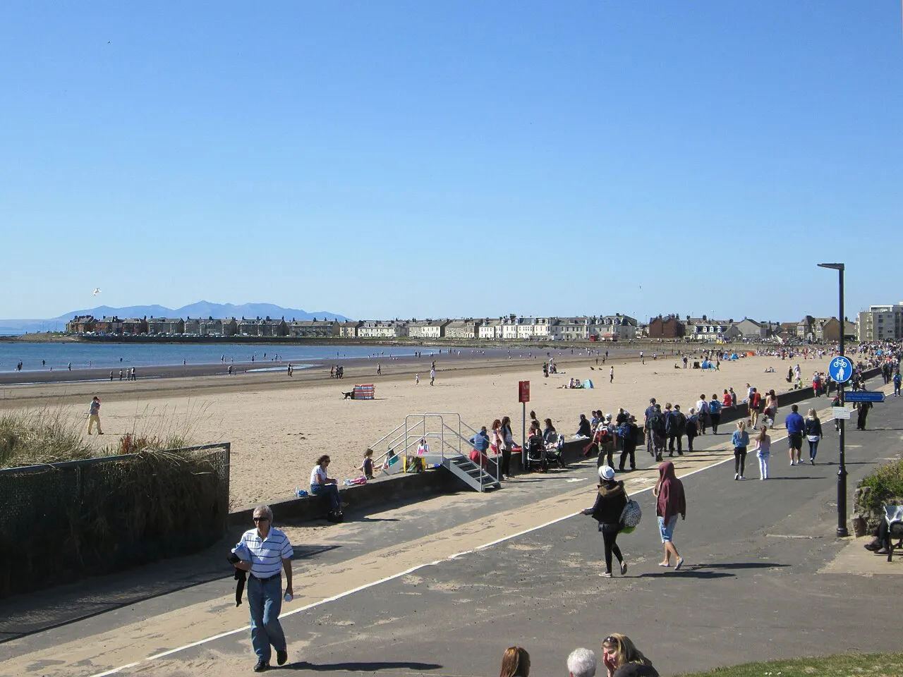
- Population
- 112,260
- 112.3K
- Elevation
- 353 m
- above sea level
- Local time
- UTC+00:00
- Europe/London · UTC+00:00
- Places inside
- 212
- listed under South Ayrshire
- Airports
- PIK Glasgow Prestwick Airport29 km
- CAL Campbeltown Airport68 km
About South Ayrshire
South Ayrshire is a district. Location: Scotland, United Kingdom. Population: 112,260.
South Ayrshire (Scots: Sooth Ayrshire; Scottish Gaelic: Siorrachd Àir a Deas, pronounced [ˈʃirˠəxk aːɾʲ ə ˈtʲes̪]) is one of thirty-two council areas of Scotland, covering the southern part of Ayrshire. It borders onto Dumfries and Galloway, East Ayrshire and North Ayrshire. South Ayrshire had an estimated population in 2021 of 112,450, making it the 19th–largest subdivision in Scotland by population. With an area of 472 sq mi, South Ayrshire ranks as the 15th largest subdivision in Scotland.
Source: Wikipedia · CC BY-SA 4.0
Photos of South Ayrshire
-
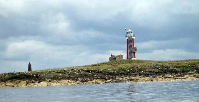
Lady Isle Gordon Dowie · CC BY-SA 2.0 -
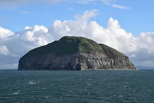
Ailsa Craig Niels Johannes · CC BY-SA 4.0 -
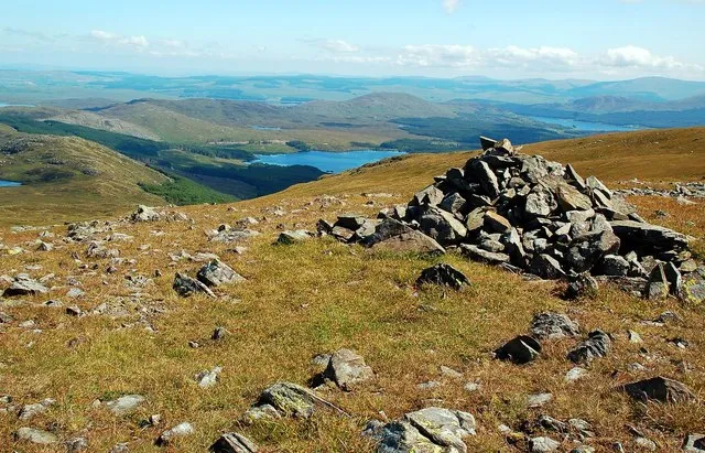
Shalloch on Minnoch Mary and Angus Hogg · CC BY-SA 2.0 -

Somerset Park Martin Le Roy · CC BY 2.5 -
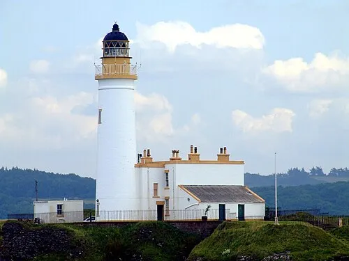
Turnberry Lighthouse S McKechnie · CC BY-SA 2.0


Population of South Ayrshire over time
| 2008 | 112,610 | |
|---|---|---|
| 2009 | 112,490 | |
| 2010 | 112,600 | |
| 2011 | 112,980 | |
| 2012 | 112,920 | |
| 2013 | 112,870 | |
| 2014 | 112,530 | |
| 2015 | 112,400 | |
| 2016 | 112,470 | |
| 2017 | 112,680 | |
| 2018 | 112,550 | |
| 2019 | 112,610 |
Censuses and official estimates; source: Wikidata.
Climate of South Ayrshire
Best months for sightseeingBest months for sightseeing: July.
This month · November
A wet month
Day 7° · Night 2° · Rain 146 mm
- Hottest month
- July (day 16°)
- Coldest month
- February (night -1°)
- Wettest month
- October (148 mm)
- Driest month
- May (69 mm)
Bars: average monthly low and high temperature. Below: precipitation. Monthly averages for 1970–2000 at about 18 km resolution, adjusted for elevation. Highlighted months are mild and relatively dry. Source: WorldClim 2.1 (CC BY 4.0).
Show values as a table
| Month | Jan | Feb | Mar | Apr | May | Jun | Jul | Aug | Sep | Oct | Nov | Dec |
|---|---|---|---|---|---|---|---|---|---|---|---|---|
| Average high (°C) | 5° | 5° | 6° | 9° | 12° | 14° | 16° | 16° | 13° | 11° | 7° | 6° |
| Average low (°C) | 0° | -1° | 1° | 2° | 4° | 7° | 9° | 9° | 7° | 5° | 2° | 1° |
| Precipitation (mm) | 141 | 100 | 112 | 74 | 69 | 79 | 87 | 108 | 125 | 148 | 146 | 141 |
Other places to visit in this season: July
How to get to South Ayrshire
The nearest airport is Glasgow Prestwick Airport (PIK), 29 km to the north as the crow flies. The nearest large city is Glasgow, 73 km to the north.
Airports
- Glasgow Prestwick Airport (PIK) Prestwick, South Ayrshire 29 kmnorth
- Campbeltown Airport (CAL) Campbeltown 68 kmwest
- Glasgow Airport (GLA) Glasgow 71 kmnorth
Nearby large cities
- Glasgow Population: 626.4K 73 kmnorth
- Belfast Population: 348K 109 kmsouthwest
- Edinburgh Population: 515K 121 kmnortheast
- Dundee Population: 148.2K 172 kmnortheast
- Blackpool Population: 145K 191 kmsoutheast
Straight-line distances; road distances are longer. Airport data: OurAirports.
Day trips from South Ayrshire
Within 100 km: 150 historic and cultural sites, 2,236 natural sites, 662 lakes, rivers and coasts.
0–25 km248 places
- Ayr Beach Beach 24 kmN
- Isles of Trool Island 21 kmSE
- Kids Isle Island 23 kmE
- Maiden Isle Island 21 kmSE
25–60 km937 places
- Isle of Arran Island 54 kmNW
- Great Cumbrae Island Island 60 kmN
- Troon Beach Beach 32 kmN
- Hunterston Sands Beach 55 kmN
60–100 km1,863 places
- Powillimount Beach Beach 80 kmSE
- West Maiden Island 77 kmSW
- Rathlin Island Island 98 kmW
- Lighthouse Island Island 83 kmSW
Straight-line distances.
Places in South Ayrshire
212 placesCities & villages26
- Holmston · Neighbourhood
- Joppa · Village
- Kilgrammie · Village
- Kilkerran · Village
- Kincaidston · Neighbourhood
- Kirkmichael · Village
- Kirkoswald · Village
- Knockdon · Village
- Knockytoul · Village
- Lagg · Village
- Laigh Glengall · Neighbourhood
- Lendalfoot · Village
- Lochside · Neighbourhood
- Masonhill · Neighbourhood
- Minishant · Village
- Muirhead · Neighbourhood
- New Prestwick · Village
- Newton on Ayr · Neighbourhood
- Old Dailly · Village
- Pinmore · Village
- Pinwherry · Village
- Poundland · Village
- Redrea · Village
- Roan of Craigoch · Village
- Rowantree · Village
- Rozelle · Neighbourhood
Mountains & nature31
- Hill of Barnweil · Mountain
- Kildoach Hill · Mountain
- Kilmoray · Mountain
- Kirk Hill · Mountain
- Kirkland Hill · Mountain
- Knockbrake · Mountain
- Knockdaw Hill · Mountain
- Knockdhu · Mountain
- Knockdolian · Mountain
- Knockeen · Mountain
- Knockinculloch · Mountain
- Knockormal Hill · Mountain
- Knockrocher Knowe · Mountain
- Knoweside Hill · Mountain
- Laggan Hill · Mountain
- Larg Hill · Mountain
- Lennie · Mountain
- Lindston Hill · Mountain
- Littleton Hill · Mountain
- Mains Hill · Mountain
- Meikle Hill of the Shalloch · Mountain
- Milljoan Hill · Mountain
- Mochrum Hill · Mountain
- Mull of Miljoan · Mountain
- North Bay · Natural site
- Penderry Hill · Mountain
- Pheelie · Mountain
- Pinbain Hill · Mountain
- Polmaddie Hill · Mountain
- Quarrel Hill · Mountain
- Raith Hill · Mountain
Lakes, rivers & coasts2
- Lady Isle · Island
- Loch Spallander · Lake
Heritage & sights1
- Robert Burns Birthplace Museum · Museum
Nearby attractions & nature
Everything nearby-
Water of Gregg River, Scotland4.9 km SW
-
Linfern Loch Lake, Scotland6.4 km E
-
Aldinna Loch Lake, Scotland8.5 km SE
-
Loch Scalloch Lake, Scotland9.5 km S
-
Loch Skelloch Lake, Scotland11 km E
-
Water of Assel River, Scotland11 km SW
Other regions in Scotland
-
East Ayrshire District, Scotland38 km NE
-
 North Ayrshire District, Scotland50 km N
-
 South Lanarkshire District, Scotland65 km NE
-
 East Renfrewshire District, Scotland60 km N
-
 Renfrewshire District, Scotland66 km N
-
North Lanarkshire District, Scotland83 km NE
Sources & licences
Data last updated: · 2 independent sources