- Elevation
- 154 m
- above sea level
- Local time
- UTC+01:00
- Europe/Zagreb · UTC+01:00
- Airports
- ZAG Zagreb Franjo Tuđman International Airport48 km
- RJK Rijeka Airport83 km
About Dobra
Dobra is a river. Location: Croatia. The best months to visit are May–September. The nearest airport is Zagreb Franjo Tuđman International Airport (48 km). Nearby sights include Dobra and Mrežnica.
Climate of Dobra
Best months for sightseeingBest months for sightseeing: May–September.
This month · November
A wet month
Day 9° · Night 2° · Rain 104 mm
- Hottest month
- July (day 26°)
- Coldest month
- January (night -3°)
- Wettest month
- June (106 mm)
- Driest month
- February (56 mm)
Bars: average monthly low and high temperature. Below: precipitation. Monthly averages for 1970–2000 at about 18 km resolution, adjusted for elevation. Highlighted months are mild and relatively dry. Source: WorldClim 2.1 (CC BY 4.0).
Show values as a table
| Month | Jan | Feb | Mar | Apr | May | Jun | Jul | Aug | Sep | Oct | Nov | Dec |
|---|---|---|---|---|---|---|---|---|---|---|---|---|
| Average high (°C) | 4° | 7° | 12° | 16° | 21° | 24° | 26° | 26° | 22° | 16° | 9° | 5° |
| Average low (°C) | -3° | -2° | 1° | 5° | 10° | 13° | 14° | 14° | 11° | 6° | 2° | -2° |
| Precipitation (mm) | 58 | 56 | 71 | 81 | 85 | 106 | 98 | 98 | 100 | 102 | 104 | 79 |
Other places to visit in this season: May June July August September
How to get to Dobra
The nearest airport is Zagreb Franjo Tuđman International Airport (ZAG), 48 km to the northeast as the crow flies. The nearest large city is Zagreb, 46 km to the northeast.
Airports
- Zagreb Franjo Tuđman International Airport (ZAG) Velika Gorica 48 kmnortheast
- Rijeka Airport (RJK) Rijeka(Omišalj) 83 kmsouthwest
- Maribor Edvard Rusjan Airport (MBX) Maribor 104 kmnorth
Nearby large cities
- Zagreb Population: 663.6K 46 kmnortheast
- Rijeka Population: 108K 88 kmwest
- Klagenfurt Population: 100.3K 152 kmnorthwest
- Graz Population: 303.3K 169 kmnorth
- Pécs Population: 145.3K 219 kmeast
Straight-line distances; road distances are longer. Airport data: OurAirports.
Nearest towns and villages
-
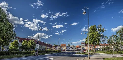 Karlovac City, Town of Karlovac6.6 km S
-
Tomašnica Village, Town of Ozalj4.4 km W
-
Donje Stative Village, Municipality of Netretić5.4 km SW
-
Mali Erjavec Village, Town of Ozalj4.9 km NW
-
Vodostaj Village, Town of Karlovac6.6 km SE
-
Ozalj City, Town of Ozalj8 km NW
Nearby attractions & nature
Everything nearbyMore lakes, rivers and coasts in Croatia

Sources & licences
Data last updated: