Palovec
Located in Municipality of Mala Subotica, Međimurje County Coordinates: 46°23′20″ N 16°32′52″ E
- Population
- 873
- 873
- Elevation
- 152 m
- above sea level
- Local time
- UTC+01:00
- Europe/Zagreb · UTC+01:00
- Airports
- SOB Hévíz–Balaton Airport57 km
- MBX Maribor Edvard Rusjan Airport67 km
About Palovec
Palovec is a village. Location: Municipality of Mala Subotica, Međimurje County. Population: 873. Elevation: 152 m.
Palovec (Hungarian: Felsőpálfa) is a village in Međimurje County, Croatia. The village is part of the municipality of Mala Subotica and had a population of 984 in the 2011 census, thus being the second largest village in the municipality. The D3 state road passes through the village, which is located around 10 kilometres east of Čakovec, the county seat and largest city of Međimurje County. The A4 highway also passes nearby, although it can not be accessed near the village.
Source: Wikipedia · CC BY-SA 4.0
At a glance
- Area
- 8.1 km²
Source: Wikidata
Climate of Palovec
Best months for sightseeingBest months for sightseeing: May–September.
This month · November
A cold month
Day 9° · Night 1° · Rain 75 mm
- Hottest month
- July (day 26°)
- Coldest month
- January (night -4°)
- Wettest month
- June (88 mm)
- Driest month
- January (38 mm)
Bars: average monthly low and high temperature. Below: precipitation. Monthly averages for 1970–2000 at about 18 km resolution, adjusted for elevation. Highlighted months are mild and relatively dry. Source: WorldClim 2.1 (CC BY 4.0).
Show values as a table
| Month | Jan | Feb | Mar | Apr | May | Jun | Jul | Aug | Sep | Oct | Nov | Dec |
|---|---|---|---|---|---|---|---|---|---|---|---|---|
| Average high (°C) | 3° | 6° | 11° | 16° | 22° | 25° | 26° | 26° | 22° | 16° | 9° | 4° |
| Average low (°C) | -4° | -3° | 1° | 5° | 10° | 13° | 14° | 14° | 10° | 5° | 1° | -2° |
| Precipitation (mm) | 38 | 39 | 49 | 61 | 71 | 88 | 87 | 81 | 76 | 69 | 75 | 53 |
Other places to visit in this season: May June July August September
How to get to Palovec
The nearest airport is Hévíz–Balaton Airport (SOB), 57 km to the northeast as the crow flies. For international flights: Zagreb Franjo Tuđman International Airport (ZAG) (81 km). The nearest large city is Zagreb, 78 km to the southwest.
Airports
- Hévíz–Balaton Airport (SOB) Sármellék 57 kmnortheast
- Maribor Edvard Rusjan Airport (MBX) Maribor 67 kmwest
- Zagreb Franjo Tuđman International Airport (ZAG) Velika Gorica 81 kmsouthwest
Nearby large cities
- Zagreb Population: 663.6K 78 kmsouthwest
- Graz Population: 303.3K 113 kmnorthwest
- Pécs Population: 145.3K 134 kmeast
- Ljubljana Population: 272.2K 162 kmwest
- Győr Population: 129.3K 166 kmnortheast
Straight-line distances; road distances are longer. Airport data: OurAirports.
Day trips from Palovec
Within 100 km: 54 historic and cultural sites, 162 natural sites, 156 lakes, rivers and coasts.
0–25 km10 places
- Ledava River 10 kmNE
- Ščavnica River 24 kmNW
- Plitvica River 17 kmSE
- Lake Dubrava Lake 11 kmSE
25–60 km25 places
- Lake Ptuj Lake 50 kmW
- Polskava River 51 kmW
- Dravinja River 48 kmW
- Plesch Bach River 53 kmNW
60–100 km337 places
- Kašina River 66 kmS
- Ribnica Lake Lake 99 kmW
- Pohorje Mountain 85 kmW
- Krka River 92 kmSW
Straight-line distances.
Nearby attractions & nature
Everything nearby-
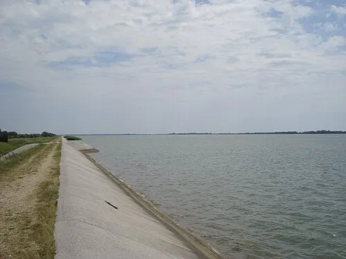 Lake Dubrava Lake, Croatia11 km SE
-
 Kerka River, Hungary10 km N
-
 Trnava Murska River, Croatia13 km E
-
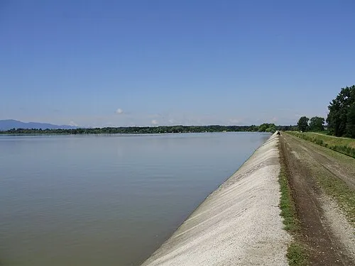 Lake Varaždin Lake, Croatia14 km SW
-
 Bednja River, Croatia19 km SE
-
 Ledava River, Slovenia10 km NE
Sources & licences
Data last updated: · 2 independent sources