Krk Bridge
Local name: Krčki most
Located in Primorje-Gorski Kotar County, Croatia Coordinates: 45°14′51″ N 14°34′15″ E
- Local time
- UTC+01:00
- Europe/Zagreb · UTC+01:00
- Elevation
- 100 m
- above sea level
- Airports
- RJK Rijeka Airport3 km
- PUY Pula Airport64 km
About Krk Bridge
Krk Bridge is a landmark. Location: Primorje-Gorski Kotar County, Croatia.
Krk Bridge (Croatian: Krčki most) is a 1,430 m (4,692 ft) long reinforced concrete arch bridge connecting the Croatian island of Krk to the mainland. Carrying over a million vehicles per year, it was the last tolled bridge in Croatia that was not part of a motorway until the removal of tolls in 2020. The longer of the bridge's two arches is the third-longest concrete arch in the world and the longest outside of China, and among the longest arches of any construction.
Source: Wikipedia · CC BY-SA 4.0
At a glance
- Built
- 1980
- Opened
- 1980
- Length
- 1.4 km
Source: Wikidata
Climate of Krk Bridge
Best months for sightseeingBest months for sightseeing: May–September.
This month · November
A wet month
Day 13° · Night 6° · Rain 171 mm
- Hottest month
- July (day 28°)
- Coldest month
- January (night 2°)
- Wettest month
- November (171 mm)
- Driest month
- July (68 mm)
Bars: average monthly low and high temperature. Below: precipitation. Monthly averages for 1970–2000 at about 18 km resolution, adjusted for elevation. Highlighted months are mild and relatively dry. Source: WorldClim 2.1 (CC BY 4.0).
Show values as a table
| Month | Jan | Feb | Mar | Apr | May | Jun | Jul | Aug | Sep | Oct | Nov | Dec |
|---|---|---|---|---|---|---|---|---|---|---|---|---|
| Average high (°C) | 8° | 9° | 12° | 16° | 21° | 25° | 28° | 28° | 23° | 18° | 13° | 9° |
| Average low (°C) | 2° | 2° | 4° | 8° | 12° | 15° | 18° | 17° | 14° | 10° | 6° | 3° |
| Precipitation (mm) | 106 | 90 | 97 | 102 | 95 | 109 | 68 | 91 | 141 | 170 | 171 | 136 |
Other places to visit in this season: May June July August September
How to get to Krk Bridge
The nearest airport is Rijeka Airport (RJK), 3 km to the south as the crow flies. The nearest large city is Rijeka, 13 km to the northwest.
Airports
- Rijeka Airport (RJK) Rijeka(Omišalj) 3 kmsouth
- Pula Airport (PUY) Pula 64 kmsouthwest
- Trieste Airport (TRS) Ronchi dei Legionari/Trieste 108 kmnorthwest
Nearby large cities
- Rijeka Population: 108K 13 kmnorthwest
- Zagreb Population: 663.6K 127 kmnortheast
- Klagenfurt Population: 100.3K 154 kmnorth
- Graz Population: 303.3K 213 kmnorth
- Split Population: 149.8K 244 kmsoutheast
Straight-line distances; road distances are longer. Airport data: OurAirports.
Day trips from Krk Bridge
Within 100 km: 8 historic and cultural sites, 61 natural sites, 43 lakes, rivers and coasts.
0–25 km10 places
- Krk Island 19 kmS
- Uvala Stipanja Natural site 13 kmSE
- Otočić Košljun Island 25 kmS
- Viševica Mountain 18 kmE
25–60 km17 places
- Rab Island 55 kmS
- Cres Island 52 kmS
- Otok Zeča Island 56 kmS
- Otok Sveti Grgur Island 45 kmS
60–100 km85 places
- Lošinj Island 75 kmS
- Silba Island 97 kmS
- Otok Ilovik Island 88 kmS
- Otočić Srakane Vele Island 77 kmS
Straight-line distances.
Nearby attractions & nature
Everything nearby-
 Tuhobić Mountain, Primorje-Gorski Kotar County11 km NE
-
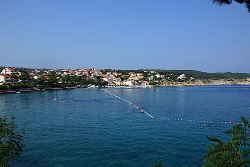 Uvala Stipanja Natural site, Primorje-Gorski Kotar County13 km SE
-
Viševica Mountain, Primorje-Gorski Kotar County18 km E
-
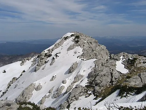 Risnjak Mountain, Primorje-Gorski Kotar County21 km N
-
Burni bitoraj - Vrh Bitoraj Mountain, Primorje-Gorski Kotar County18 km E
-
Rjecina River River, Primorje-Gorski Kotar County13 km NW
-
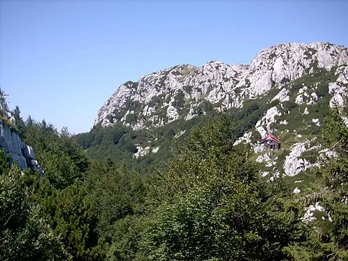 Risnjak National Park Natural site, Primorje-Gorski Kotar County21 km N
-
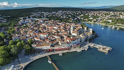 Krk Island, Primorje-Gorski Kotar County19 km S
Nearest towns and villages
-
Šmrika Village, Town of Kraljevica2.4 km E
-
 Kraljevica City, Town of Kraljevica3 km N
-
Bakarac Village, Town of Kraljevica3.7 km N
-
Hreljin Village, Town of Bakar4.5 km NE
Sources & licences
Data last updated: · 2 independent sources