Tribanj
Located in Municipality of Starigrad, Zadar County Coordinates: 44°21′06″ N 15°19′06″ E
- Population
- 232
- 232
- Elevation
- 45 m
- above sea level
- Local time
- UTC+01:00
- Europe/Zagreb · UTC+01:00
- Airports
- ZAD Zadar Airport28 km
- RJK Rijeka Airport113 km
About Tribanj
Tribanj is a village. Location: Municipality of Starigrad, Zadar County. Population: 232. Elevation: 45 m.
Tribanj is a village in the municipality of Starigrad, Zadar County, north Dalmatia. The village consists of seven hamlets: Kozjača, Kruščica, Lisarica, Ljubotić, Običaj, Sveta Marija Magdalena, and Šibuljina. In a geopolitical context, Tribanj was the border of Austrian Kingdom of Dalmatia in the 19th century, and is still viewed as a cultural border between Dalmatia and Croatian Littoral. It is situated on the southern slopes of Velebit mountain, also known as Podgorje.
Source: Wikipedia · CC BY-SA 4.0
At a glance
- Area
- 52 km²
Source: Wikidata
Climate of Tribanj
Best months for sightseeingBest months for sightseeing: May–September.
This month · November
A wet month
Day 13° · Night 6° · Rain 155 mm
- Hottest month
- July (day 28°)
- Coldest month
- January (night 2°)
- Wettest month
- November (155 mm)
- Driest month
- July (50 mm)
Bars: average monthly low and high temperature. Below: precipitation. Monthly averages for 1970–2000 at about 18 km resolution, adjusted for elevation. Highlighted months are mild and relatively dry. Source: WorldClim 2.1 (CC BY 4.0).
Show values as a table
| Month | Jan | Feb | Mar | Apr | May | Jun | Jul | Aug | Sep | Oct | Nov | Dec |
|---|---|---|---|---|---|---|---|---|---|---|---|---|
| Average high (°C) | 9° | 9° | 12° | 16° | 21° | 25° | 28° | 28° | 24° | 19° | 13° | 10° |
| Average low (°C) | 2° | 2° | 4° | 8° | 12° | 15° | 17° | 17° | 14° | 10° | 6° | 3° |
| Precipitation (mm) | 93 | 90 | 93 | 99 | 87 | 84 | 50 | 72 | 123 | 140 | 155 | 127 |
Other places to visit in this season: May June July August September
How to get to Tribanj
The nearest airport is Zadar Airport (ZAD), 28 km to the south as the crow flies. The nearest large city is Rijeka, 129 km to the northwest.
Airports
- Zadar Airport (ZAD) Zadar 28 kmsouth
- Rijeka Airport (RJK) Rijeka(Omišalj) 113 kmnorthwest
- Split Saint Jerome Airport (SPU) Split 120 kmsoutheast
Nearby large cities
- Rijeka Population: 108K 129 kmnorthwest
- Split Population: 149.8K 130 kmsoutheast
- Zagreb Population: 663.6K 171 kmnorth
- Ljubljana Population: 272.2K 199 kmnorth
- Klagenfurt Population: 100.3K 265 kmnorth
Straight-line distances; road distances are longer. Airport data: OurAirports.
Day trips from Tribanj
Within 100 km: 8 historic and cultural sites, 21 natural sites, 71 lakes, rivers and coasts.
0–25 km6 places
- Otočić Mišjak Island 12 kmSW
- Sveti Ivan Mountain 18 kmNW
- Otok Vir Island 21 kmW
- Velebit Mountain 21 kmN
25–60 km43 places
- Silba Island 50 kmW
- Birovača Mountain 57 kmNE
- Otok Premuda Island 55 kmW
- Otok Sestrunj Island 34 kmSW
60–100 km51 places
- Krk Island 98 kmNW
- Lošinj Island 78 kmW
- Otok Prvić Island 79 kmSE
- Otok Zlarin Island 85 kmSE
Straight-line distances.
Nearby attractions & nature
Everything nearby-
Pag Bridge Landmark, Croatia5.6 km SW
-
 Paklenica National Park Natural site, Croatia9.3 km E
-
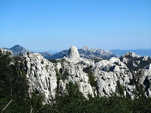 Velebit Mountain, Croatia21 km N
-
Otočić Mišjak Island, Zadar County12 km SW
-
Sveti Ivan Mountain, Zadar County18 km NW
-
Otok Vir Island, Zadar County21 km W
Sources & licences
Data last updated: · 2 independent sources