Municipality of Dubrava
Located in Zagreb County, Croatia Coordinates: 45°50′15″ N 16°32′13″ E
- Population
- 4,520
- 4.5K
- Elevation
- 141 m
- above sea level
- Local time
- UTC+01:00
- Europe/Zagreb · UTC+01:00
- Places inside
- 7
- listed under Municipality of Dubrava
- Airports
- ZAG Zagreb Franjo Tuđman International Airport38 km
- MBX Maribor Edvard Rusjan Airport97 km
About Municipality of Dubrava
Municipality of Dubrava is a district. Location: Zagreb County, Croatia. Population: 4,520.
Dubrava is a village and a municipality ("općina") in Zagreb County, Croatia. According to the 2001 Croatian census, there are 5,478 inhabitants in the municipality, 94% which are Croats.
Source: Wikipedia · CC BY-SA 4.0
Places bordering Municipality of Dubrava
- Čazma
Climate of Municipality of Dubrava
Best months for sightseeingBest months for sightseeing: May–September.
This month · November
A cold month
Day 9° · Night 2° · Rain 80 mm
- Hottest month
- July (day 27°)
- Coldest month
- January (night -3°)
- Wettest month
- June (88 mm)
- Driest month
- February (43 mm)
Bars: average monthly low and high temperature. Below: precipitation. Monthly averages for 1970–2000 at about 18 km resolution, adjusted for elevation. Highlighted months are mild and relatively dry. Source: WorldClim 2.1 (CC BY 4.0).
Show values as a table
| Month | Jan | Feb | Mar | Apr | May | Jun | Jul | Aug | Sep | Oct | Nov | Dec |
|---|---|---|---|---|---|---|---|---|---|---|---|---|
| Average high (°C) | 3° | 6° | 12° | 16° | 22° | 25° | 27° | 26° | 22° | 16° | 9° | 4° |
| Average low (°C) | -3° | -2° | 2° | 6° | 10° | 14° | 15° | 14° | 11° | 6° | 2° | -2° |
| Precipitation (mm) | 44 | 43 | 50 | 61 | 74 | 88 | 76 | 74 | 74 | 74 | 80 | 61 |
Other places to visit in this season: May June July August September
How to get to Municipality of Dubrava
The nearest airport is Zagreb Franjo Tuđman International Airport (ZAG), 38 km to the west as the crow flies. The nearest large city is Zagreb, 44 km to the west.
Airports
- Zagreb Franjo Tuđman International Airport (ZAG) Velika Gorica 38 kmwest
- Maribor Edvard Rusjan Airport (MBX) Maribor 97 kmnorthwest
- Hévíz–Balaton Airport (SOB) Sármellék 106 kmnortheast
Nearby large cities
- Zagreb Population: 663.6K 44 kmwest
- Pécs Population: 145.3K 134 kmeast
- Graz Population: 303.3K 161 kmnorthwest
- Rijeka Population: 108K 173 kmwest
- Klagenfurt Population: 100.3K 193 kmnorthwest
Straight-line distances; road distances are longer. Airport data: OurAirports.
Day trips from Municipality of Dubrava
Within 100 km: 10 historic and cultural sites, 17 natural sites, 46 lakes, rivers and coasts.
0–25 km3 places
- Kašina River 23 kmW
- Gora Moslavačka Mountain 24 kmSE
- Glogovnica River 8 kmSW
25–60 km36 places
- Golinja River 56 kmSW
- Sredska River 27 kmE
- Plitvica River 55 kmN
- Krapina River 58 kmW
60–100 km34 places
- Plesch Bach River 97 kmNW
- Pesnica River 72 kmNW
- Lake Trakoščan Lake 66 kmNW
- Palanka Mountain 92 kmS
Straight-line distances.
Places in Municipality of Dubrava
7 places- 1 Dubrava 1.3K
- 2 Dubrava 1.2K
- 3 Nova Kapela 207
- 4 Koritna 160
- 5 Bađinec 135
- 6 Ladina 76
- 7 Svinjarec 41
Bar: population relative to the most populous place in this list.
Nearby attractions & nature
Everything nearby-
Glogovnica River, Croatia7.7 km SW
-
Kašina River, Croatia23 km W
-
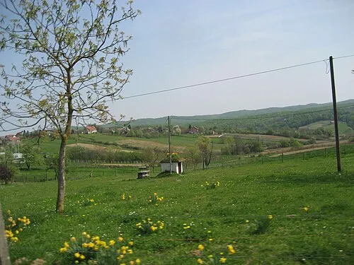 Gora Moslavačka Mountain, Croatia24 km SE
Sources & licences
Data last updated: · 2 independent sources