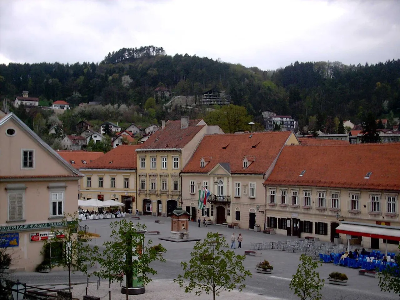
- Population
- 16,911
- 16.9K
- Elevation
- 153 m
- above sea level
- Local time
- UTC+01:00
- Europe/Zagreb · UTC+01:00
- Airports
- ZAG Zagreb Franjo Tuđman International Airport28 km
- MBX Maribor Edvard Rusjan Airport75 km
About Samobor
Samobor is a city. Location: Town of Samobor, Zagreb County. Population: 16,911. Elevation: 153 m. The best months to visit are May–September. The nearest airport is Zagreb Franjo Tuđman International Airport (28 km). Nearby sights include Sutla and Novi Dvori.
Photos of Samobor
-

Hibasi · CC BY-SA 4.0 -

Janezdrilc · CC0 -

Slava Raškaj · Public domain -

Indi.gra · CC BY-SA 4.0 -

Slava Raškaj · Public domain


Travel notes for Samobor
From Wikivoyage
Samobor is 25 km west of Zagreb, Croatia. The town had a population of 37,633, as of the 2011 census.
Understand+
Samobor is a picturesque medieval town with well preserved old lore and long tourist tradition. The prevailing architecture is that of the Baroque period. The town is also reputed to be the place where the best "kremšnite" - one of Croatia's best known cakes - are made.
Get in+
By car:
Samobor is a short 20 minute drive from the Zagreb city center. Take the A3 towards the Slovenian border.
By bus:
Samobor is accessible by bus from Zagreb. Buses leave approximately every 15 minutes from Črnomerec terminal and every 30 minutes from Autobusni kolodvor (main bus station) and Ljubljanica terminal.
By train:
A train link is planned to be reconnected to Samobor by 2026. The last passenger train arrived in Samobor on December 31, 1979.
Source: Wikivoyage · CC BY-SA 4.0 · abridged
Climate of Samobor
Best months for sightseeingBest months for sightseeing: May–September.
This month · November
A cold month
Day 9° · Night 2° · Rain 98 mm
- Hottest month
- July (day 26°)
- Coldest month
- January (night -3°)
- Wettest month
- June (107 mm)
- Driest month
- February (53 mm)
Bars: average monthly low and high temperature. Below: precipitation. Monthly averages for 1970–2000 at about 18 km resolution, adjusted for elevation. Highlighted months are mild and relatively dry. Source: WorldClim 2.1 (CC BY 4.0).
Show values as a table
| Month | Jan | Feb | Mar | Apr | May | Jun | Jul | Aug | Sep | Oct | Nov | Dec |
|---|---|---|---|---|---|---|---|---|---|---|---|---|
| Average high (°C) | 4° | 7° | 12° | 16° | 21° | 24° | 26° | 26° | 22° | 16° | 9° | 5° |
| Average low (°C) | -3° | -2° | 2° | 6° | 10° | 13° | 15° | 14° | 11° | 7° | 2° | -1° |
| Precipitation (mm) | 54 | 53 | 67 | 74 | 84 | 107 | 94 | 97 | 98 | 97 | 98 | 73 |
Other places to visit in this season: May June July August September
How to get to Samobor
The nearest airport is Zagreb Franjo Tuđman International Airport (ZAG), 28 km to the east as the crow flies. The nearest large city is Zagreb, 20 km to the east.
Airports
- Zagreb Franjo Tuđman International Airport (ZAG) Velika Gorica 28 kmeast
- Maribor Edvard Rusjan Airport (MBX) Maribor 75 kmnorth
- Ljubljana Jože Pučnik Airport (LJU) Zgornji Brnik 108 kmnorthwest
Nearby large cities
- Zagreb Population: 663.6K 20 kmeast
- Ljubljana Population: 272.2K 98 kmwest
- Rijeka Population: 108K 113 kmsouthwest
- Klagenfurt Population: 100.3K 142 kmnorthwest
- Graz Population: 303.3K 142 kmnorth
Straight-line distances; road distances are longer. Airport data: OurAirports.
Day trips from Samobor
Within 100 km: 9 historic and cultural sites, 35 natural sites, 76 lakes, rivers and coasts.
0–25 km15 places
- Krka River 14 kmNW
- Krapina River 21 kmN
- Krapina River 8 kmE
- Zagreb ZOO Attraction 23 kmE
25–60 km31 places
- Kašina River 40 kmE
- Žumberačka Gora Mountain 30 kmW
- Trdinov Vrh Mountain 31 kmW
- Kum Mountain 59 kmNW
60–100 km74 places
- Ribnica Lake Lake 85 kmNW
- Pohorje Mountain 83 kmN
- Mala Gora Mountain 76 kmW
- Krim Mountain 98 kmW
Straight-line distances.
Nearby attractions & nature
Everything nearby-
Sutla River, Croatia5.9 km NW
-
Novi Dvori Historic site, Zagreb County9.5 km NE
-
Krapina River, Croatia8.2 km E
-
Bistra River, Croatia13 km NE
-
Medvedgrad Historic site, City of Zagreb19 km NE
-
Lotrščak tower Landmark, City of Zagreb20 km E
-
St. Mark's Church Attraction, City of Zagreb20 km E
-
Zagreb Cathedral Attraction, Croatia20 km E
Sources & licences
Data last updated: