Černýšovice
Located in Tábor District, South Bohemian Region Coordinates: 49°19′28″ N 14°31′05″ E
- Elevation
- 417 m
- above sea level
- Local time
- UTC+01:00
- Europe/Prague · UTC+01:00
- Places inside
- 2
- listed under Černýšovice
- Airports
- JCL České Budějovice South Bohemian Airport42 km
- PRG Václav Havel Airport Prague88 km
About Černýšovice
Černýšovice is a municipality. Location: Tábor District, South Bohemian Region. Elevation: 417 m. The best months to visit are May–September. The nearest airport is České Budějovice South Bohemian Airport (42 km). Nearby sights include Babina [Bechyně-Hvožďany] and Planina.
Climate of Černýšovice
Best months for sightseeingBest months for sightseeing: May–September.
This month · November
A cold month
Day 6° · Night 1° · Rain 44 mm
- Hottest month
- August (day 24°)
- Coldest month
- January (night -4°)
- Wettest month
- July (86 mm)
- Driest month
- February (33 mm)
Bars: average monthly low and high temperature. Below: precipitation. Monthly averages for 1970–2000 at about 18 km resolution, adjusted for elevation. Highlighted months are mild and relatively dry. Source: WorldClim 2.1 (CC BY 4.0).
Show values as a table
| Month | Jan | Feb | Mar | Apr | May | Jun | Jul | Aug | Sep | Oct | Nov | Dec |
|---|---|---|---|---|---|---|---|---|---|---|---|---|
| Average high (°C) | 2° | 4° | 8° | 13° | 19° | 22° | 24° | 24° | 18° | 13° | 6° | 2° |
| Average low (°C) | -4° | -3° | 0° | 3° | 8° | 11° | 13° | 12° | 8° | 4° | 1° | -3° |
| Precipitation (mm) | 37 | 33 | 41 | 44 | 67 | 81 | 86 | 70 | 49 | 40 | 44 | 44 |
Other places to visit in this season: May June July August September
How to get to Černýšovice
The nearest airport is České Budějovice South Bohemian Airport (JCL), 42 km to the south as the crow flies. The nearest large city is Prague, 85 km to the north.
Airports
- České Budějovice South Bohemian Airport (JCL) České Budějovice 42 kmsouth
- Václav Havel Airport Prague (PRG) Prague 88 kmnorth
- Pardubice Airport (PED) Pardubice 117 kmnortheast
Nearby large cities
- Prague Population: 1.2M 85 kmnorth
- Linz Population: 204.8K 115 kmsouth
- Brno Population: 404.3K 153 kmeast
- Regensburg Population: 151.4K 180 kmwest
- Dresden Population: 564.9K 200 kmnorth
Straight-line distances; road distances are longer. Airport data: OurAirports.
Day trips from Černýšovice
Within 100 km: 46 historic and cultural sites, 854 natural sites, 154 lakes, rivers and coasts.
0–25 km11 places
- Zdoba Mountain 18 kmSW
- Velký Mehelník Mountain 22 kmW
- Středočeská Žulová vrchovina Mountain 24 kmNW
- Smrčí Mountain 17 kmN
25–60 km105 places
- Steinbühel Mountain 59 kmSE
- Steinberg Mountain 52 kmSE
- Brennesselberg Mountain 53 kmSE
- Birkenberg Mountain 52 kmSE
60–100 km938 places
- Královský vršek Mountain 78 kmE
- Unter-Rosenhofer Teich Lake 86 kmS
- Ober-Rosenhofer Teich Lake 85 kmS
- Kranbühel Mountain 78 kmSE
Straight-line distances.
Places in Černýšovice
2 placesBar: population relative to the most populous place in this list.
Nearby attractions & nature
Everything nearby-
Babina [Bechyně-Hvožďany] Mountain, Bechyně7.9 km SW
-
Planina Mountain, Sepekov16 km NW
-
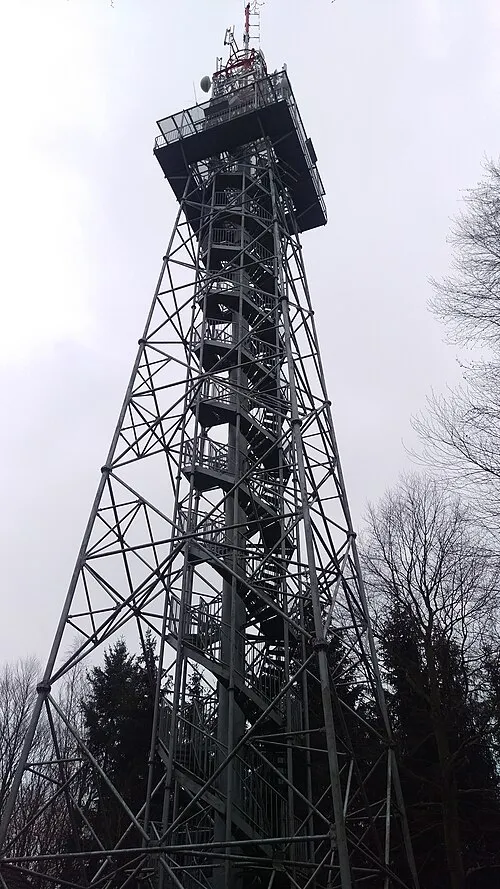 Jarník Mountain, Písek24 km W
-
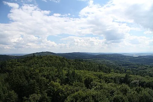 Velký Mehelník Mountain, Písek22 km W
-
Jenšovice Mountain, Milevsko22 km NW
-
Smrčí Mountain, Jistebnice17 km N
-
Panský Kopec Mountain, Mažice15 km SE
-
Středočeská Žulová vrchovina Mountain, Czechia24 km NW
Sources & licences
Data last updated: