Arrondissement of Aurillac
Located in Cantal, Auvergne-Rhône-Alpes Coordinates: 44°53′29″ N 2°22′57″ E
- Population
- 82,808
- 82.8K
- Elevation
- 610 m
- above sea level
- Local time
- UTC+01:00
- Europe/Paris · UTC+01:00
- Places inside
- 93
- listed under Arrondissement of Aurillac
- Airports
- AUR Aurillac airport3 km
- RDZ Rodez–Aveyron Airport54 km
About Arrondissement of Aurillac
Arrondissement of Aurillac is a municipality. Location: Cantal, Auvergne-Rhône-Alpes. Population: 82,808. Elevation: 610 m. The best months to visit are June–September. The nearest airport is Aurillac airport (3 km). Nearby sights include Ruisseau de Roannes and Jordanne.
Photos of Arrondissement of Aurillac
-
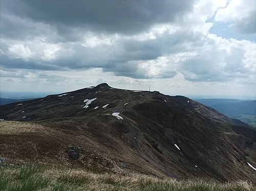
Plomb du Cantal Nouill · CC BY-SA 4.0 -
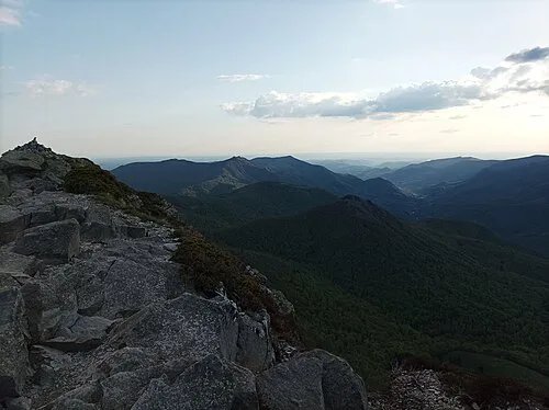
Puy de l'Usclade Nouill · CC BY-SA 4.0 -
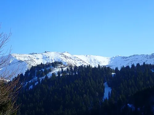
Puy Brunet Jmp48 · CC BY-SA 4.0


Climate of Arrondissement of Aurillac
Best months for sightseeingBest months for sightseeing: June–September.
This month · November
A cold month
Day 10° · Night 2° · Rain 66 mm
- Hottest month
- July (day 25°)
- Coldest month
- January (night -1°)
- Wettest month
- May (87 mm)
- Driest month
- March (51 mm)
Bars: average monthly low and high temperature. Below: precipitation. Monthly averages for 1970–2000 at about 18 km resolution, adjusted for elevation. Highlighted months are mild and relatively dry. Source: WorldClim 2.1 (CC BY 4.0).
Show values as a table
| Month | Jan | Feb | Mar | Apr | May | Jun | Jul | Aug | Sep | Oct | Nov | Dec |
|---|---|---|---|---|---|---|---|---|---|---|---|---|
| Average high (°C) | 7° | 8° | 11° | 14° | 18° | 22° | 25° | 24° | 21° | 16° | 10° | 8° |
| Average low (°C) | -1° | -1° | 1° | 3° | 7° | 10° | 12° | 12° | 9° | 6° | 2° | -1° |
| Precipitation (mm) | 64 | 60 | 51 | 65 | 87 | 74 | 53 | 65 | 72 | 82 | 66 | 66 |
Other places to visit in this season: June July August September
How to get to Arrondissement of Aurillac
The nearest airport is Aurillac airport (AUR), 3 km to the east as the crow flies. The nearest large city is Clermont-Ferrand, 113 km to the northeast.
Airports
- Aurillac airport (AUR) Aurillac 3 kmeast
- Rodez–Aveyron Airport (RDZ) Rodez/Marcillac 54 kmsouth
- Brive Souillac airport (BVE) Brive 73 kmwest
Nearby large cities
- Clermont-Ferrand Population: 147.9K 113 kmnortheast
- Limoges Population: 141.2K 137 kmnorthwest
- Toulouse Population: 511.7K 161 kmsouthwest
- Saint-Etienne Population: 176.3K 169 kmeast
- Montpellier Population: 248.3K 186 kmsoutheast
Straight-line distances; road distances are longer. Airport data: OurAirports.
Day trips from Arrondissement of Aurillac
Within 100 km: 150 historic and cultural sites, 312 natural sites, 206 lakes, rivers and coasts.
0–25 km69 places
- Ancien îlot Gambetta Island 6 kmNE
- La Falzinde Mountain 19 kmW
- Puy de l'Arbre Mountain 22 kmSE
- Puy Majou Mountain 19 kmS
25–60 km250 places
- Étang de Taysse Lake 55 kmNW
- Étang du Prévôt Lake 55 kmNW
- Lac de Madic Lake 54 kmN
- Étang Ferrier Lake 52 kmNW
60–100 km349 places
- Lac de Servière Lake 92 kmNE
- Étang de Ruffaud Lake 62 kmNW
- Étang de la Ramade Lake 99 kmN
- Étang de Pissevache Lake 77 kmNW
Straight-line distances.
Arrondissement of Aurillac and similar cities
Side by side with cities of similar size in the same country: population, elevation and climate.
| Measure | Arrondissement of Aurillac | Pau | Créteil | Versailles |
|---|---|---|---|---|
| Population | 82.8K | 82.7K | 84.8K | 85.4K |
| Elevation | 610 m | 219 m | 49 m | 140 m |
| Summer day (hottest month) | 25° | 25° | 25° | 24° |
| Winter night (coldest month) | -1° | 4° | 2° | 1° |
| Annual rainfall | 805 mm | 1,304 mm | 632 mm | 646 mm |
| Best months | Jun–Sep | Jun–Sep | May–Sep | Jun–Sep |
| Distance | — | 281 km | 434 km | 435 km |
Climate values are 1970–2000 monthly averages; straight-line distance.
Places in Arrondissement of Aurillac
93 places- 1 Aurillac 26K
- 2 Arpajon-sur-Cère 6.3K
- 3 Ytrac 4.2K
- 4 Maurs 2.2K
- 5 Jussac 2K
- 6 Naucelles 2K
- 7 Vic-sur-Cère 1.8K
- 8 Saint-Mamet-la-Salvetat 1.5K
- 9 Saint-Paul-des-Landes 1.5K
- 10 Sansac-de-Marmiesse 1.4K
- 11 Le Rouget-Pers 1.3K
- 12 Vézac 1.2K
- 13 Saint-Simon 1.2K
- 14 Polminhac 1.2K
- 15 Reilhac 1.1K
- 16 Roannes-Saint-Mary 1.1K
- 17 Saint-Cernin 1.1K
- 18 Laroquebrou 888
- 19 Montsalvy 839
- 20 Crandelles 828
- 21 Puycapel 813
- 22 Saint-Étienne-de-Maurs 784
- 23 Giou-de-Mamou 774
- 24 Marmanhac 721
- 25 Ayrens 664
- 26 Prunet 662
- 27 Saint-Illide 656
- 28 Boisset 633
- 29 Saint-Constant-Fournoulès 619
- 30 Thiézac 606
- 31 Lafeuillade-en-Vézie 597
- 32 Marcolès 593
- 33 Yolet 555
- 34 Cassaniouze 539
- 35 Lacapelle-Viescamp 513
- 36 Labrousse 505
- 37 Siran 483
- 38 Ladinhac 464
- 39 Parlan 431
- 40 Velzic 420
- 41 Saint-Santin-de-Maurs 357
- 42 Carlat 352
- 43 Laroquevieille 349
- 44 Omps 349
- 45 Saint-Jacques-des-Blats 349
- 46 Leynhac 348
- 47 Lacapelle-del-Fraisse 336
- 48 Quézac 328
- 49 Teissières-lès-Bouliès 322
- 50 Roumégoux 312
- 51 Junhac 310
- 52 Saint-Santin-Cantalès 306
- 53 Lascelle 299
- 54 Cayrols 294
- 55 Labesserette 293
- 56 Teissières-de-Cornet 288
- 57 Raulhac 276
- 58 Vitrac 262
- 59 Saint-Cirgues-de-Malbert 250
- 60 Leucamp 234
Bar: population relative to the most populous place in this list.
Nearby attractions & nature
Everything nearby-
Ruisseau de Roannes River, Cantal4.1 km W
-
Jordanne River, Cantal5.1 km E
-
Dautre River, Cantal9.1 km W
-
Vallée de la Jordanne Natural site, Cantal23 km NE
-
Vallée de la Cère Natural site, Cantal24 km NE
-
Soulane River, Cantal18 km NW
-
Doire River, Cantal19 km N
-
Ânes River, Cantal22 km SW
Sources & licences
Data last updated: