- Population
- 16,927
- 16.9K
- Elevation
- 23 m
- above sea level
- Local time
- UTC+09:00
- Asia/Tokyo · UTC+09:00
- Airports
- HND Tokyo Haneda International Airport66 km
- NRT Narita International Airport69 km
About Katsuura
Katsuura is a city. Location: Katsuura-shi, Chiba. Population: 16,927. Elevation: 23 m.
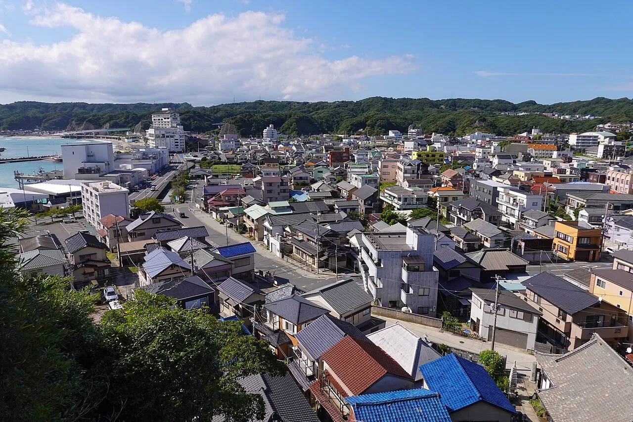
Katsuura (勝浦市, Katsuura-shi) is a city located in Chiba Prefecture, Japan. As of 30 November 2020, the city had an estimated population of 16,872 in 8566 households and a population density of 180 persons per km2. The total area of the city is 94.20 square kilometres (36.37 sq mi). Katsuura City is famous for Katsuura Fishing Port, which features one of the top three largest morning markets in Japan.
Source: Wikipedia · CC BY-SA 4.0
Photos of Katsuura
-

Asturio Cantabrio · CC BY-SA 4.0 -

Asturio Cantabrio · CC BY-SA 4.0 -

663highland · CC BY-SA 4.0 -

くろふね · CC BY 3.0 -

Earth Science and Remote Sensing Unit , Lyndon B. Johnson Space Center · Public domain


Travel notes for Katsuura
From Wikivoyage
Katsuura (勝浦) is a
city located in Chiba, Japan.
Understand+
Tourist information site:
The local tourist association has a Japanese-only guide site.
Source: Wikivoyage · CC BY-SA 4.0 · abridged
Places bordering Katsuura
- Kamogawa-shi
- Isumi
- Ōtaki
- Shinmachi
Twin towns and sister cities of Katsuura
- Nishi-Tokyo-shi· Japan
Source: Wikidata. Only places with a page on this site are shown.
Population of Katsuura over time
| 2010 | 20,788 | |
|---|---|---|
| 2015 | 19,248 | |
| 2021 | 16,723 |
Censuses and official estimates; source: Wikidata.
Climate of Katsuura
Best months for sightseeingBest months for sightseeing: May–July, September–October.
This month · November
A wet month
Day 17° · Night 9° · Rain 143 mm
Better nearby cities in November
- Isehara · 95 km west18°
- Odawara · 106 km west19°
- Mishima · 127 km west18°
- Hottest month
- August (day 29°)
- Coldest month
- January (night 1°)
- Wettest month
- October (231 mm)
- Driest month
- December (74 mm)
Bars: average monthly low and high temperature. Below: precipitation. Monthly averages for 1970–2000 at about 18 km resolution, adjusted for elevation. Highlighted months are mild and relatively dry. Source: WorldClim 2.1 (CC BY 4.0).
Show values as a table
| Month | Jan | Feb | Mar | Apr | May | Jun | Jul | Aug | Sep | Oct | Nov | Dec |
|---|---|---|---|---|---|---|---|---|---|---|---|---|
| Average high (°C) | 10° | 10° | 13° | 18° | 21° | 24° | 27° | 29° | 26° | 22° | 17° | 13° |
| Average low (°C) | 1° | 2° | 5° | 10° | 14° | 18° | 21° | 23° | 20° | 15° | 9° | 4° |
| Precipitation (mm) | 76 | 100 | 157 | 150 | 163 | 211 | 133 | 151 | 220 | 231 | 143 | 74 |
Other places to visit in this season: May June July September October
How to get to Katsuura
The nearest airport is Tokyo Haneda International Airport (HND), 66 km to the northwest as the crow flies. The nearest large city is Kisarazu, 44 km to the northwest.
Airports
- Tokyo Haneda International Airport (HND) Tokyo 66 kmnorthwest
- Narita International Airport (NRT) Narita 69 kmnorth
- Oshima Airport (OIM) Izu Oshima 96 kmsouthwest
Nearby large cities
- Kisarazu Population: 136.2K 44 kmnorthwest
- Ichihara Population: 283.5K 46 kmnorthwest
- Yokosuka Population: 409.5K 61 kmwest
- Sakura Population: 173.7K 64 kmnorth
- Narashino Population: 176.2K 64 kmnorthwest
Straight-line distances; road distances are longer. Airport data: OurAirports.
Day trips from Katsuura
Within 100 km: 47 historic and cultural sites, 19 natural sites, 32 lakes, rivers and coasts.
0–25 km3 places
- Isumi Gawa River 19 kmNE
- Uchiura Wan Natural site 12 kmW
- Bōsō Peninsula Natural site 25 kmNW
25–60 km14 places
- Obitsu River River 48 kmNW
- Koito River River 48 kmNW
- Sarushima Island 59 kmW
- Tokyo Bay Natural site 57 kmNW
60–100 km81 places
- Ō Shima Island 95 kmSW
- Jōga Shima Island 63 kmW
- Enoshima Island 78 kmW
- Shingashi River River 97 kmNW
Straight-line distances.
Nearby attractions & nature
Everything nearby-
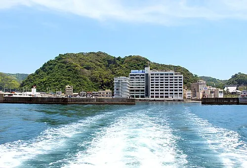 Uchiura Wan Natural site, Chiba12 km W
-
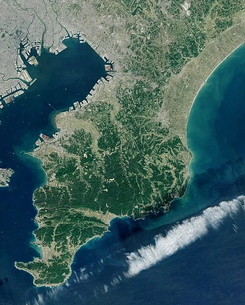 Bōsō Peninsula Natural site, Chiba25 km NW
-
Isumi Gawa River, Chiba19 km NE
Sources & licences
Data last updated: · 2 independent sources