- Population
- 136,166
- 136.2K
- Elevation
- 5 m
- above sea level
- Local time
- UTC+09:00
- Asia/Tokyo · UTC+09:00
- Airports
- HND Tokyo Haneda International Airport23 km
- NRT Narita International Airport59 km
About Kisarazu
Kisarazu is a city. Location: Kisarazu Shi, Chiba. Population: 136,166. Elevation: 5 m.
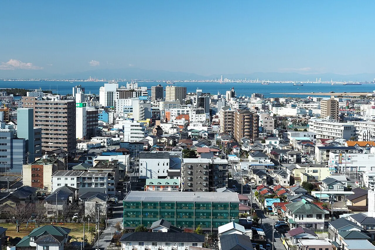
Kisarazu (木更津市, Kisarazu-shi) is a city located in Chiba Prefecture, Japan. As of 1 December 2020, the city had an estimated population of 136,023 in 63,431 households and a population density of 980 persons per km2. The total area of the city is 138.95 square kilometres (53.65 sq mi).
Source: Wikipedia · CC BY-SA 4.0
Photos of Kisarazu
-

Stck w · CC BY-SA 4.0 -

Stck w · CC BY-SA 4.0 -

Syced · CC0 -

Syced · CC0 -

運転太郎 · CC BY 3.0


Travel notes for Kisarazu
From Wikivoyage
Kisarazu (木更津) is a city of 122,000 in Chiba, Japan.
Understand+
Tourist information site:
The local tourist association has a multilingual guide site.
Get in+
By train:
1 Kisarazu Station (木更津駅), Fujimi 1-1. The main station for the city. This is a stop on the Uchibo Line and the terminus of the Kururi Line. (updated Jan 2023)
From Tokyo Station, Kisarazu can be reached by either the JR Sobu Line or the JR Keiyo Line. Both of these connect to the JR Uchibo Line, on which Kisarazu Station is located.
Infrequent Sazanami limited express trains via the Keiyo Line leave once every few hours, generally at 30 past, with more frequent runs during the late afternoon and evening. This will get you to Kisarazu in as little as 55 minutes for ¥2490.
The cheaper and more frequent alternative is to use the JR Sobu line at a cost of ¥1280. A direct train to Kisarazu (last stop Kimitsu) leaves once per hour and takes 80 minutes, or else a change of trains will be required.
Uchibo Line trains from Chiba leave every 10-20 minutes, reaching Kisarazu in about 40 minutes (¥650).
These trains are free to use with a Japan Rail Pass or JR East Rail Pass.
By bus:
Across the street in front of Tokyo Station, there is a Keisei bus heading for Kisarazu and Kimitsu. With irregular schedule, mostly with a 40-60 min interval between them. Fare is ¥1300 for Kisarazu Station and ¥1400 further across the city, heading to Kimitsu. Travel time is about 1 hour, going thru Tokyo Wan Aqua-Line.
There are also bus lines for and from Yokohama, Shinagawa, Kawasaki and Haneda airport.
Source: Wikivoyage · CC BY-SA 4.0 · abridged
Places bordering Kisarazu
- Sodegaura-shi
- Kimitsu
Twin towns and sister cities of Kisarazu
- Oceanside· United States
Source: Wikidata. Only places with a page on this site are shown.
Population of Kisarazu over time
| 2010 | 129,312 | |
|---|---|---|
| 2015 | 134,141 | |
| 2021 | 136,118 |
Censuses and official estimates; source: Wikidata.
Climate of Kisarazu
Best months for sightseeingBest months for sightseeing: May–June, September–October.
This month · November
A wet month
Day 17° · Night 9° · Rain 112 mm
Better nearby cities in November
- Isehara · 56 km west18°
- Odawara · 72 km west19°
- Mishima · 97 km west18°
- Hottest month
- August (day 30°)
- Coldest month
- January (night 1°)
- Wettest month
- September (203 mm)
- Driest month
- December (54 mm)
Bars: average monthly low and high temperature. Below: precipitation. Monthly averages for 1970–2000 at about 18 km resolution, adjusted for elevation. Highlighted months are mild and relatively dry. Source: WorldClim 2.1 (CC BY 4.0).
Show values as a table
| Month | Jan | Feb | Mar | Apr | May | Jun | Jul | Aug | Sep | Oct | Nov | Dec |
|---|---|---|---|---|---|---|---|---|---|---|---|---|
| Average high (°C) | 10° | 10° | 13° | 18° | 22° | 25° | 28° | 30° | 26° | 22° | 17° | 13° |
| Average low (°C) | 1° | 2° | 4° | 10° | 14° | 18° | 22° | 23° | 20° | 14° | 9° | 4° |
| Precipitation (mm) | 59 | 77 | 127 | 136 | 136 | 186 | 131 | 139 | 203 | 193 | 112 | 54 |
Other places to visit in this season: May June September October
How to get to Kisarazu
The nearest airport is Tokyo Haneda International Airport (HND), 23 km to the northwest as the crow flies. The nearest large city is Ichihara, 20 km to the northeast.
Airports
- Tokyo Haneda International Airport (HND) Tokyo 23 kmnorthwest
- Narita International Airport (NRT) Narita 59 kmnortheast
- Oshima Airport (OIM) Izu Oshima 85 kmsouthwest
Nearby large cities
- Ichihara Population: 283.5K 20 kmnortheast
- Kawasaki Population: 1.5M 25 kmnorthwest
- Yokohama Population: 3.8M 26 kmwest
- Yokosuka Population: 409.5K 27 kmsouthwest
- Ōta-ku Population: 748.1K 28 kmnorthwest
Straight-line distances; road distances are longer. Airport data: OurAirports.
Day trips from Kisarazu
Within 100 km: 50 historic and cultural sites, 34 natural sites, 40 lakes, rivers and coasts.
0–25 km9 places
- Obitsu River River 4 kmNW
- Koito River River 8 kmSW
- Sarushima Island 24 kmSW
- Tokyo Bay Natural site 14 kmW
25–60 km82 places
- Jōga Shima Island 40 kmSW
- Enoshima Island 42 kmW
- Mount Ōyama Natural site 28 kmW
- Miura Hantō Natural site 31 kmSW
60–100 km33 places
- Ō Shima Island 87 kmSW
- Hatsu-shima Island 79 kmSW
- Saitama Super Arena Landmark 63 kmNW
- Mount Bukō Mountain 98 kmNW
Straight-line distances.
Kisarazu and similar cities
Side by side with cities of similar size in the same country: population, elevation and climate.
| Measure | Kisarazu | Isahaya | Minoh | Inazawa |
|---|---|---|---|---|
| Population | 136.2K | 135.5K | 136.9K | 134.8K |
| Elevation | 5 m | 104 m | 76 m | 4 m |
| Summer day (hottest month) | 30° | 31° | 32° | 31° |
| Winter night (coldest month) | 1° | 2° | 1° | 0° |
| Annual rainfall | 1,553 mm | 2,157 mm | 1,355 mm | 1,884 mm |
| Best months | May–Jun, Sep–Oct | May, Oct | May, Oct | May–Jun, Oct |
| Distance | — | 955 km | 411 km | 287 km |
Climate values are 1970–2000 monthly averages; straight-line distance.
Nearby attractions & nature
Everything nearby-
Obitsu River River, Chiba4.2 km NW
-
Koito River River, Chiba7.9 km SW
-
 Tokyo Bay Natural site, Kanagawa14 km W
-
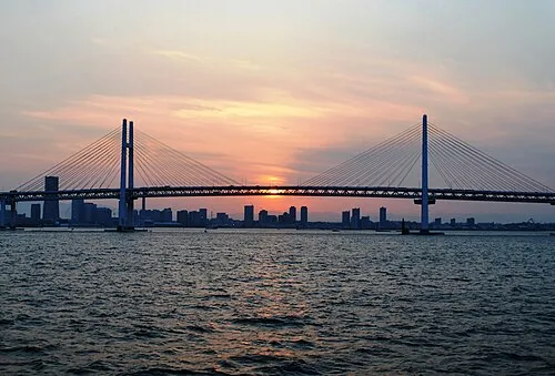 Yokohama Bay Bridge Landmark, Kanagawa25 km W
-
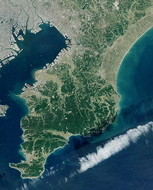 Bōsō Peninsula Natural site, Chiba22 km E
-
Tama Gawa River, Japan20 km NW
-
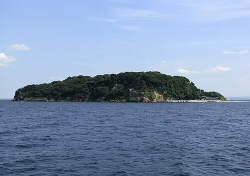 Sarushima Island, Kanagawa24 km SW
-
Ai River River, Chiba20 km S
Sources & licences
Data last updated: · 2 independent sources