Kokura-minami Ku
Located in Kitakyushu City, Fukuoka Coordinates: 33°47′54″ N 130°52′52″ E

- Population
- 214,793
- 214.8K
- Elevation
- 117 m
- above sea level
- Local time
- UTC+09:00
- Asia/Tokyo · UTC+09:00
- Airports
- KKJ Kitakyushu Airport15 km
- UBJ Yamaguchi Ube Airport40 km
About Kokura-minami Ku
Kokura-minami Ku is a municipality. Location: Kitakyushu City, Fukuoka. Population: 214,793. Elevation: 117 m.
Kokuraminami-ku (小倉南区) is a ward of Kitakyūshū, Fukuoka, Japan. It is the southern part of what used to be Kokura City, which was merged into Kitakyūshū city when the latter was created out of the merger of five cities in 1963. At this time Kokura was divided into North and South wards. Kokuraminami ward is mainly rural and undeveloped, and includes the Hiraodai karst plateau and Sugao no taki (waterfall).
Source: Wikipedia · CC BY-SA 4.0
Photos of Kokura-minami Ku
-

Allied Geographical Section · Public domain -

Suikotei · CC BY 4.0 -

Suikotei · CC BY 4.0 -

そらみみ · CC BY-SA 4.0 -

Kugel · Public domain


Population of Kokura-minami Ku over time
| 2010 | 214,793 | |
|---|---|---|
| 2015 | 212,850 | |
| 2020 | 208,039 |
Censuses and official estimates; source: Wikidata.
Climate of Kokura-minami Ku
Best months for sightseeingBest months for sightseeing: May–June, September–October.
This month · November
Outside the best season
Day 16° · Night 8° · Rain 75 mm
Better nearby cities in November
- Beppu · 81 km southeast17°
- Ōita · 92 km southeast18°
- Nobeoka · 154 km southeast18°
- Hottest month
- August (day 30°)
- Coldest month
- January (night 1°)
- Wettest month
- July (299 mm)
- Driest month
- December (60 mm)
Bars: average monthly low and high temperature. Below: precipitation. Monthly averages for 1970–2000 at about 18 km resolution, adjusted for elevation. Highlighted months are mild and relatively dry. Source: WorldClim 2.1 (CC BY 4.0).
Show values as a table
| Month | Jan | Feb | Mar | Apr | May | Jun | Jul | Aug | Sep | Oct | Nov | Dec |
|---|---|---|---|---|---|---|---|---|---|---|---|---|
| Average high (°C) | 8° | 9° | 12° | 18° | 22° | 25° | 29° | 30° | 26° | 21° | 16° | 11° |
| Average low (°C) | 1° | 1° | 4° | 9° | 14° | 18° | 23° | 23° | 19° | 13° | 8° | 3° |
| Precipitation (mm) | 71 | 85 | 112 | 157 | 161 | 286 | 299 | 149 | 201 | 100 | 75 | 60 |
Other places to visit in this season: May June September October
How to get to Kokura-minami Ku
The nearest airport is Kitakyushu Airport (KKJ), 15 km to the east as the crow flies. The nearest large city is Shimonoseki, 18 km to the north.
Airports
- Kitakyushu Airport (KKJ) Kitakyushu 15 kmeast
- Yamaguchi Ube Airport (UBJ) Ube 40 kmeast
- Fukuoka Airport (FUK) Fukuoka 46 kmsouthwest
Nearby large cities
- Shimonoseki Population: 265.7K 18 kmnorth
- Iizuka Population: 126.4K 25 kmsouthwest
- Ube Population: 173.7K 38 kmnortheast
- Ōnojō Population: 102.1K 47 kmsouthwest
- Chikushino-shi Population: 103.3K 48 kmsouthwest
Straight-line distances; road distances are longer. Airport data: OurAirports.
Day trips from Kokura-minami Ku
Within 100 km: 17 historic and cultural sites, 15 natural sites, 13 lakes, rivers and coasts.
0–25 km7 places
- Hiko Shima Island 15 kmN
- Kōzan Ji Attraction 24 kmNE
- Kanmon Kyō Landmark 20 kmN
- Wakato Ōhashi Landmark 13 kmNW
25–60 km19 places
- Kyūshū Kokuritsu Hakubutsukan Museum 44 kmSW
- Shika Island Island 56 kmW
- Mt. Abura Mountain 57 kmSW
- Shōfū-en Natural site 51 kmSW
60–100 km19 places
- Okino-shima Island 87 kmNW
- Mount Tsurumi Mountain 76 kmSE
- Tsuno Shima Island 62 kmN
- Kakara Shima Island 98 kmW
Straight-line distances.
Kokura-minami Ku and similar cities
Side by side with cities of similar size in the same country: population, elevation and climate.
| Measure | Kokura-minami Ku | Kure | Isesaki | Nishi-Tokyo-shi |
|---|---|---|---|---|
| Population | 214.8K | 214.6K | 211.8K | 207.4K |
| Elevation | 117 m | 102 m | 62 m | 58 m |
| Summer day (hottest month) | 30° | 31° | 31° | 30° |
| Winter night (coldest month) | 1° | 2° | -2° | -1° |
| Annual rainfall | 1,756 mm | 1,786 mm | 1,256 mm | 1,461 mm |
| Best months | May–Jun, Sep–Oct | May–Jun, Oct | Apr–May, Oct | May–Jun, Oct |
| Distance | — | 163 km | 808 km | 821 km |
Climate values are 1970–2000 monthly averages; straight-line distance.
Nearby attractions & nature
Everything nearby-
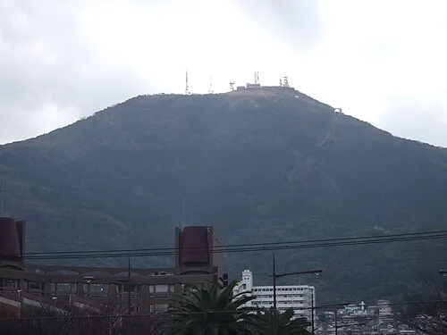 Mount Sarakura Mountain, Yahata-higashi Ku9.5 km NW
-
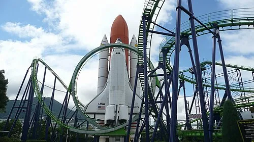 Space World Natural site, Yahata-higashi Ku11 km NW
-
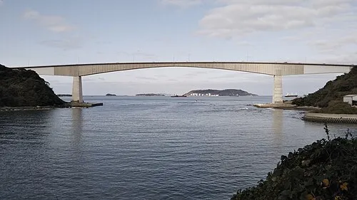 Hiko Shima Island, Shimonoseki Shi15 km N
-
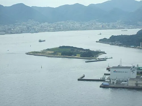 Ganryū-jima Island, Yamaguchi16 km N
-
Wakato Ōhashi Landmark, Fukuoka13 km NW
-
Kōzan Ji Attraction, Shimonoseki Shi24 km NE
-
Kanmon Kyō Landmark, Japan20 km N
Sources & licences
Data last updated: · 2 independent sources