Inawashiro
Local name: 猪苗代町
Located in Inawashiro Machi, Yama-gun Coordinates: 37°34′00″ N 140°07′00″ E

- Population
- 13,810
- 13.8K
- Elevation
- 532 m
- above sea level
- Local time
- UTC+09:00
- Asia/Tokyo · UTC+09:00
- Airports
- FKS Fukushima Airport47 km
- SDJ Sendai Airport95 km
About Inawashiro
Inawashiro is a town. Location: Inawashiro Machi, Yama-gun. Population: 13,810. Elevation: 532 m.
Inawashiro (猪苗代町, Inawashiro-machi) is a town located in Fukushima Prefecture, Japan. As of 1 March 2020, the town had an estimated population of 13,810 in 5309 households, and a population density of 35 persons per km2. The total area of the town was 394.85 square kilometres (152.45 sq mi). It is noted as the birthplace of the famous doctor Hideyo Noguchi, who contributed to knowledge in the fight against syphilis and yellow fever.
Source: Wikipedia · CC BY-SA 4.0
Photos of Inawashiro
-

Raita Futo from Tokyo, Japan · CC BY 2.0 -

SQUAREZERO · CC BY 4.0 -

Raita Futo from Tokyo, Japan · CC BY 2.0 -

MAKIKO OMOKAWA · CC BY-SA 3.0 -

raneko · CC BY 2.0


Travel notes for Inawashiro
From Wikivoyage
Inawashiro (猪苗代町) is a town in Fukushima, Japan. It lies by the namesake lake, Japan's fourth largest, with beach resorts, swimming, camping and boating.
Get in+
The JR Banetsu Line runs through Inawashiro with 6 stations within the town: Joko, Inawashiro-kohan, Sekito, Kawageta, Inawashiro, and Okinashima. The ride from Aizu-Wakamatsu by JR East takes an hour.
Source: Wikivoyage · CC BY-SA 4.0 · abridged
Places bordering Inawashiro
- Fukushima
- Nihommatsu
- Kōriyama
- Aizu-Wakamatsu
- Kitashiobara Mura
- Yonezawa
Population of Inawashiro over time
| 2010 | 15,805 | |
|---|---|---|
| 2015 | 15,037 | |
| 2021 | 13,403 |
Censuses and official estimates; source: Wikidata.
Climate of Inawashiro
Best months for sightseeingBest months for sightseeing: May–July, September.
This month · November
A cold month
Day 11° · Night 2° · Rain 88 mm
Better nearby cities in November
- Isehara · 252 km south18°
- Kofu · 253 km southwest17°
- Odawara · 271 km south19°
- Hottest month
- August (day 27°)
- Coldest month
- February (night -5°)
- Wettest month
- August (194 mm)
- Driest month
- February (69 mm)
Bars: average monthly low and high temperature. Below: precipitation. Monthly averages for 1970–2000 at about 18 km resolution, adjusted for elevation. Highlighted months are mild and relatively dry. Source: WorldClim 2.1 (CC BY 4.0).
Show values as a table
| Month | Jan | Feb | Mar | Apr | May | Jun | Jul | Aug | Sep | Oct | Nov | Dec |
|---|---|---|---|---|---|---|---|---|---|---|---|---|
| Average high (°C) | 2° | 2° | 5° | 13° | 19° | 22° | 26° | 27° | 23° | 17° | 11° | 5° |
| Average low (°C) | -5° | -5° | -3° | 3° | 9° | 14° | 18° | 19° | 15° | 8° | 2° | -2° |
| Precipitation (mm) | 73 | 69 | 82 | 100 | 103 | 150 | 178 | 194 | 187 | 121 | 88 | 73 |
Other places to visit in this season: May June July September
How to get to Inawashiro
The nearest airport is Fukushima Airport (FKS), 47 km to the southeast as the crow flies. For international flights: Sendai Airport (SDJ) (95 km). The nearest large city is Aizu-Wakamatsu, 17 km to the southwest.
Airports
- Fukushima Airport (FKS) Sukagawa 47 kmsoutheast
- Sendai Airport (SDJ) Natori 95 kmnortheast
- Yamagata Airport (GAJ) Higashine 96 kmnorth
Nearby large cities
- Aizu-Wakamatsu Population: 118.2K 17 kmsouthwest
- Kōriyama Population: 327.7K 30 kmsoutheast
- Fukushima Population: 294.2K 37 kmnortheast
- Yamagata Population: 248.8K 77 kmnorth
- Iwaki Population: 357.3K 89 kmsoutheast
Straight-line distances; road distances are longer. Airport data: OurAirports.
Day trips from Inawashiro
Within 100 km: 1 historic or cultural site, 17 natural sites, 5 lakes, rivers and coasts.
0–25 km7 places
- Mount Bandai Mountain 5 kmNW
- Lake Hibara Lake 15 kmN
- Mount Azuma-kofuji Mountain 22 kmNE
- Mount Adatara Mountain 16 kmE
25–60 km7 places
- Echigo Sanmyaku Mountain 39 kmNW
- Tadami River River 33 kmW
- Mount Nasu Mountain 52 kmS
- Chausu Dake Mountain 51 kmS
60–100 km9 places
- Abukuma River River 89 kmNE
- Asahi Dake Mountain 80 kmN
- Mount Zaō Mountain 70 kmNE
- Mount Zaō Mountain 69 kmNE
Straight-line distances.
Nearby attractions & nature
Everything nearby-
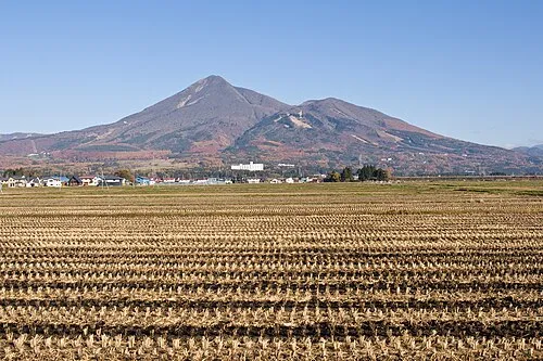 Mount Bandai Mountain, Bandai Machi5.5 km NW
-
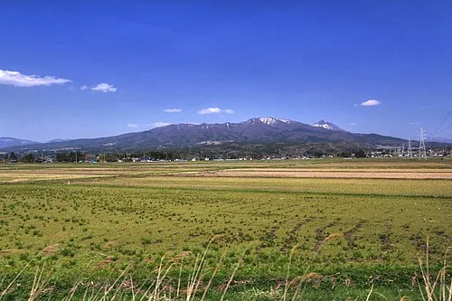 Nekomaga Dake Mountain, Bandai Machi9.2 km NW
-
 Lake Inawashiro Lake, Fukushima9.4 km S
-
 Lake Hibara Lake, Fukushima15 km N
-
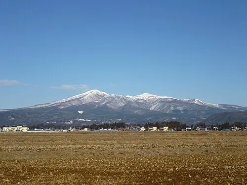 Mount Adatara Mountain, Nihonmatsu Shi16 km E
-
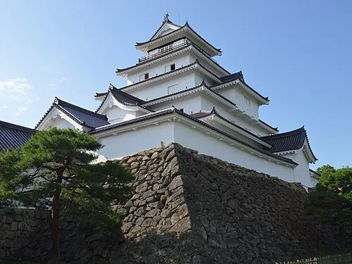 Tsuruga Castle Historic site, Aizu-wakamatsu Shi19 km SW
-
 Mount Azuma-kofuji Mountain, Fukushima Shi22 km NE
Sources & licences
Data last updated: · 2 independent sources