- Population
- 8,207
- 8.2K
- Elevation
- -2 m
- above sea level
- Local time
- UTC+09:00
- Asia/Tokyo · UTC+09:00
- Airports
- HIJ Hiroshima Airport21 km
- MYJ Matsuyama Airport50 km
About Ōsakikamijima
Ōsakikamijima is a municipality. Location: Toyota, Hiroshima. Population: 8,207. Elevation: -2 m.
Ōsakikamijima (大崎上島町, Ōsakikamijima-chō) is a town located in Toyota District, Hiroshima Prefecture, Japan. Ōsakikamijima is coterminous with the island of the same name, which is one of the Geiyo Islands of the Seto Inland Sea between Hiroshima Prefecture and Ehime Prefecture. The new town of Ōsakikamijima was formed on 1 April 2003, with the merger of the towns of Ōsaki, Higashino and Kinoe, all from Toyota District.
Source: Wikipedia · CC BY-SA 4.0
At a glance
- Built
- 2003
- Area
- 43.1 km²
- Official website
- town.osakikamijima.hiroshima.jp
Source: Wikidata
Twin towns and sister cities of Ōsakikamijima
- Musashino· Japan
Source: Wikidata. Only places with a page on this site are shown.
Population of Ōsakikamijima over time
| 2010 | 8,448 | |
|---|---|---|
| 2015 | 7,992 | |
| 2021 | 7,281 |
Censuses and official estimates; source: Wikidata.
Climate of Ōsakikamijima
Best months for sightseeingBest months for sightseeing: May–June, October.
This month · November
Outside the best season
Day 17° · Night 10° · Rain 74 mm
Better nearby cities in November
- Kochi · 97 km southeast18°
- Ōita · 164 km southwest18°
- Beppu · 168 km southwest17°
- Hottest month
- August (day 31°)
- Coldest month
- February (night 2°)
- Wettest month
- June (249 mm)
- Driest month
- December (40 mm)
Bars: average monthly low and high temperature. Below: precipitation. Monthly averages for 1970–2000 at about 18 km resolution, adjusted for elevation. Highlighted months are mild and relatively dry. Source: WorldClim 2.1 (CC BY 4.0).
Show values as a table
| Month | Jan | Feb | Mar | Apr | May | Jun | Jul | Aug | Sep | Oct | Nov | Dec |
|---|---|---|---|---|---|---|---|---|---|---|---|---|
| Average high (°C) | 10° | 10° | 13° | 18° | 22° | 26° | 30° | 31° | 27° | 22° | 17° | 12° |
| Average low (°C) | 3° | 2° | 5° | 10° | 15° | 19° | 23° | 24° | 21° | 15° | 10° | 5° |
| Precipitation (mm) | 48 | 65 | 99 | 146 | 150 | 249 | 194 | 128 | 197 | 117 | 74 | 40 |
How to get to Ōsakikamijima
The nearest airport is Hiroshima Airport (HIJ), 21 km to the north as the crow flies. The nearest large city is Imabari, 22 km to the southeast.
Airports
- Hiroshima Airport (HIJ) Hiroshima 21 kmnorth
- Matsuyama Airport (MYJ) Matsuyama 50 kmsouth
- Iwakuni Kintaikyo Airport (IWK) Iwakuni 60 kmwest
Nearby large cities
- Imabari Population: 171K 22 kmsoutheast
- Higashihiroshima Population: 196.6K 23 kmnorthwest
- Kure Population: 214.6K 30 kmwest
- Onomichi Population: 131.2K 34 kmnortheast
- Hiroshima Population: 1.2M 44 kmnorthwest
Straight-line distances; road distances are longer. Airport data: OurAirports.
Nearby attractions & nature
Everything nearby-
 Okamura Jima Island, Imabari6.5 km S
-
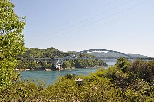 Ōmi Shima Island, Imabari12 km E
-
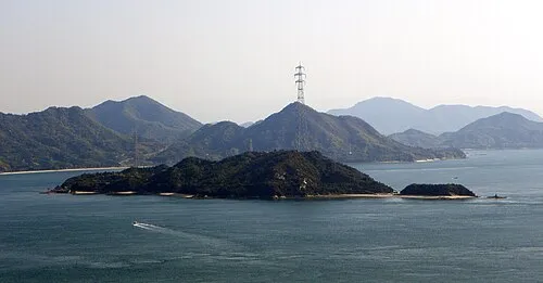 Ōkuno Shima Island, Hiroshima12 km NE
-
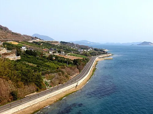 Ikuchi Jima Island, Hiroshima20 km E
-
 Tatara Bridge Landmark, Japan16 km E
-
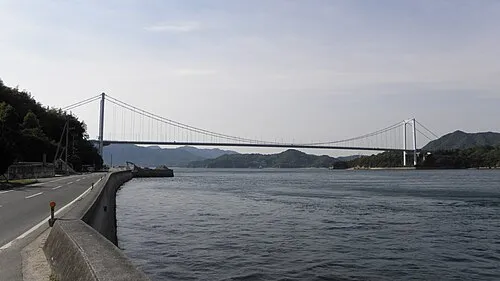 Ō Shima Island, Ehime18 km SE
-
Mount Noro Mountain, Kure22 km W
-
 Kurushima Island, Japan16 km SE
Sources & licences
Data last updated: · 2 independent sources