- Population
- 141,976
- 142K
- Elevation
- 84 m
- above sea level
- Local time
- UTC+09:00
- Asia/Tokyo · UTC+09:00
- Airports
- OKD Sapporo Okadama Airport12 km
- CTS New Chitose Airport52 km
About Teine-ku
Teine-ku is a municipality. Location: Sapporo-shi, Hokkaido. Population: 141,976. Elevation: 84 m.
Teine-ku (手稲区) is one of the 10 wards in Sapporo, Hokkaidō, Japan. The ward is located in northwest of Sapporo, which is neighboured to three other wards in Sapporo and two cities. The area was established as one of the wards in Sapporo in 1989, when it was split from Nishi-ku, Sapporo.
Source: Wikipedia · CC BY-SA 4.0
Places bordering Teine-ku
- Kita Ku
Population of Teine-ku over time
| 2010 | 139,644 | |
|---|---|---|
| 2015 | 140,999 | |
| 2020 | 141,976 |
Censuses and official estimates; source: Wikidata.
Climate of Teine-ku
Best months for sightseeingBest months for sightseeing: June–September.
This month · November
A wet month
Day 8° · Night 1° · Rain 131 mm
- Hottest month
- August (day 25°)
- Coldest month
- January (night -8°)
- Wettest month
- August (155 mm)
- Driest month
- April (71 mm)
Bars: average monthly low and high temperature. Below: precipitation. Monthly averages for 1970–2000 at about 18 km resolution, adjusted for elevation. Highlighted months are mild and relatively dry. Source: WorldClim 2.1 (CC BY 4.0).
Show values as a table
| Month | Jan | Feb | Mar | Apr | May | Jun | Jul | Aug | Sep | Oct | Nov | Dec |
|---|---|---|---|---|---|---|---|---|---|---|---|---|
| Average high (°C) | -1° | 0° | 3° | 10° | 16° | 20° | 24° | 25° | 22° | 16° | 8° | 2° |
| Average low (°C) | -8° | -8° | -4° | 2° | 7° | 12° | 17° | 18° | 13° | 6° | 1° | -5° |
| Precipitation (mm) | 115 | 88 | 76 | 71 | 74 | 77 | 107 | 155 | 144 | 125 | 131 | 124 |
Other places to visit in this season: June July August September
How to get to Teine-ku
The nearest airport is Sapporo Okadama Airport (OKD), 12 km to the east as the crow flies. For international flights: New Chitose Airport (CTS) (52 km). The nearest large city is Sapporo, 10 km to the southeast.
Airports
- Sapporo Okadama Airport (OKD) Sapporo 12 kmeast
- New Chitose Airport (CTS) Sapporo 52 kmsoutheast
- Asahikawa Airport (AKJ) Higashikagura 116 kmnortheast
Nearby large cities
- Sapporo Population: 2M 10 kmsoutheast
- Otaru Population: 115.3K 21 kmnorthwest
- Ebetsu Population: 134K 25 kmeast
- Tomakomai Population: 174.8K 60 kmsoutheast
- Asahikawa Population: 333.5K 117 kmnortheast
Straight-line distances; road distances are longer. Airport data: OurAirports.
Day trips from Teine-ku
Within 100 km: 2 historic and cultural sites, 16 natural sites, 11 lakes, rivers and coasts.
0–25 km5 places
- Toyohira River River 23 kmE
- Ishikari River River 21 kmNE
- Hokkaido University Botanical Gardens Attraction 10 kmSE
- Zenibako River River 7 kmNW
25–60 km11 places
- Yūbari River River 28 kmE
- Chitose River River 28 kmE
- Yōtei-zan Mountain 47 kmSW
- Mount Tarumae Mountain 49 kmS
60–100 km13 places
- Kuttara-ko Lake 68 kmS
- Saru River River 92 kmSE
- Mu River River 83 kmSE
- Toya Lake Lake 64 kmSW
Straight-line distances.
Teine-ku and similar cities
Side by side with cities of similar size in the same country: population, elevation and climate.
| Measure | Teine-ku | Misato, Saitama | Fukayachō | Okinawa |
|---|---|---|---|---|
| Population | 142K | 142.1K | 141.3K | 142.8K |
| Elevation | 84 m | 5 m | 35 m | 112 m |
| Summer day (hottest month) | 25° | 30° | 31° | 31° |
| Winter night (coldest month) | -8° | -1° | -2° | 14° |
| Annual rainfall | 1,287 mm | 1,327 mm | 1,256 mm | 2,100 mm |
| Best months | Jun–Sep | May–Jun, Oct | Apr–May, Oct | Mar–May, Nov–Dec |
| Distance | — | 815 km | 785 km | 2,225 km |
Climate values are 1970–2000 monthly averages; straight-line distance.
Nearby attractions & nature
Everything nearby-
Zenibako River River, Japan6.6 km NW
-
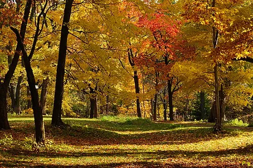 Hokkaido University Botanical Gardens Attraction, Chūō Ku9.8 km SE
-
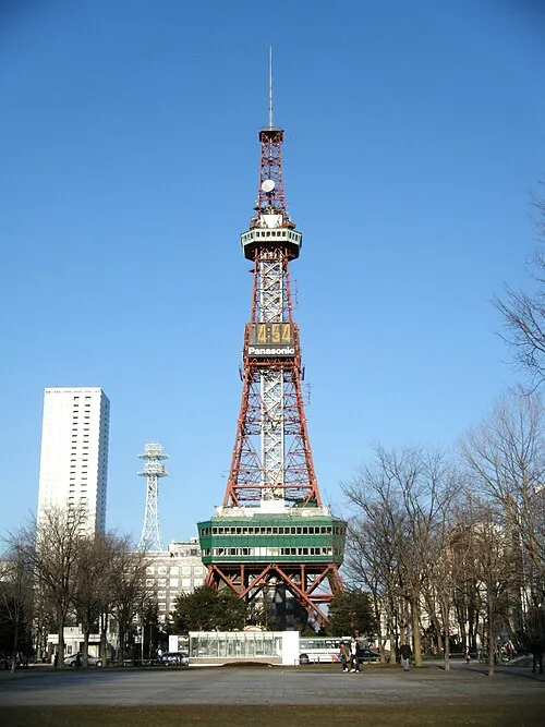 Sapporo TV Tower Landmark, Chūō Ku11 km SE
-
Toyohira River River, Japan23 km E
-
Ishikari River River, Hokkaido21 km NE
Sources & licences
Data last updated: · 2 independent sources