
- Elevation
- 14 m
- above sea level
- Local time
- UTC+09:00
- Asia/Tokyo · UTC+09:00
- Airports
- WKJ Wakkanai Airport17 km
- RIS Rishiri Airport67 km
About Cape Soya
Cape Soya is a natural site. Location: Wakkanai Shi, Hokkaido.
Cape Sōya (宗谷岬, Sōya-misaki) is the northernmost point of the island of Hokkaidō, Japan. It is situated in Wakkanai, Sōya Subprefecture. The Monument of the Northernmost Point of Japan (日本最北端の地の碑) is at the cape, although the true northernmost point under Japanese control is the small deserted island of Benten-jima, 1 kilometre (3,300 ft) northwest.
Source: Wikipedia · CC BY-SA 4.0
Photos of Cape Soya
-

Raita Futo from Tokyo, Japan · CC BY 2.0 -

Raita Futo from Tokyo, Japan · CC BY 2.0 -

Ippukucho · CC BY 3.0 -
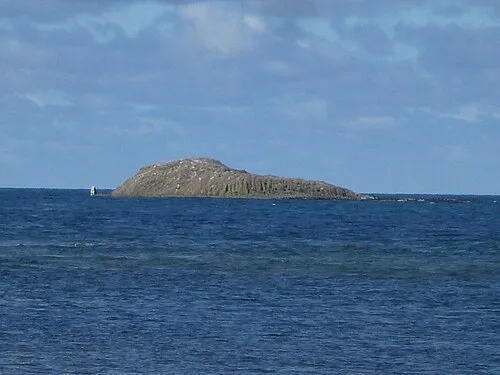
Benten-jima Kzaral · CC BY 2.0


Climate of Cape Soya
Best months for sightseeingBest months for sightseeing: July–September.
This month · November
A wet month
Day 5° · Night -1° · Rain 111 mm
- Hottest month
- August (day 21°)
- Coldest month
- February (night -9°)
- Wettest month
- October (122 mm)
- Driest month
- April (51 mm)
Bars: average monthly low and high temperature. Below: precipitation. Monthly averages for 1970–2000 at about 18 km resolution, adjusted for elevation. Highlighted months are mild and relatively dry. Source: WorldClim 2.1 (CC BY 4.0).
Show values as a table
| Month | Jan | Feb | Mar | Apr | May | Jun | Jul | Aug | Sep | Oct | Nov | Dec |
|---|---|---|---|---|---|---|---|---|---|---|---|---|
| Average high (°C) | -4° | -4° | 0° | 7° | 11° | 15° | 19° | 21° | 19° | 13° | 5° | -1° |
| Average low (°C) | -9° | -9° | -5° | 1° | 4° | 9° | 13° | 16° | 13° | 7° | -1° | -6° |
| Precipitation (mm) | 89 | 59 | 54 | 51 | 65 | 63 | 88 | 111 | 114 | 122 | 111 | 109 |
How to get to Cape Soya
The nearest airport is Wakkanai Airport (WKJ), 17 km to the southwest as the crow flies. For international flights: Yuzhno-Sakhalinsk International Airport (UUS) (163 km). The nearest large city is Asahikawa, 198 km to the south.
Airports
- Wakkanai Airport (WKJ) Wakkanai 17 kmsouthwest
- Rishiri Airport (RIS) Rishiri 67 kmsouthwest
- Yuzhno-Sakhalinsk International Airport (UUS) Yuzhno-Sakhalinsk 163 kmnorth
Nearby large cities
- Asahikawa Population: 333.5K 198 kmsouth
- Kitami Population: 119.1K 246 kmsoutheast
- Otaru Population: 115.3K 270 kmsouth
- Ebetsu Population: 134K 270 kmsouth
- Sapporo Population: 2M 277 kmsouth
Straight-line distances; road distances are longer. Airport data: OurAirports.
Day trips from Cape Soya
Within 100 km: 3 natural sites, 5 lakes, rivers and coasts.
0–25 km3 places
- Koetoi River River 19 kmSW
- Sōya Bay Natural site 16 kmSW
- Benten-jima Island 1 kmW
60–100 km5 places
- Rishiri Tō Island 66 kmSW
- Rebun Tō Island 73 kmW
- Rishiri Zan Mountain 66 kmSW
- Rebun Dake Mountain 74 kmW
Straight-line distances.
Nearest towns and villages
-
Makubetsu Town, Wakkanai Shi19 km SW
-
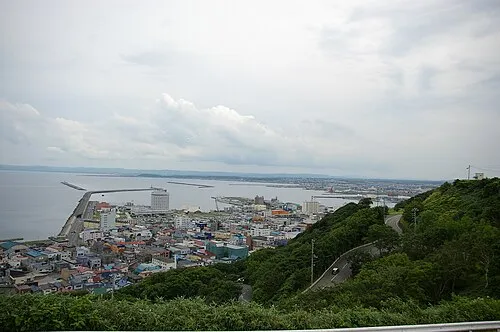 Wakkanai City, Wakkanai Shi24 km SW
-
Sarufutsu Mura Municipality, Sōya Gun36 km SE
-
Toyotomi Chō Municipality, Teshio Gun43 km S
-
Toyotomi Village, Toyotomi Chō48 km S
-
Hamatonbetsu Chō Municipality, Esashi Gun58 km SE
Nearby attractions & nature
Everything nearby-
Benten-jima Island, Hokkaido1.4 km W
-
Sōya Bay Natural site, Hokkaido16 km SW
-
Koetoi River River, Hokkaido19 km SW
Sources & licences
Data last updated: · 2 independent sources