
- Elevation
- 9 m
- above sea level
- Local time
- UTC+09:00
- Asia/Tokyo · UTC+09:00
- Airports
- TJH Konotori Tajima Airport63 km
- ITM Osaka Itami International Airport103 km
About Ko-shima
Ko-shima is an island. Location: Japan.
Kutsujima (沓島, Kutsu-jima), also known as Meshima (沓島, Me-shima) in the Oomoto religion, is a volcanic island in the Sea of Japan, 2.5 km from the coast of the Kyoto Prefecture in Japan. Kutsujima Island is administered as part of Maizuru city.
Read more on Wikipedia Text: Wikipedia contributors · CC BY-SA 4.0 · shortened
At a glance
- Area
- 1 ha
Source: Wikidata
Climate of Ko-shima
Best months for sightseeingBest months for sightseeing: May–June, September–October.
Bars: average monthly low and high temperature. Below: precipitation. Monthly averages for 1970–2000 at about 18 km resolution, adjusted for elevation. Highlighted months are mild and relatively dry. Source: WorldClim 2.1 (CC BY 4.0).
Show values as a table
| Month | Jan | Feb | Mar | Apr | May | Jun | Jul | Aug | Sep | Oct | Nov | Dec |
|---|---|---|---|---|---|---|---|---|---|---|---|---|
| Average high (°C) | 7° | 8° | 11° | 18° | 22° | 26° | 30° | 31° | 27° | 21° | 16° | 11° |
| Average low (°C) | 1° | 0° | 3° | 8° | 13° | 18° | 22° | 23° | 19° | 13° | 8° | 3° |
| Precipitation (mm) | 203 | 165 | 139 | 119 | 135 | 180 | 187 | 138 | 225 | 148 | 157 | 178 |
Other places to visit in this season: May June September October
Airports nearest to Ko-shima
- Konotori Tajima Airport (TJH) Toyooka 63 km
- Osaka Itami International Airport (ITM) Osaka 103 km
- Komatsu Airport / JASDF Komatsu Air Base (KMQ) Kanazawa 116 km
Straight-line distance; airports with scheduled flights only. Source: OurAirports (public domain).
Nearest towns and villages
Nearby attractions & nature
Everything nearby-
Kamuri Jima Island, Kyoto3.4 km S
-
 Wakasa Bay Natural site, Japan21 km E
More lakes, rivers and coasts in Japan
-
Takano River River, Kyoto30 km S
-
Yura River River, Kyoto26 km SW
-
Kamo River River, Japan88 km S
-
Kita-gawa River, Japan36 km SE
-
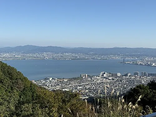 Lake Biwa Lake, Shiga Prefecture78 km SE
-
Lake Suigetsu Lake, Japan43 km E
Sources & licences
Data last updated: · 2 independent sources