- Elevation
- 0 m
- above sea level
- Local time
- UTC+09:00
- Asia/Tokyo · UTC+09:00
- Airports
- KMJ Kumamoto Airport31 km
- HSG Kyushu Saga International Airport36 km
About Kikuchi River
Kikuchi River is a river. Location: Kumamoto, Japan.
The Kikuchi River (菊池川, Kikuchi-gawa) flows through the northern part of Kumamoto Prefecture, Kyūshū, Japan. The source of the Class A river is Fukaba, Aso city near Mt. Aso at the height of 1,041 metres (3,415 ft) and flows west through the Kikuchi Valley. It turns south near Kikusui and empties into the Shimabara Bay in the Ariake sea. Land reclamation is taking place at its mouth. The river has a total length of 71 km (44 mi).
Read more on Wikipedia Text: Wikipedia contributors · CC BY-SA 4.0 · shortened
At a glance
- Length
- 71 km
Source: Wikidata
Climate of Kikuchi River
Best months for sightseeingBest months for sightseeing: May, October.
Bars: average monthly low and high temperature. Below: precipitation. Monthly averages for 1970–2000 at about 18 km resolution, adjusted for elevation. Highlighted months are mild and relatively dry. Source: WorldClim 2.1 (CC BY 4.0).
Show values as a table
| Month | Jan | Feb | Mar | Apr | May | Jun | Jul | Aug | Sep | Oct | Nov | Dec |
|---|---|---|---|---|---|---|---|---|---|---|---|---|
| Average high (°C) | 10° | 11° | 15° | 20° | 24° | 27° | 30° | 32° | 28° | 23° | 18° | 12° |
| Average low (°C) | 1° | 2° | 5° | 10° | 15° | 19° | 23° | 24° | 20° | 14° | 8° | 3° |
| Precipitation (mm) | 57 | 80 | 122 | 160 | 189 | 355 | 354 | 189 | 185 | 95 | 70 | 55 |
Airports nearest to Kikuchi River
- Kumamoto Airport (KMJ) Kumamoto 31 km
- Kyushu Saga International Airport (HSG) Saga 36 km
- Amakusa Airport (AXJ) Amakusa 56 km
Straight-line distance; airports with scheduled flights only. Source: OurAirports (public domain).
Nearest towns and villages
-
Nagasu Machi Municipality, Tamana-gun7.6 km NW
-
Tamana City, Tamana Shi8.8 km NE
-
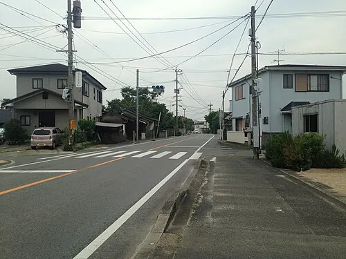 Nagasu Town, Nagasu Machi9.7 km NW
-
Gyokutō Machi Municipality, Tamana-gun10 km E
-
Nishi-ku Municipality, Kumamoto Shi13 km SE
-
Kita-ku Municipality, Kumamoto Shi16 km E
Nearby attractions & nature
Everything nearby-
 Mount Kinbō Mountain, Nishi-ku13 km SE
-
 Kumamoto castle Historic site, Chuo-ku19 km SE
-
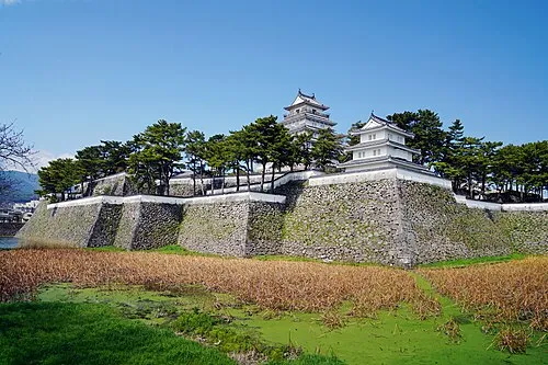 Shimabara Castle Historic site, Shimabara Shi18 km SW
-
Suizenji Jōjuen Attraction, Chuo-ku22 km SE
More lakes, rivers and coasts in Japan
-
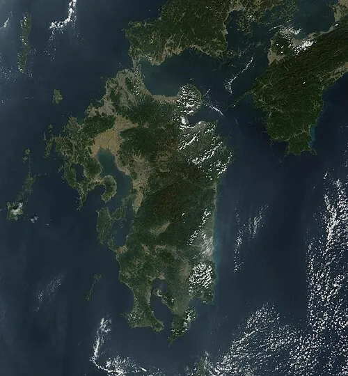 Kyūshū Island, Kumamoto66 km SE
-
 Ōyano Jima Island, Kumamoto34 km S
-
Shimoshima Island Island, Kumamoto73 km SW
-
Hi Kawa River, Kumamoto32 km S
-
Kuma River River, Kumamoto45 km S
-
Kami Shima Island, Kumamoto51 km S
Sources & licences
Data last updated: · 2 independent sources